ISRA FACTSHEETS
ISRA FACTSHEETS
ASIA REGION
Southern Flores
Summary
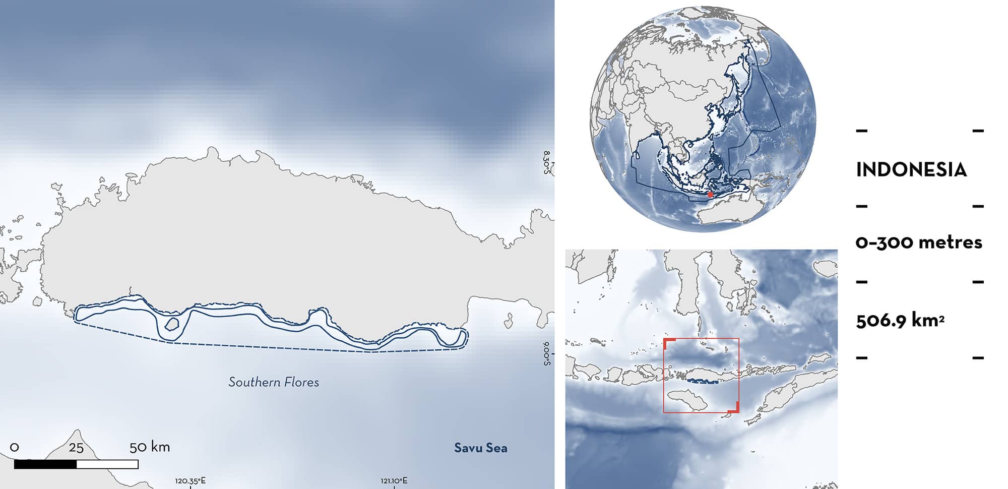
Southern Flores is located in eastern Indonesia. The area includes Mules Island and several small bays along the coast of Flores. It is characterised by a narrow shelf with terrestrial input from multiple rivers. The area overlaps with the KKPN Laut Sawu Marine National Park. Within the area there are: threatened species and reproductive areas (Silky Shark Carcharhinus falciformis).
Download factsheet
Southern Flores
DESCRIPTION OF HABITAT
Southern Flores is located in eastern Indonesia. It is situated within the Lesser Sunda Islands in the Savu Sea of the Eastern Nusa Tengara province. The area includes Mules Island and several small bays along the coast of Flores. It is characterised by a narrow shelf receiving freshwater input from multiple rivers flowing to the coast.
The area is influenced by the Indonesian Throughflow, which flows through the Ombai Strait producing seasonal upwellings during southeast monsoons, which, combined with river discharge, creates a high-productivity area year-round (Moore & Marra 2002; Putra & Mustika 2020; Wirasatriya et al. 2021).
The area overlaps with one marine protected area, the KKPN Laut Sawu Marine National Park.
This Important Shark and Ray Area is benthopelagic and is delineated from inshore and surface waters (0 m) to 300 m based on the depth range of the Qualifying Species in the area.
CRITERION A
VULNERABILITY
One Qualifying Species considered threatened with extinction according to the IUCN Red List of Threatened Species regularly occur in the area. This is the Vulnerable Silky Shark (Rigby et al. 2021).
CRITERION C
SUB-CRITERION C1 – REPRODUCTIVE AREAS
Southern Flores is an important reproductive area for one shark species.
Based on weekly monitoring of landings from fisheries operating in the area during the fishing season (August–February) between 2019–2022, Silky Shark (~1,800), including pregnant females, were regularly caught from September to April (BM Simeon unpubl. data 2024). Individuals were caught with benthic and surface longlines (BM Simeon unpubl. data 2024). While the fishery operates in other parts of the Savu Sea, pregnant females (n = 30) were caught only in areas around Mules Island and in the shelf break of Southern Flores. The majority of embryos were near-term (BM Simeon unpubl. data 2024), measuring 42–65 cm total length (TL), which is similar to the known size-at-birth for the species (56–87 cm TL; Ebert et al. 2021), confirming that this a pupping area for the species. Due to the fishing gear selectivity, neonates and young-of-the-year are largely absent from catches. In addition, the individuals sampled only represent a small portion of the total number of pregnant females caught in the area (BM Simeon unpubl. data 2024).
Download factsheet
SUBMIT A REQUEST
ISRA SPATIAL LAYER REQUEST
To make a request to download the ISRA Layer in either a GIS compatible Shapefile (.shp) or Google Earth compatible Keyhole Markup Language Zipped file (.kmz) please complete the following form. We will review your request and send the download details to you. We will endeavor to send you the requested files as soon as we can. However, please note that this is not an automated process, and before requests are responded to, they undergo internal review and authorization. As such, requests normally take 5–10 working days to process.
Should you have questions about the data or process, please do not hesitate to contact us.


