ISRA FACTSHEETS
ISRA FACTSHEETS
SOUTH AMERICAN INLAND WATERS
Southern Iberá Marshlands
Summary
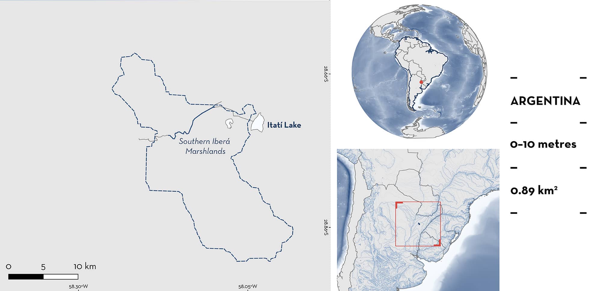
Southern Iberá Marshlands is located in northeastern Argentina. The area is situated in the upper section of Corriente River in the northeastern corner of the Middle Parana Basin. This area is characterised by slow-moving channels and semi-flooded plains. Within this area there are: undefined aggregations (e.g., Ocellate River Stingray Potamotrygon motoro).
Download factsheet
Southern Iberá Marshlands
DESCRIPTION OF HABITAT
Southern Iberá Marshlands is located in northeastern Argentina. The area is situated in the upper section of Corriente River in the northeastern corner of the Middle Parana Basin. This area is part of the larger Esteros del Iberá, one of the most extensive wetlands in the world. The Corriente River originates from the Itati lagoon, the southernmost extension of the Ibera Marshlands, and runs for ~247 km (Graca et al. 2025). This area is characterised by slow-moving channels with sandy substrates and semi-flooded plains. The upper course of the Corriente River is rich in fish species and represents a biodiversity corridor that connects the Iberá Marshlands with the Paraná River (Graca et al. 2025). The rainy season occurs mainly during the austral summer (November–March). During this period, rainfall can be intense, increasing the water level in the estuaries.
This Important Shark and Ray Area is benthic and is delineated from surface waters (0 m) to 10 m based on the bathymetry of the area.
CRITERION C
SUB-CRITERION C5 – UNDEFINED AGGREGATIONS
Southern Iberá Marshlands is an important area for undefined aggregations of two ray species.
This area is a well-known dive site on the Iberá Marshlands and is recognised for regular and predictable interactions with large numbers of rays that are resting together on the sand. Between 2005–2021, recreational divers that visited this site regularly during the winter (June–August), have observed assemblages of Ocellate River Stingrays and Amanda’s Freshwater Stingrays on most dives (M Arrúa pers. obs. 2025). Assemblages of these ray species are usually observed with groups of 3–10 individuals on average resting on the sand next to each other. An average of 20–30 individuals can be observed in one dive (M Arrúa pers. obs. 2025). More information is needed to determine the nature and function of these aggregations.
Download factsheet
SUBMIT A REQUEST
ISRA SPATIAL LAYER REQUEST
To make a request to download the ISRA Layer in either a GIS compatible Shapefile (.shp) or Google Earth compatible Keyhole Markup Language Zipped file (.kmz) please complete the following form. We will review your request and send the download details to you. We will endeavor to send you the requested files as soon as we can. However, please note that this is not an automated process, and before requests are responded to, they undergo internal review and authorization. As such, requests normally take 5–10 working days to process.
Should you have questions about the data or process, please do not hesitate to contact us.


