ISRA FACTSHEETS
ISRA FACTSHEETS
WESTERN INDIAN OCEAN REGION
Southern Red Sea
Summary
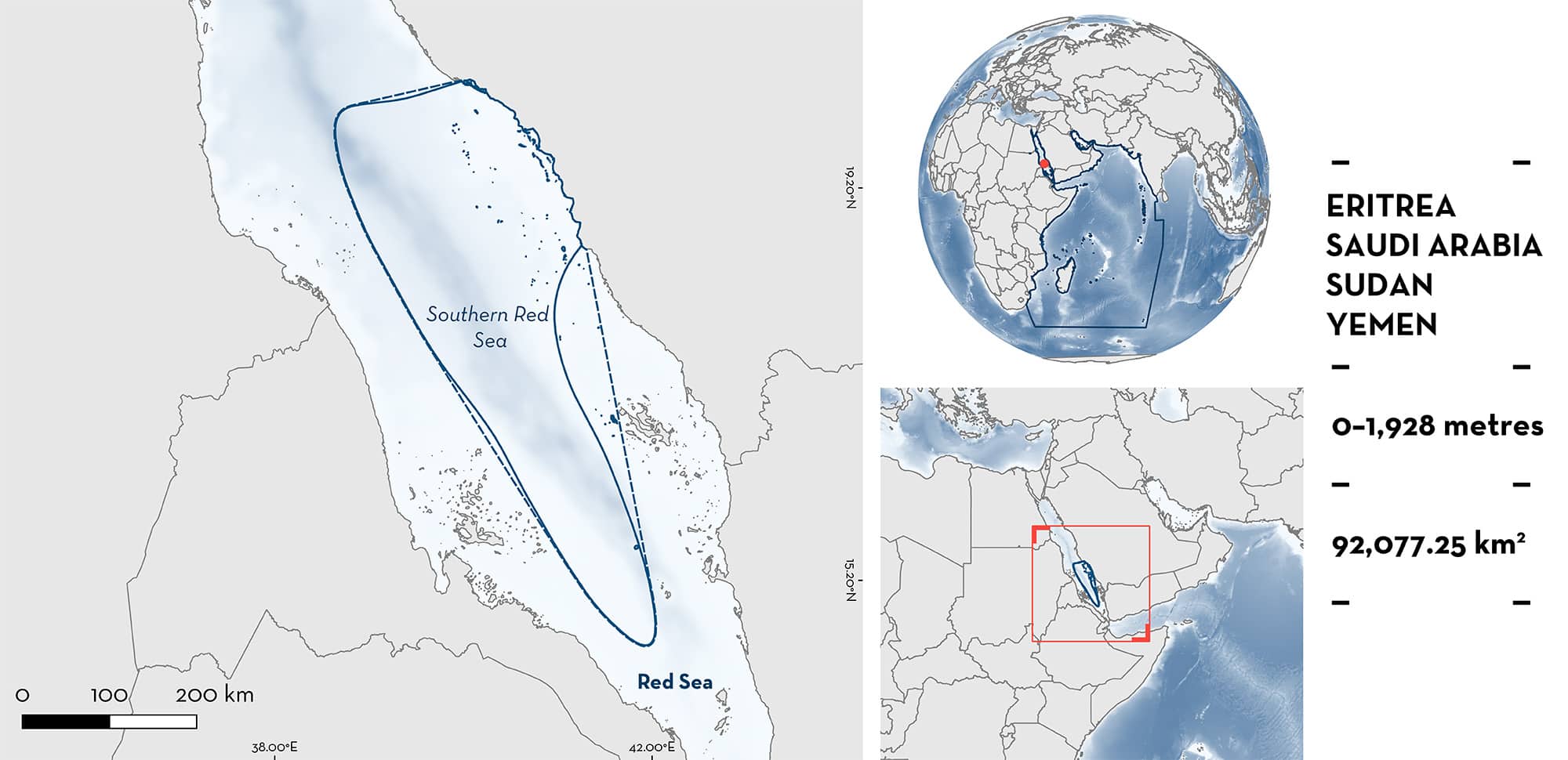
Southern Red Sea is a benthopelagic and transboundary area, overlapping parts of the Eritrean, Saudi Arabian, Sudanese, and Yemeni Exclusive Economic Zones. The area includes coastal, shelf, and open ocean habitats. The coastal environment is highly variable, with fringing reefs, mangrove forests, seagrass meadows, and sand plains. The open-sea hosts epipelagic, mesopelagic, and bathypelagic waters. It is characterised by higher productivity than the northern regions of the Red Sea basin. This area overlaps with two Ecologically or Biologically Significant Marine Areas, and three Key Biodiversity Areas. Within this area there are: threatened species and areas important for movement (Whale Shark Rhincodon typus).
Download factsheet
Southern Red Sea
DESCRIPTION OF HABITAT
Southern Red Sea is a benthopelagic and transboundary area, overlapping parts of the Eritrean, Saudi Arabian, Sudanese, and Yemeni Exclusive Economic Zones. The Red Sea is a semi-enclosed marginal basin with unique environmental features including low productivity, high salinity, and high temperatures both at the surface and at depth (Berumen et al. 2019). These characteristics along with the physical isolation of the Red Sea have led to high rates of endemism (DiBattista et al. 2016). The coastal environment of the area is highly variable, with fringing reefs, mangrove forests, seagrass meadows, and sand plains. The open-sea hosts epipelagic, mesopelagic, and bathypelagic waters. One of the most unique features of the Red Sea is thermal homogeneity with depth, with a 22◦C isotherm extending from 200 m to the benthos (Seidler 1969).
Southern Red Sea is characterised by warmer, high productivity surface waters (Raitsos et al. 2013) that host unique reef fish and invertebrate assemblages when compared to the north (Salwall 2014). The circulation is dominated by two basin scale eddies, an anticyclonic eddy in the south-central Red Sea and a cyclonic eddy in the far south (Raitsos et al. 2013).
Southern Red Sea overlaps with two Ecologically or Biologically Significant Marine Areas (EBSAs): the Southern Red Sea Pelagic Ecosystems (CBD 2023a) and the Suakin Archipelago and Sudanese Southern Red Sea EBSA (CBD 2023b). The area also overlaps with three Key Biodiversity Areas (KBAs): Jaza’ir al-Hanish (KBA 2023a), Umm Al-Qamari (KBA 2023b), and Qishran Bay (KBA 2023c).
This Important Shark and Ray Area is benthopelagic and extends from inshore and surface waters (0 m) to 1,928 m based on the global depth range of the Qualifying Species.
CRITERION A
VULNERABILITY
The one Qualifying Species within the area is considered threatened with extinction according to the IUCN Red List of Threatened SpeciesTM. The Whale Shark is assessed as Endangered (Pierce & Norman 2016).
CRITERION C
SUB-CRITERION C4 – MOVEMENT
Southern Red Sea is an important movement area for one shark species.
This area delineates the most important movement area for Whale Sharks in the Red Sea. The combination of visual (Cochran et al. 2016), passive acoustic telemetry (Cochran et al. 2019), and satellite telemetry (Berumen et al. 2014) methods have revealed a pattern of seasonal immigration of Whale Sharks to a feeding aggregation near the small port city of Al Lith, Saudi Arabia. The sharks are resident to the area for a period of weeks to months before emigration and dispersal into the wider Red Sea and Indian Ocean. Whale Sharks have been recorded diving to more than 1,300 m within this area (Berumen et al. 2014). Homing migrations have been documented at this site, demonstrating a tendency for some individuals to return to the area over multiple years (Cochran et al. 2019).
Satellite telemetry has tracked three animals moving north into the Red Sea, as far as the Sinai Peninsula. Similarly, six animals have been tracked south out of the straits of Bab El Mandeb and into the wider Indian Ocean. However, the majority of tracked animals (n = 39) remained within the southern central Red Sea, moving between the waters of Eritrea, Saudi Arabia, Sudan, and Yemen (Berumen et al. 2014). These movements appear to follow thermal fronts, sea surface anomalies, and other oceanographic features that may correspond to local plankton abundances (Lubambo Ostrovski unpubl. data 2023). Whale Sharks tracked from a nearby seasonal feeding aggregation make extensive use of this area during the offseason from June to February (Berumen et al. 2014; Cochran et al. 2019).
Download factsheet
SUBMIT A REQUEST
ISRA SPATIAL LAYER REQUEST
To make a request to download the ISRA Layer in either a GIS compatible Shapefile (.shp) or Google Earth compatible Keyhole Markup Language Zipped file (.kmz) please complete the following form. We will review your request and send the download details to you. We will endeavor to send you the requested files as soon as we can. However, please note that this is not an automated process, and before requests are responded to, they undergo internal review and authorization. As such, requests normally take 5–10 working days to process.
Should you have questions about the data or process, please do not hesitate to contact us.


