ISRA FACTSHEETS
ISRA FACTSHEETS
ASIA REGION
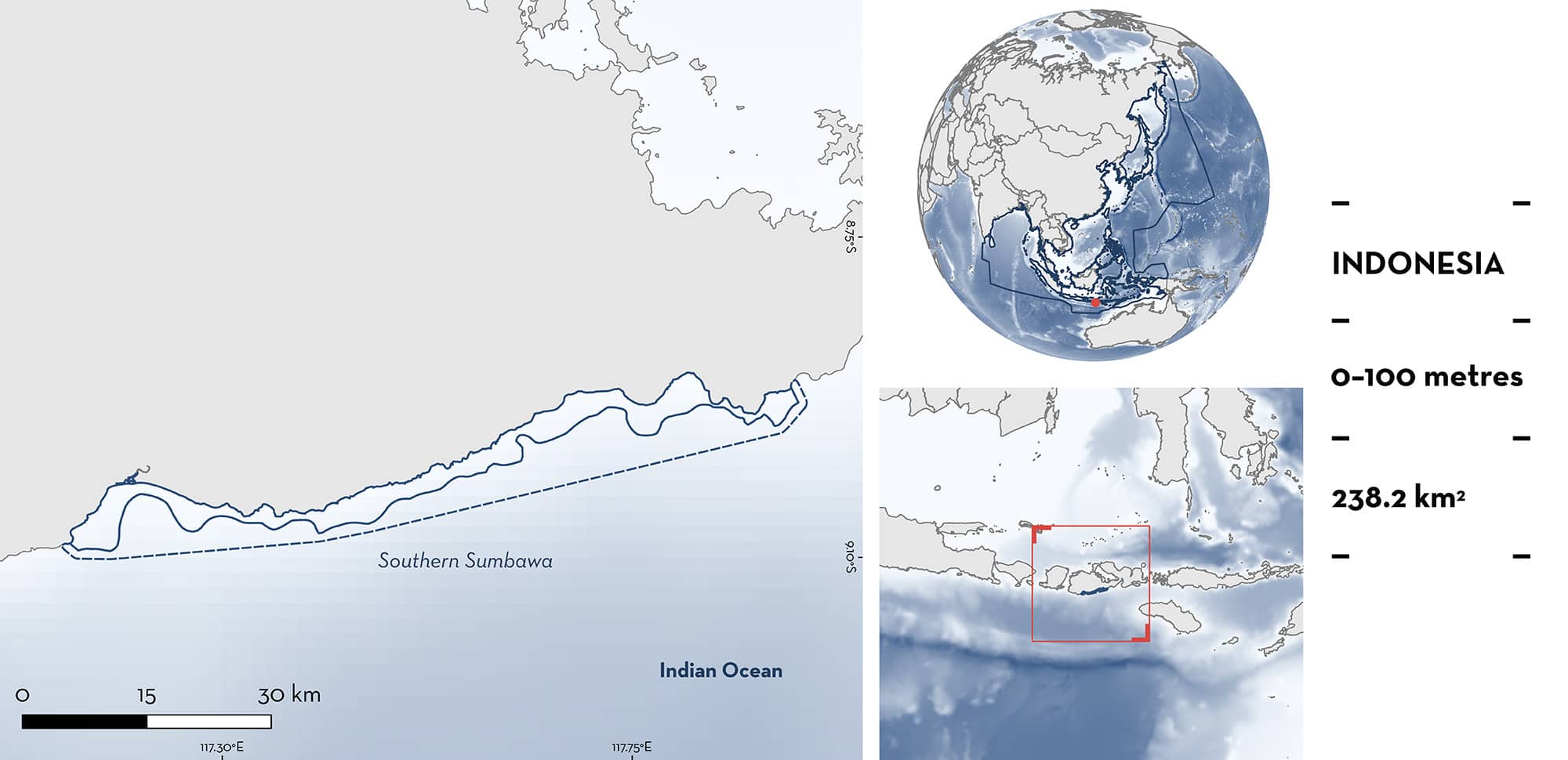
Southern Sumbawa
Summary
Southern Sumbawa is located in West Nusa Tenggara Province, Indonesia. The area includes a narrow shelf characterised by sandy, muddy and rocky substrates, and rivers flowing into the area. The area overlaps with the Lunyuk Tatar Sepang marine protected area. Within the area there are: threatened species (e.g., Jimbaran Guitarfish Rhinobatos jimbaranensis); range-restricted species (e.g., Bali Numbfish Narcine baliensis); and reproductive areas (e.g., Bottlenose Wedgefish Rhynchobatus australiae).
Download factsheet
Southern Sumbawa
DESCRIPTION OF HABITAT
Southern Sumbawa is located on the southern side of Sumbawa Island in West Nusa Tenggara Province, Indonesia. The area includes a narrow shelf characterised by sandy, muddy, and rocky substrates. Several rivers flow into the area, discharging nutrients that increases the productivity of the area (Taufikurahman & Hidayat 2017).
The area is influenced by monsoon winds. The northwest monsoon (December to February) brings low-speed winds and high rainfall while the southeast monsoon (June to August) brings high-speed winds and lower precipitation (Wirasatriya et al. 2021). These winds induce coastal upwelling in the area that causes phytoplankton and zooplankton blooms, especially during the southeast monsoon season (Taifukurahman 2016; Simanjuntak & Lin 2022). In addition, in the southern part of the area, upwellings are produced by the El Nino-Southern Oscillation (Simanjuntak & Lin 2022).
The area overlaps with the Lunyuk Tatar Sepang marine protected area.
This Important Shark and Ray Area is benthic and pelagic and is delineated from inshore and surface waters (0 m) to 100 m based on the depth range of Qualifying Species in the area.
CRITERION A
VULNERABILITY
Four Qualifying Species considered threatened with extinction according to the IUCN Red List of Threatened Species regularly occur in the area. These are the Critically Endangered Scalloped Hammerhead (Rigby et al. 2019), Bottlenose Wedgefish (Kyne et al. 2019), and Jimbaran Guitarfish (Dulvy et al. 2021), and the Endangered Indonesian Houndshark (Sherman et al. 2021).
CRITERION B
RANGE RESTRICTED
This area holds the regular presence of the Indonesian Houndshark, Bali Numbfish, and Jimbaran Guitarfish as resident range-restricted species. These species occur year-round in the area and were regularly recorded in landings from fisheries operating in the area (BM Simeon unpubl. data 2023). Based on landing monitoring near Lunyuk Bay between 2014–2023 (once every three days on average), 197 Indonesian Houndshark, 13 Bali Numbfish, and 68 Jimbaran Guitarfish were recorded (BM Simeon unpubl. data 2023). The number of individuals recorded in the area is higher than in other sites from Indonesia (White & Dharmadi 2007; Dharmadi & Fahmi 2008; Oktaviyani et al. 2020). Jimbaran Guitarfish and Bali Numbfish were previously only known from areas in Bali, where both species were described (Last et al. 2006; de Carvalho & White 2016) and Bali Numbfish was reported as a very rare species. Indonesian Houndshark and Jimbaran Guitarfish occur primarily in the Indonesian Sea Large Marine Ecosystem (LME) and marginally into the Bay of Bengal LME. Bali Numbfish are endemic to the Indonesian Sea LME.
CRITERION C
SUB-CRITERION C1 – REPRODUCTIVE AREAS
Southern Sumbawa is an important reproductive area for one shark and one ray species.
Based on monitoring of demersal longline fisheries operating in the area between 2014–2023, neonate and young-of-the-year (YOY) Scalloped Hammerhead and Bottlenose Wedgefish were regularly recorded (BM Simeon et al. unpubl. data 2024).
For Scalloped Hammerhead, 1,011 individuals between 30–60 cm total length (TL) were recorded (BM Simeon et al. unpubl. data 2024). These sizes are similar to the known size-at-birth for the species (31–57 cm TL; Ebert et al. 2021), confirming that these individuals were neonates or YOY. Most of these small individuals were caught between November and January (BM Simeon et al. unpubl. data 2024), suggesting a seasonality to their reproductive activity in the area.
For Bottlenose Wedgefish, 68 individuals measuring 48–60 cm TL were recorded (BM Simeon et al. unpubl. data 2024). These sizes are similar to the known size-at-birth for the species (46–50 cm TL; Last & Stevens 2009), confirming that these individuals were neonates or YOY.
Download factsheet
SUBMIT A REQUEST
ISRA SPATIAL LAYER REQUEST
To make a request to download the ISRA Layer in either a GIS compatible Shapefile (.shp) or Google Earth compatible Keyhole Markup Language Zipped file (.kmz) please complete the following form. We will review your request and send the download details to you. We will endeavor to send you the requested files as soon as we can. However, please note that this is not an automated process, and before requests are responded to, they undergo internal review and authorization. As such, requests normally take 5–10 working days to process.
Should you have questions about the data or process, please do not hesitate to contact us.


