ISRA FACTSHEETS
ISRA FACTSHEETS
POLAR WATERS REGION
Sullualuk
Summary
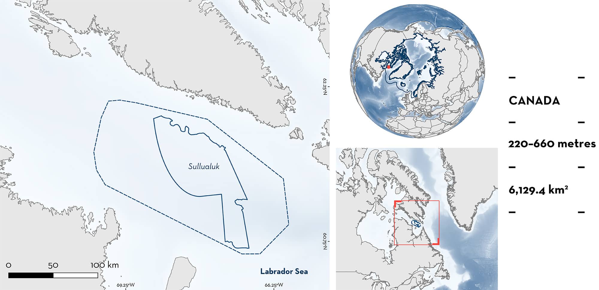
Sullualuk, also known as Hudson Strait, is located in northeast Canada. It is part of the Hudson Bay system, situated in a stretch of water connecting the Labrador Sea to Hudson Bay. The benthic habitat is characterised by soft corals of the family Nephtheidae and sponges. The area is characterised by the strong seasonal cycle related to the annual melt/freeze cycle of the sea ice. Within this area there are: threatened species and reproductive areas (Thorny Skate Amblyraja radiata).
Download factsheet
Sullualuk
DESCRIPTION OF HABITAT
Sullualuk, also known as Hudson Strait, is located in northeast Canada. It is part of the Hudson Bay system, situated in a stretch of water connecting the Labrador Sea to Hudson Bay. The benthic habitat is characterised by soft corals of the family Nephtheidae and sponges. The high abundance of gorgonian corals in this area is supported by ice-contact derived boulders and cobbles in relatively current-swept environments (Edinger et al. 2011). Strong tidal currents and high tidal elevations (>6 m) are observed in the strait.
The strait has two main flows: the Hudson Strait outflow which heads southeasterly along the Quebec coastline into the Labrador Sea, and the northern current flowing west along Baffin Island into the Hudson Bay system (Straneo & Saucier 2008). This outflow provides the third largest source of freshwater input into the North Atlantic Ocean, exhibiting a strong seasonal cycle related to the annual melt/freeze cycle of the sea ice and the timing of the river discharge into Hudson Bay. Additionally, it offers the principal source of nutrients to the Labrador Shelf, supporting productivity (Sutherland et al. 2011). Sea ice usually covers much of the area from mid-December to July.
This Important Shark and Ray Area is benthic and subsurface and is delineated from 220 m to 660 m based on the depth range of the Qualifying Species in the area.
CRITERION A
VULNERABILITY
One Qualifying Species considered threatened with extinction according to the IUCN Red List of Threatened Species regularly occurs in the area. This is the Vulnerable Thorny Skate (Kulka et al. 2016).
CRITERION C
SUB-CRITERION C1 – REPRODUCTIVE AREAS
Sullualuk is an important reproductive area for one ray species.
Between 1999 and 2023, 8,325 trawl set surveys were conducted by Fisheries and Oceans Canada (DFO) in Northwest Atlantic Fisheries Organization (NAFO) Subarea 0 (Baffin Bay, Davis Strait, and Eastern Hudson Strait) at depths between 102 and 1,502 m. Surveys were conducted during the ice-free months, between August–November (K Hedges unpubl. data 2024). Within these surveys, 4,846 Thorny Skates were caught, of which 1,048 were neonates or young-of-the-year (YOY) (829 contemporary records from 2009 to 2023; 219 historical records from 2001-2008). All animals measuring 14 cm total length (TL) or less were classed as neonates and YOY. The hatching size for this species is 8–12 cm TL (Last et al. 2016). Neonates and YOY were captured at depths from 179 to 966 m and only by three of the gear types used in 2,554 trawls (‘Bacalao 6’, n = 138; ‘Alfredo-03’, n = 39; ‘Cosmos-2000’, n = 870).
Within Sullualuk, 1,425 trawl sets were conducted from 2005–2023 (1,266 since 2009) and 1,269 Thorny Skates were captured at depths of 220–663 m (n = 1,004 since 2009). Of these, 461 (contemporary records = 393) were classed as neonates or YOY. All neonate and YOY in this area were captured using “Cosmos-2000” gear type, which was also used along the east coast of Baffin Island where no neonate or YOY Thorny Skates were captured (K Hedges unpubl. data 2024), emphasising the importance of this area for reproduction. Neonates and YOY of Sullualuk represent 47.4% of all contemporary records across NAFO Subarea 0.
Download factsheet
SUBMIT A REQUEST
ISRA SPATIAL LAYER REQUEST
To make a request to download the ISRA Layer in either a GIS compatible Shapefile (.shp) or Google Earth compatible Keyhole Markup Language Zipped file (.kmz) please complete the following form. We will review your request and send the download details to you. We will endeavor to send you the requested files as soon as we can. However, please note that this is not an automated process, and before requests are responded to, they undergo internal review and authorization. As such, requests normally take 5–10 working days to process.
Should you have questions about the data or process, please do not hesitate to contact us.


