ISRA FACTSHEETS
ISRA FACTSHEETS
POLAR WATERS REGION
Tallurutiup Imanga
Summary
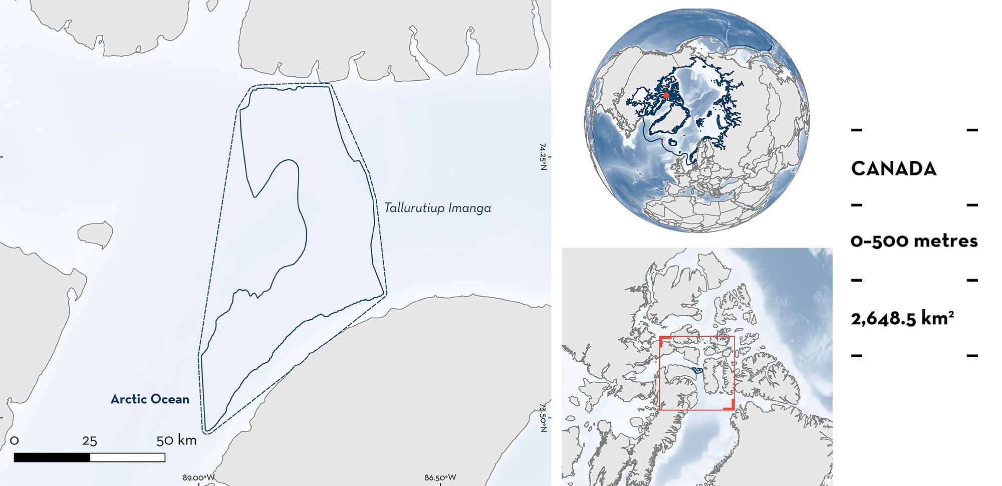
Tallurutiup Imanga, also known as Lancaster Sound, is located in Nunavut, Canada. The sound is an inshore area that connects Baffin Bay to the Northwest Passage, situated between Baffin Island and Devon Island. The benthic habitat is composed of fine-grained sediment and crinoids. The dynamic oceanography contributes to high productivity and the presence of open water surrounded by ice (polynya). The area overlaps with the Tallurutiup Imanga National Marine Conservation Area. Within the area there are: threatened species and undefined aggregations (Greenland Shark Somniosus microcephalus).
Download factsheet
Tallurutiup Imanga
DESCRIPTION OF HABITAT
Tallurutiup Imanga is located within a sound of the same name, also known as Lancaster Sound, in Nunavut, Canada. The sound is an inshore area connecting Baffin Bay to the Northwest Passage, situated between Baffin Island and Devon Island. The benthic habitat is composed of fine-grained sediment and crinoids (Heliometra spp.) (Devine et al. 2018).
Dynamic surface currents and relatively significant tidal amplitudes (~2 m) contribute to the presence of stretches of open water surrounded by ice (polynyas) throughout the boreal winter (Vincent 2023). The area’s flaw lead (opening between pack ice and fast ice) and seasonal polynya on the northern side enhance productivity through the upwelling of warm, nutrient-rich water (Welch et al. 1992). Phytoplankton production, believed to be higher here than in most Arctic waters, coincides with ice retreat and supports a large summer zooplankton population, forming large schools of Arctic Cod Boreogadus saida in nearshore waters and attracting marine mammals and seabirds (Milne & Smiley 1978; Sameoto et al. 1986; Welch et al. 1992; Hannah et al. 2009).
Many species of Inuit cultural significance and food security use the waterway as a migration corridor and as vital feeding and nursery grounds, including Bowhead Whale Balaena mysticetus, Narwhal Monodon monoceros, Beluga Whale Delphinapterus leucas, and Ringed Seal Pusa hispida (Darnis et al. 2012; Matley et al. 2015). Typically, ice break-up occurs in June or July, and freeze-up usually begins in mid-September in the channels of the western part and only ends in February or early March because of the strong currents that prevent rapid ice consolidation (Hamilton et al. 2013).
The area overlaps with the Tallurutiup Imanga National Marine Conservation Area (UNEP-WCMC & IUCN 2024).
This Important Shark and Ray Area is benthopelagic and is delineated from surface waters (0 m) to 500 m based on the bathymetry of the area.
CRITERION A
VULNERABILITY
One Qualifying Species considered threatened with extinction according to the IUCN Red List of Threatened Species regularly occurs in the area. This is the Vulnerable Greenland Shark (Kulka et al. 2020).
CRITERION C
SUB-CRITERION C5 – UNDEFINED AGGREGATIONS
Tallurutiup Imanga is an important area for undefined aggregations of one shark species.
In September 2023, two baited remote underwater video stations (BRUVS) were deployed within this area at depths of 384–431 m (mean recording time = 11.6 hours). Individuals were identified from the video footage using unique scar and colouration patterns and other physical characteristics. Six and eight individuals were observed during each set, respectively. During the same survey, two longline fishing sets (600 hooks per set, soak time 22.9 hours per set) were also deployed within the area. Ten Greenland Sharks measuring 150–300 cm total length were captured (Donovan & Forbes 2023). While the number of sharks per hook within this area was 0.08, similar longlines deployed from 2014 to 2016 in Arctic Bay, west Jones Sound, and Qikiqtarjuaq captured less than 0.02 sharks per hook (Wheeland et al. 2015; Wheeland & Devine 2015, 2016).
In August 2015, one BRUVS was deployed at a depth of 360 m within this area and had a recording time of 7.7 hours (Devine et al. 2018). Five Greenland Sharks were recorded within the first 250 minutes, two of which were spotted in the same frame. These observations are higher than in adjacent areas. East of this area, two BRUVS were deployed, and eight Greenland Sharks were recorded for a recording time of 18.5 hours (Devine et al. 2018). West of this area, in Resolute Bay, six BRUVS were deployed (total recording time = 42.6 hours) from 112–304 m, and only three sharks were recorded (Devine et al. 2018).
Greenland Shark movements indicate seasonal migrations between coastal and offshore regions of Baffin Bay, utilising coastal waters from July to November during ice-free periods (Edwards et al. 2022). Although their group behaviours are unconfirmed, evidence from longline catch rates and BRUVS observations suggest seasonal aggregations in inshore areas like fjords and sounds (Devine et al. 2018; Edwards et al. 2021). This area is renowned for its high productivity and feeding ground of marine mammals that feed on similar prey to the Greenland Shark (Matley et al. 2015). More information is required to determine the nature and function of these aggregations.
Download factsheet
SUBMIT A REQUEST
ISRA SPATIAL LAYER REQUEST
To make a request to download the ISRA Layer in either a GIS compatible Shapefile (.shp) or Google Earth compatible Keyhole Markup Language Zipped file (.kmz) please complete the following form. We will review your request and send the download details to you. We will endeavor to send you the requested files as soon as we can. However, please note that this is not an automated process, and before requests are responded to, they undergo internal review and authorization. As such, requests normally take 5–10 working days to process.
Should you have questions about the data or process, please do not hesitate to contact us.


