ISRA FACTSHEETS
ISRA FACTSHEETS
SOUTH AMERICAN INLAND WATERS
Tapajós-Teles Pires
Summary
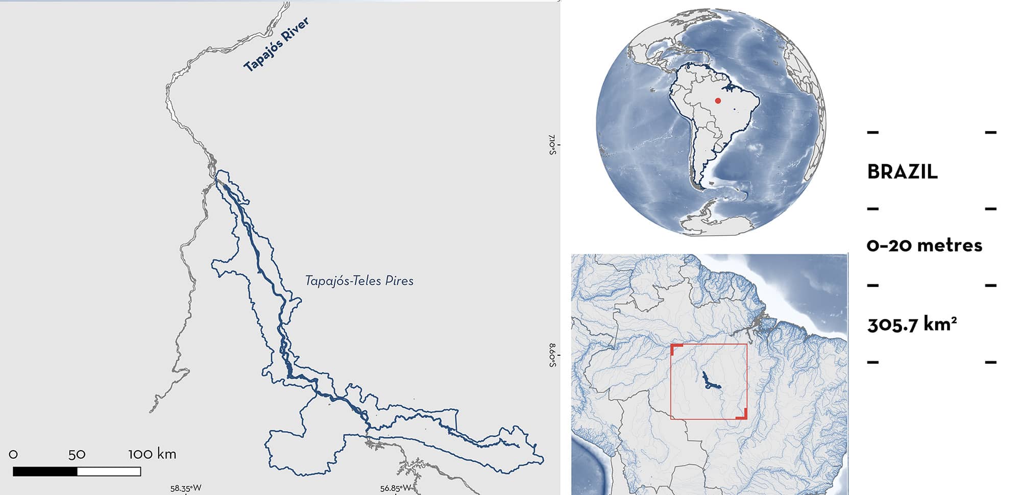
Tapajós-Teles Pires is located in the upper Tapajós basin, Pará and Mato Grosso states in northern Brazil. This area is characterised by clear water, and fast-flowing rivers with large numbers of rapids and waterfalls. This area partially overlaps with Parque Nacional Do Juruena. Within this area there are: threatened species (e.g., Tapajós Freshwater Stingray Potamotrygon albimaculata), and range-restricted species (e.g., Pearl Freshwater Stingray Potamotrygon jabuti).
Download factsheet
Tapajós-Teles Pires
DESCRIPTION OF HABITAT
Tapajós-Teles Pires is located in the upper Tapajós Basin, Pará and Mato Grosso states in northern Brazil. This area comprises the Teles Pires River, a major tributary of the Tapajós River, and the Rio São Benedito I and Rio Azul (or São Benedito II), a primary and secondary tributary of the Teles Pires River, respectively.
The Tapajós River is formed by the confluence of the Teles Pires and Juruena rivers in Barra de São Manuel, along the borders of Pará and Mato Grosso states. The Tapajós is one of the two primary rivers draining the Brazilian Shield within the Amazon Basin (Abell et al. 2008; Dagosta & de Pinna 2019). This area is characterised by clear water, fast-flowing rivers with numerous rapids and waterfalls, which may serve as isolating barriers (Goulding et al. 2003; Vari & Calegari 2014).
The Tapajós Basin experiences a tropical climate with minor variations in surface temperatures but exhibits marked seasonality in precipitation (Peel et al. 2007). In the main channel of the downstream river, water temperatures range from 28–30°C (Fricke et al. 2017). The South American Monsoon System drives rainfall in the basin, promoting a rainy season during the austral summer, with peak discharge occurring from February–May. This high discharge variation creates a pronounced flood pulse that sustains unique seasonally flooded environments in rocky channels with rapids, sediment bar islands, and extensive marginal floodplains.
This area partially overlaps with Parque Nacional Do Juruena (UNEP-WCMC 2025).
This Important Shark and Ray Area is benthic and is delineated from surface waters (0 m) to 20 m based on the bathymetry of the area.
CRITERION A
VULNERABILITY
Two Qualifying Species considered threatened with extinction according to the IUCN Red List of Threatened Species regularly occur in the area. These are the Endangered Pearl Freshwater Stingray (Araújo et al. submitted b) and the Vulnerable Tapajós Freshwater Stingray (Araújo et al. submitted a).
CRITERION B
RANGE RESTRICTED
This area holds the regular presence of Tapajós Freshwater Stingray and Pearl Freshwater Stingray as resident range-restricted species (Carvalho 2016; A Murch pers. comm. 2025).
The Tapajós Freshwater Stingray is endemic to the middle and upper Tapajós River Basin, primarily in the main channel of the Tapajós River (Carvalho 2016; Araújo et al. submitted a). It generally inhabits the deeper, fast‐flowing channels of the main river, and is more abundant in central troughs (Carvalho 2016). In 2005, individuals were captured using several techniques — hand nets, hook and line, and baited longlines (Carvalho 2016). Five of six reports of Tapajós Freshwater Stingray were from this area (Carvalho 2016). The other specimen was captured in the lower section of the Tapajos River (~600 km upstream) (Carvalho 2016). Animals had a body size range of 47–79 cm disc width (DW) which included one juvenile and four adults. During a three‐day expedition in September 2024, an observer snorkelled for three to four hours each day in this area (A Murch pers. comm. 2025; Shark and Rays 2025). During this period, ~5 individuals of Tapajós Freshwater Stingray were encountered daily (A Murch pers. comm. 2025).
The Pearl Freshwater Stingray is endemic to part of the mid and upper Tapajós River Basin, Brazil. This species has a patchy occurrence in the Tapajós River and is mainly present in some of its tributaries. The main occurrence area of the Pearl Freshwater Stingray comprises the Jamanxin River, part of the Teles Pires River, and the Tapajós main river (Carvalho 2016; Araújo et al. submitted b). This species is found in anabranches, creeks, and smaller streams with shallower, cooler waters over rocky, sandy, and leafy substrates (Carvalho 2016). During various surveys, 28 Pearl Freshwater Stingrays were collected using several techniques — hand nets, hook and line, and baited longlines (Carvalho 2016). Of these 15 (56%) were reported from this area (Carvalho 2016). The other specimens were collected from the lower section of the Tapajos River, Cururu River and Jamanxim River (both of which are tributaries of the Tapajos River) upstream from this area (Carvalho 2016). From this area, one individual was collected in 1979 and the other individuals between October–December 2005. These individuals measured 10.7–46.5 cm DW and included a pregnant female (determined by the presence of embryos), 12 adults, and two neonates measuring 10.7–11 cm DW (based on a size at-birth of 10–11 cm DW) (Carvalho 2016). This suggests that this area harbours animals of different life-stages. Furthermore, social media reports from citizen scientists highlight the occurrence of Pearl River Stingray in this area on five occasions between 2019–2020 (Instagram 2025). Finally, in the three‐day snorkelling expedition in September 2024, ~5 individuals of Pearl Freshwater Stingray were encountered daily in addition to an aggregation of four Pearl River Stingrays recorded (A Murch pers. comm. 2025).
Download factsheet
SUBMIT A REQUEST
ISRA SPATIAL LAYER REQUEST
To make a request to download the ISRA Layer in either a GIS compatible Shapefile (.shp) or Google Earth compatible Keyhole Markup Language Zipped file (.kmz) please complete the following form. We will review your request and send the download details to you. We will endeavor to send you the requested files as soon as we can. However, please note that this is not an automated process, and before requests are responded to, they undergo internal review and authorization. As such, requests normally take 5–10 working days to process.
Should you have questions about the data or process, please do not hesitate to contact us.


