ISRA FACTSHEETS
ISRA FACTSHEETS
NEW ZEALAND & PACIFIC ISLANDS REGION
Teuaua and Hemeni
Summary
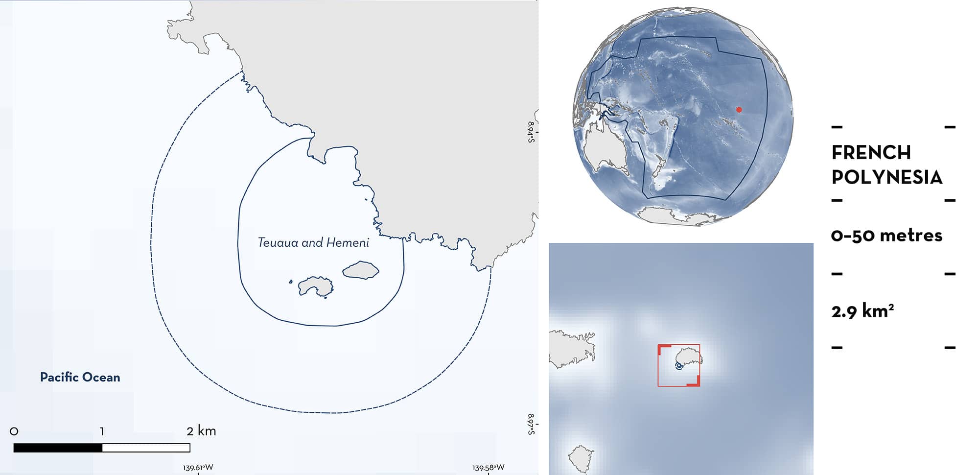
Teuaua and Hemeni is located in the southwest of Ua Huka Island in the Marquesas Archipelago of French Polynesia. This area incorporates two small islets, Teuaua and Hemeni, which support large nesting colonies of seabirds and turbulent surface conditions to provide plankton-rich waters. This area overlaps with the Marquesas Marin Key Biodiversity Area. Within this area there are: threatened species and feeding areas (Reef Manta Ray Mobula alfredi).
Download factsheet
Teuaua and Hemeni
DESCRIPTION OF HABITAT
Teuaua and Hemeni is located on the southwest coast of Ua Huka Island in the Marquesas Archipelago of French Polynesia. The area encompasses the two small islets of Teuaua and Hemeni. An additional small islet, included in the area, to the west of Hemeni is covered at high tide, creating a turbulent and productive seamount environment (M Santangelo pers. obs. 2023). The area is influenced by high concentrations of zooplankton, owing to the position of the islands and exposure to turbulent surface conditions, and the large breeding colonies of Sooty Terns Onychoprion fuscatus (Agence des Aires Marines Protégées 2016). The area is characterised by a steep bathymetry falling to 25 m deep close to Ua Huka Island and in between Teuaua and Hemeni, while descending deeper northwest in the ocean side of these islets.
This area overlaps with the Marquesas Marin Key Biodiversity Area (KBA 2024).
This Important Shark and Ray Area is benthopelagic and is delineated from inshore and surface waters (0 m) to 50 m based on the bathymetry of the area.
CRITERION A
VULNERABILITY
One Qualifying Species considered threatened with extinction according to the IUCN Red List of Threatened Species regularly occurs in the area. This is the Vulnerable Reef Manta Ray (Marshall et al. 2022).
CRITERION C
SUB-CRITERION C2 – FEEDING AREAS
Teuaua and Hemeni is an important feeding area for one ray species.
Between 2018–2023, snorkelling and dive surveys using photo-identification (n = 13), as well as citizen science observations in the area, resulted in a total of 141 sightings of 117 individual Reef Manta Rays (Carpentier et al. 2019; M Santangelo pers. obs. 2023; French Polynesia Manta Project unpubl. data 2024). A total of 12 different feeding aggregations (up to >20 individuals at a time) of Reef Manta Rays have been recorded during the following months and years: June and August 2018, May 2019, 2021, 2022, and February, May and July 2023 (M Santangelo pers. obs. 2023; A Carpentier pers. obs. 2023; French Polynesia Manta Project unpubl. data 2024). No surveys were conducted during the other months of the year (French Polynesia Manta Project unpubl. data 2024). Feeding behaviour was observed in 97% (n = 137) of the observations of Reef Manta Rays in the area (Carpentier 2023; French Polynesia Manta Project unpubl. data 2024).
Additionally, a maximum of 80 individuals within the area have been photo-identified in a single day, highlighting the importance of the area for Reef Manta Rays (M Santangelo pers. obs. 2023; A Carpentier pers. obs. 2023; French Polynesia Manta Project unpubl. data 2024). Reef Manta Rays observed feeding in this area represent 85% (n = 138) of animals identified in Ua Huka Island, and 21% of individuals have been resighted feeding in this area (French Polynesia Manta Project unpubl. data 2024). Further, local ecological knowledge collected from residents from Ua Huka confirm this area as an important site for feeding Reef Manta Rays, with feeding aggregations seen regularly, ranging in size from 15 to >100 individuals (A Carpentier pers. obs. 2023). Reef Manta Rays regularly aggregate in this area, and predictably feed on the high concentrations of zooplankton (A Carpentier pers. obs. 2023; M Santangelo pers. obs. 2023; French Polynesia Manta Project unpubl. data 2024). The unique positioning of the islands and the turbulent surface conditions contribute to this abundance, while large breeding colonies of seabirds and their depositions may further enhance productivity in the surrounding waters as demonstrate in other regions (McCauley et al. 2012).
Download factsheet
SUBMIT A REQUEST
ISRA SPATIAL LAYER REQUEST
To make a request to download the ISRA Layer in either a GIS compatible Shapefile (.shp) or Google Earth compatible Keyhole Markup Language Zipped file (.kmz) please complete the following form. We will review your request and send the download details to you. We will endeavor to send you the requested files as soon as we can. However, please note that this is not an automated process, and before requests are responded to, they undergo internal review and authorization. As such, requests normally take 5–10 working days to process.
Should you have questions about the data or process, please do not hesitate to contact us.


