ISRA FACTSHEETS
ISRA FACTSHEETS
MEDITERRANEAN AND BLACK SEAS REGION
The Trabzon-Rize
Summary
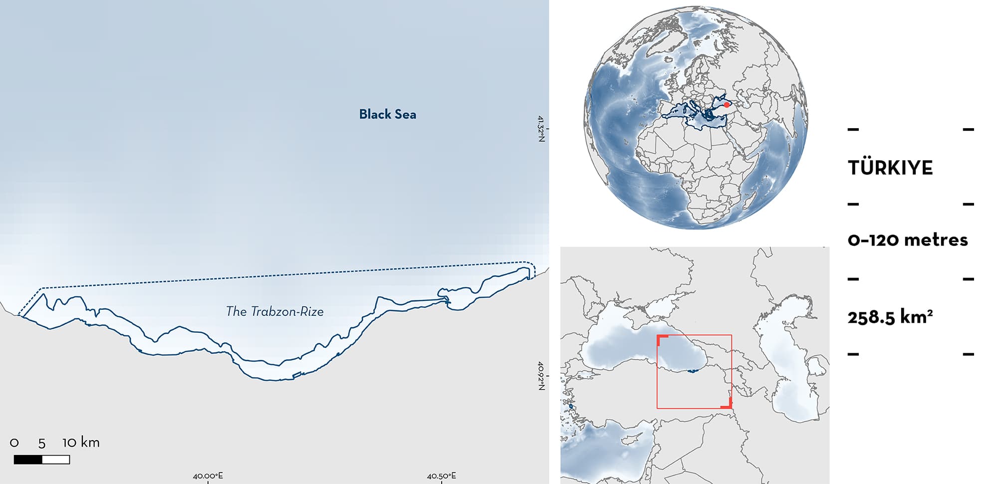
The Trabzon-Rize is located in the southeastern Black Sea of Türkiye. The area is characterised by mud and sand-gravel substrates, with the discharge of several rivers contributing terrestrial nutrients to coastal waters. The area overlaps with two Ecologically or Biologically Significant Marine Areas (Trabzon-Arsin and Trabzon-Surmene). Within the area there are: reproductive areas (Thornback Skate Raja clavata).
Download factsheet
The Trabzon-Rize
DESCRIPTION OF HABITAT
The Trabzon-Rize is located in the southeastern Black Sea of Türkiye. The area is characterised by mud and sand-gravel substrates (Alkan et al. 2022). The area has many large and small rivers that input terrestrial nutrients into coastal waters (Alkan et al. 2022). The highest surface water temperatures are recorded in the boreal summer (~26°C) and the lowest in winter (~9.4°C) when primary productivity is higher (Alkan et al. 2022). The circulation within the area is mostly influenced by rim currents on the slope and anticyclonic eddies on the shelf break.
The area overlaps with two Ecologically or Biologically Significant Marine Areas (EBSA), Trabzon-Arsin and Trabzon-Surmene (CBD 2023a, 2023b).
This Important Shark and Ray Area is delineated from the surface (0 m) to a depth of 120 m based on the distribution of the Qualifying Species within the area.
CRITERION C
SUB-CRITERION C1 – REPRODUCTIVE AREAS
The Trabzon-Rize is an important reproductive area for one ray species.
Based on catches recorded from benthic trawls, female Thornback Skates containing egg cases were recorded between May and December during 2002–2003 (Demirhan et al. 2005) and from July to October in 2009 (n = 2; Saglam & Ak 2012). In addition, based on their body size, neonates have been reported across multiple years. During 2009 (n = 15) and 2011–2013, neonates measuring 12.5–15 cm total length (TL), close to the reported size-at-birth for the species (~10–13 cm TL; Last et al. 2016), were captured with turbot gillnets and beam trawlers, confirming the regular presence of this life-stage in the area (Bilgin & Onay 2020).
Download factsheet
SUBMIT A REQUEST
ISRA SPATIAL LAYER REQUEST
To make a request to download the ISRA Layer in either a GIS compatible Shapefile (.shp) or Google Earth compatible Keyhole Markup Language Zipped file (.kmz) please complete the following form. We will review your request and send the download details to you. We will endeavor to send you the requested files as soon as we can. However, please note that this is not an automated process, and before requests are responded to, they undergo internal review and authorization. As such, requests normally take 5–10 working days to process.
Should you have questions about the data or process, please do not hesitate to contact us.


