ISRA FACTSHEETS
ISRA FACTSHEETS
NEW ZEALAND & PACIFIC ISLANDS REGION
Titi Islands and Ruapuke
Summary
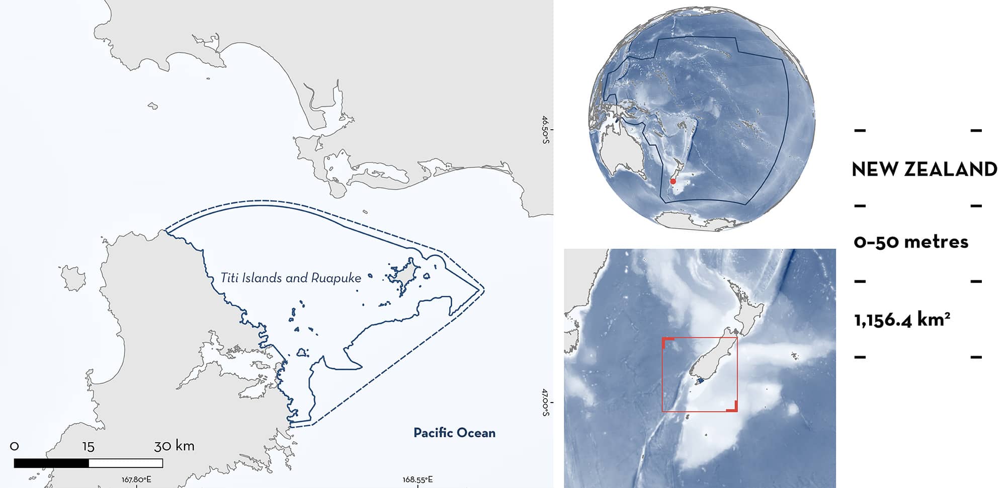
Titi Islands and Ruapuke is located at the southern end of New Zealand’s South Island. The area sits within Foveaux Strait and it is next to Rakiura/Stewart Island. The area is characterised by an extended inner shelf with fine sand, mud and gravel substrates mixed with rocky reefs, and macroalgal patches. It is influenced by strong tidal flows. The area overlaps with the Rakiura (offshore) Key Biodiversity Area. Within this area there are: threatened species and feeding areas (White Shark Carcharodon carcharias).
Download factsheet
Titi Islands and Ruapuke
DESCRIPTION OF HABITAT
Titi Islands and Ruapuke is located at the southern end of New Zealand’s South Island. It is situated in the Foveaux Strait and includes the Titi Islands, Ruapuke Island, Bench Island, Half Passage Rock, Hazelburgh Group, Bird Island, Green Island, and Seal, Topi, and Fairchild Rocks. Foveaux Strait is a shallow water body (~50 m depth) that separates the Tasman Sea from the South Pacific Ocean and is influenced by strong tidal flows (Carbines & Cole 2009). The Titi Islands are a chain of seven islands (North, Women’s, Edwards, Jacky Lee, Herekopare, Kanetetoe) and three small islets (The Bunker Islets) found east of Rakiura/Stewart Island (Moller et al. 2009). Ruapuke is located ~15 km south of the South Island and ~32 km from Rakiura/Stewart Island. The area is characterised by an extended inner shelf with fine sand, mud, and gravel substrates mixed with rocky reefs and macroalgal patches and assemblages of bryozoans and bivalves (Cranfield et al. 2004).
The area overlaps with the Rakiura (offshore) Key Biodiversity Area (KBA 2024).
This Important Shark and Ray Area is benthic and pelagic and is delineated from inshore and surface waters (0 m) to 50 m based on the bathymetry of the area.
CRITERION A
VULNERABILITY
One Qualifying Species considered threatened with extinction according to the IUCN Red List of Threatened Species regularly occurs in the area. This is the Vulnerable White Shark (Rigby et al. 2022).
CRITERION C
SUB-CRITERION C2 – FEEDING AREAS
Titi Islands and Ruapuke is an important feeding area for one shark species.
White Sharks seasonally feed on aggregations of New Zealand Fur Seals Arctocephalus forsteri in the area (Duffy et al. 2012; Francis et al. 2015). This area is a well-known site for cage-diving operations as it is recognised for the regular and predictable presence of White Shark aggregations (SharkExperience 2024). Individuals tagged with satellite and acoustic transmitters between 2007–2013 as well as direct observations by tourist operators have revealed that White Sharks aggregate in the area and have high residency to it (Duffy et al. 2012; Francis et al. 2015; iNaturalist 2024). Sixty-three White Sharks were tagged around Titi Islands and the northeast side of Stewart Island with pop-up archival tags (n = 28: 2007–2012), satellite tags (SPOT, n = 3: 2007, 2010, and 2013), and acoustic tags (n = 45: 2011–2012) mostly in February with only two sharks tagged in March and April (Duffy et al. 2012; Francis et al. 2015). All White Sharks tagged with acoustic transmitters were detected in the receivers’ array from late austral summer to early winter, with a peak in autumn (March–June). White Sharks left the area between May and June and moved to northern areas in New Zealand or to other jurisdictions (New Caledonia and Australia; Duffy et al. 2012; Francis et al. 2015) with half of the sharks returning to Titi Islands and Ruapuke based on satellite tagging, acoustic tagging, and photo-identification (Francis et al. 2015). Most detections were around the north and south sides of Titi Islands with fewer detections around Ruapuke. Tagged White Sharks ranged from 250–480 cm total length (TL; median 350 cm TL) with the majority (~65%) being subadults and the aggregation is dominated by males (2.5:1 ratio). No mature females were observed suggesting that the aggregations are not driven by reproductive processes.
Seasonal aggregations of White Sharks during autumn and winter have also been reported globally (e.g., Guadalupe Island in Mexico, Central California in the United States of America; Jorgensen et al. 2010; Nasby-Lucas & Domeier 2012). This aggregation of White Sharks in Titi Islands and Ruapuke overlaps with the breeding season of New Zealand Fur Seal in summer and autumn (Francis et al. 2015; Watson et al. 2015). New Zealand Fur Seal pups are born from November to January and start swimming in exposed tide pools between February and March. Pups start to move offshore as they start foraging in the following months (Baylis et al. 2005). In addition, female seals make periodical trips to feed and come back to nurse the pups making them vulnerable to predation by White Sharks. Anecdotal observations have confirmed that New Zealand Fur Seals have been found in the stomach contents of White Sharks from the area and attempted predation events have been observed (CAJ Duffy pers. obs. 2024) but none of these sources of information have been quantified. Predation on fur seals have been reported for White Sharks in winter in other regions (Seal Island, South Africa; Fallows et al. 2012).
Download factsheet
SUBMIT A REQUEST
ISRA SPATIAL LAYER REQUEST
To make a request to download the ISRA Layer in either a GIS compatible Shapefile (.shp) or Google Earth compatible Keyhole Markup Language Zipped file (.kmz) please complete the following form. We will review your request and send the download details to you. We will endeavor to send you the requested files as soon as we can. However, please note that this is not an automated process, and before requests are responded to, they undergo internal review and authorization. As such, requests normally take 5–10 working days to process.
Should you have questions about the data or process, please do not hesitate to contact us.


