ISRA FACTSHEETS
ISRA FACTSHEETS
NEW ZEALAND & PACIFIC ISLANDS REGION
Touho
Summary
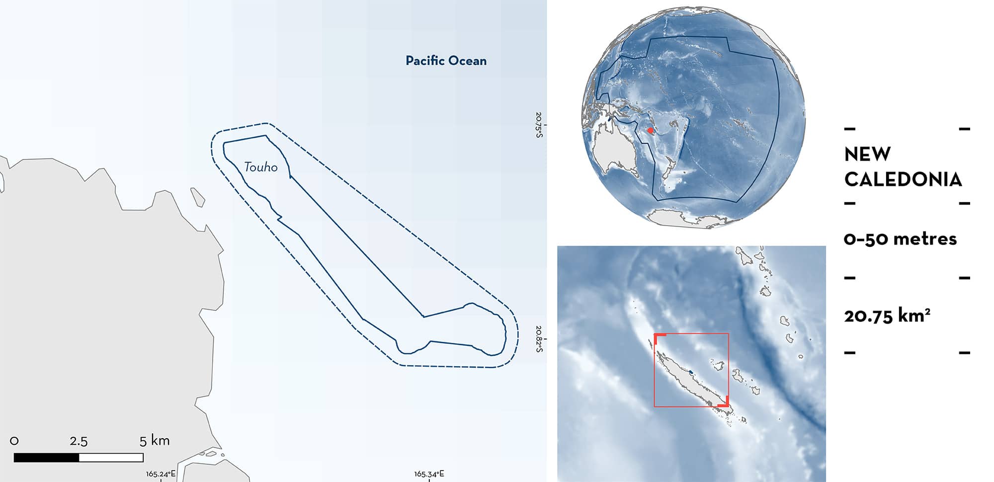
Touho is located on the northeast side of the Grande Terre Island of New Caledonia. The area consists of a barrier reef with reef flats and forereefs, and includes the Great Channel of Touho, a pass with strong currents. It is characterised by dead and live coral substrates with sandy patches. The area overlaps with the Îlots de Poindimié Marin Key Biodiversity Area. Within this area there are: threatened species and undefined aggregations (Reef Manta Ray Mobula alfredi).
Download factsheet
Touho
DESCRIPTION OF HABITAT
Touho is located on the northeast side of the Grande Terre Island of New Caledonia. The area is ~5 km from the coast and consists of a barrier reef with reef flats and forereefs. The area includes the Great Channel of Touho, a pass with strong currents that extends ~10 km. It is characterised by dead and live coral substrates with sandy patches (Pelletier et al. 2020).
The area overlaps with the Îlots de Poindimié Marin Key Biodiversity Area (KBA 2024).
This Important Shark and Ray Area is benthic and pelagic and is delineated from inshore and surface waters (0 m) to 50 m based on the bathymetry of the area.
CRITERION A
VULNERABILITY
One Qualifying Species considered threatened with extinction according to the IUCN Red List of Threatened Species regularly occurs in the area. This is the Vulnerable Reef Manta Ray (Marshall et al. 2022).
CRITERION C
SUB-CRITERION C5 – UNDEFINED AGGREGATIONS
Touho is an important area for undefined aggregations of one ray species.
Reef Manta Rays regularly and predictably use the cleaning station which characterises this area (Lassauce et al. 2024). Between 2017–2020, photographs of Reef Manta Rays were collected from recreational divers, snorkelers, and during diving surveys across 11 sites in New Caledonia (Lassauce et al. 2024). Additionally, photographs from Touho were taken in 150 days of sampling between 2014–2020, with a higher effort (85.3%) concentrated between 2014–2015 (Lassauce et al. 2024). In Touho, 591 sightings (average = 3.9 individuals sighted per day) were recorded from one aggregation site that serves as a cleaning station, in the northern tip of the Great Channel of Touho. Of the total sightings, 72 individuals were identified within the area with 76.4% of them resighted at least once in a period of 1,196 ± 764 days (maximum of 4,596 days; Lassauce et al. 2024). This cleaning station is located on the reef flat at 15–20 m depth. Within the area, aggregations of 5–20 individuals are regularly observed (H Lassauce unpubl. data 2024). Juveniles and pregnant females (determined by visual size estimation and the presence of extended abdomen) have also been observed within these aggregations (H Lassauce unpubl. data 2024). However, further information is required to determine whether this area is also important for reproductive purposes.
Download factsheet
SUBMIT A REQUEST
ISRA SPATIAL LAYER REQUEST
To make a request to download the ISRA Layer in either a GIS compatible Shapefile (.shp) or Google Earth compatible Keyhole Markup Language Zipped file (.kmz) please complete the following form. We will review your request and send the download details to you. We will endeavor to send you the requested files as soon as we can. However, please note that this is not an automated process, and before requests are responded to, they undergo internal review and authorization. As such, requests normally take 5–10 working days to process.
Should you have questions about the data or process, please do not hesitate to contact us.


