ISRA FACTSHEETS
ISRA FACTSHEETS
MEDITERRANEAN AND BLACK SEAS REGION
Tuscany Offshore Thumb
Summary
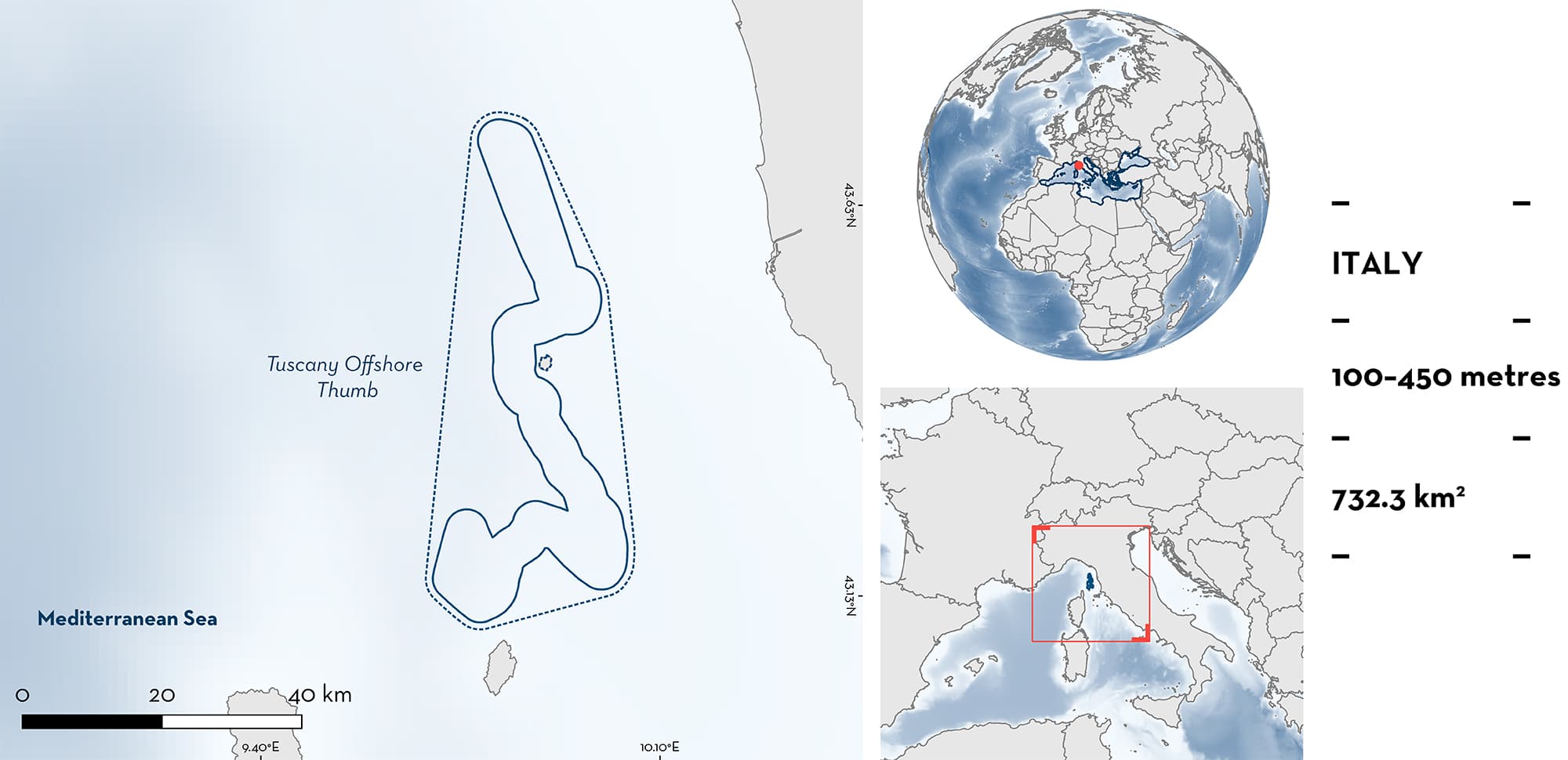
Tuscany Offshore Thumb is located ~45 km off the Tuscany coast of Italy. The area is a platform bordering the continental shelf and lies around the Islands of Capraia and Gorgona in the Tyrrhenian Sea, northwest Mediterranean Sea. The area belongs to the Tuscany Magmatic Province, an association of intrusive and effusive rocks. In the core of the area, the seafloor is characterised by thanatocoenosis surrounded at relatively lower depths by fine detrital substrates with communities of the sea-lily crinoid Leptometra phalangium. The area overlaps with the Pelagos Sanctuary for Marine Mammals, an Ecologically and Biologically Significant Marine Area, and a Key Biodiversity Area. Within this area there are: reproductive areas (Smallspotted Catshark Scyliorhinus canicula).
Download factsheet
Tuscany Offshore Thumb
DESCRIPTION OF HABITAT
Tuscany Offshore Thumb is located ~45 km off the western Italian coastline, in the Tuscan Archipelago. The area extends on the bottom of the outer limit of the continental shelf and has its midpoint at ~25 km from the island of Gorgona and 20 km from the island of Capraia. At a large scale, the area is affected by the Eastern Corsica Current that merges the colder Western Corsica Current supporting a cyclonic circulation toward the Northern Tyrrhenian and Ligurian Seas (Cataudella & Spagnolo 2011). At a finer scale, the surface currents form a clockwise circulation that turns southwards on the northern part of the island of Gorgona, until they embrace the southern coast of the island of Capraia (Astraldi et al. 1993). The seafloor includes beds of thanatocoenosis, surrounded at relatively lower depths by shelf-edge detrital substrates with communities of the sea-lily crinoid Leptometra phalangium.
The area overlaps with the Pelagos Sanctuary for Marine Mammals, an Ecologically and Biologically Significant Marine Area (the North-western Mediterranean Benthic Ecosystems EBSA; CBD 2016), and a Key Biodiversity Area (Arcipelago Toscano; KBA 2023).
This Important Shark and Ray Area is benthic and is delineated from 100 m to 450 m based on the bathymetry of the area.
CRITERION C
SUB-CRITERION C1 – REPRODUCTIVE AREAS
Tuscany Offshore Thumb is an important reproductive area for one shark species.
High densities of juveniles and egg cases of Smallspotted Catshark have been found in the area during >30 years of investigations (1985–2022; GRUND, Data Collection Framework-MEDITS [Mediterranean International Trawl Surveys]; Relini et al. 2000; Bertrand et al. 2002; Spedicato et al. 2019; MEDITS 2022). Egg cases are deposited in the area, attached to any material of biological and anthropological origin on the seafloor, and juveniles were recorded in MEDITS hauls (n = 6). Three trawl hauls were reported from south of the island of Gorgona at approximately 190, 220, and 400 m depth, and three hauls in the northern part at 200, 270, and 305 m depth. Further, in about 160 hauls conducted in the area from 1985 to 2022, an average of 2–4 egg cases were observed per haul, with an exceptional observation of tens of egg cases in one haul. Smallspotted Catshark pregnant females stay in the area only for the deposition of eggs and thereafter move to shallower waters, where they are more frequently caught (F. Serena unpubl. data 1985–2021).
In addition to the density of egg cases in the area, juvenile Smallspotted Catshark remain in the area for about a year, which is demonstrated by the capture of individuals up to 25 cm total length (TL) over several research campaigns (Baino & Serena 2000; Ivory et al 2004; Abella et al. 2017). This size corresponds to the size of young-of-the-year individuals (Ivory et al. 2004; Abella et al. 2017). These findings were recently confirmed by data from the MEDITS trawl survey, conducted from 2014 to 2018, with individuals considered to be <1 year old caught in the southernmost three MEDITS hauls, and a relatively high number also caught in the hauls to the north of the island of Gorgona.
Download factsheet
SUBMIT A REQUEST
ISRA SPATIAL LAYER REQUEST
To make a request to download the ISRA Layer in either a GIS compatible Shapefile (.shp) or Google Earth compatible Keyhole Markup Language Zipped file (.kmz) please complete the following form. We will review your request and send the download details to you. We will endeavor to send you the requested files as soon as we can. However, please note that this is not an automated process, and before requests are responded to, they undergo internal review and authorization. As such, requests normally take 5–10 working days to process.
Should you have questions about the data or process, please do not hesitate to contact us.


