ISRA FACTSHEETS
ISRA FACTSHEETS
MEDITERRANEAN AND BLACK SEAS REGION
Tyrrhenian
Summary
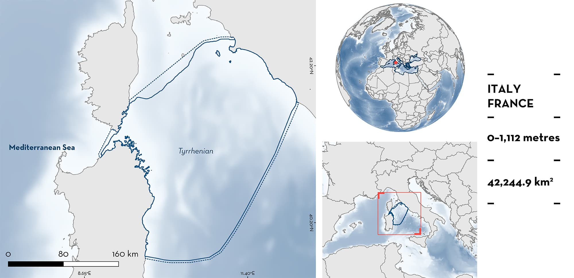
Tyrrhenian is a large area between the Italian peninsula and the east coasts of southern Corsica and Sardinia. The area is characterised by habitats that include mostly pelagic waters over an abyssal plain scattered with ridges and seamounts. The northern part of the area includes a portion of the Tuscan Archipelago National Park, and the North-western Mediterranean Pelagic Ecosystem Ecologically or Biologically Significant Marine Area. Within this area there are: threatened species and undefined aggregations (Spinetail Devil Ray Mobula mobular).
Download factsheet
Tyrrhenian
DESCRIPTION OF HABITAT
Tyrrhenian is a large area between the Italian peninsula and the east coasts of southern Corsica and Sardinia. The area includes mostly pelagic habitats over an abyssal plain scattered with ridges and seamounts, typical of the Tyrrhenian Sea. This sea hosts delicate coastal and offshore ecosystems, and is characterised by rich hydrodynamics, driven by interactions between the local forcing, the topography, the bathymetry of the area, and exchanges with adjacent sub-basins (Iacono et al. 2021).
The northern part of the area includes a portion of the Tuscan Archipelago National Park, and the North-western Mediterranean Pelagic Ecosystem Ecologically or Biologically Significant Marine Area (CBD 2023).
This Important Shark and Ray Area is pelagic and is delineated from surface waters (0 m) to 1,112 m based on the known depth range of the Qualifying Species.
CRITERION A
VULNERABILITY
The one Qualifying Species within the area is considered threatened with extinction according to the IUCN Red List of Threatened SpeciesTM. The Spinetail Devil Ray is assessed as Endangered (Marshall et al. 2022).
CRITERION C
SUB-CRITERION C5 – UNDEFINED AGGREGATIONS
Tyrrhenian is an important area for aggregations of one ray species.
Evidence from aerial surveys indicates that Spinetail Devil Ray aggregate in the area during summer in densities comprised between 0.58 and 4.19 individuals per grid cell (17 km2) (Notarbartolo di Sciara et al. 2015). These data are based on a total of 118 sightings made in two separate years (2010 and 2013), with a total population estimate of 3,265 animals (CV = 15.1).
The reason(s) for this aggregation is/are still undefined. Spinetail Devil Ray is known to feed in the area, and there are a few instances in which stomach contents could be examined in individuals taken as bycatch. Likewise, Spinetail Devil Ray is known to migrate across the area in its seasonal movements within the Mediterranean.
Download factsheet
SUBMIT A REQUEST
ISRA SPATIAL LAYER REQUEST
To make a request to download the ISRA Layer in either a GIS compatible Shapefile (.shp) or Google Earth compatible Keyhole Markup Language Zipped file (.kmz) please complete the following form. We will review your request and send the download details to you. We will endeavor to send you the requested files as soon as we can. However, please note that this is not an automated process, and before requests are responded to, they undergo internal review and authorization. As such, requests normally take 5–10 working days to process.
Should you have questions about the data or process, please do not hesitate to contact us.


