ISRA FACTSHEETS
ISRA FACTSHEETS
MEDITERRANEAN AND BLACK SEAS REGION
Vama Veche
Summary
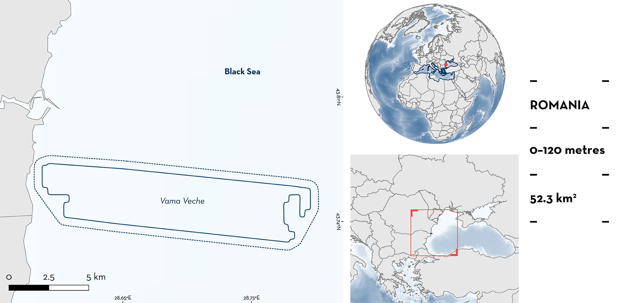
Vama Veche is located in the southern Romanian Black Sea. The area is characterised by a wide continental shelf with sandy and muddy substrates. Other habitats within the area include reefs, rocky areas, and patches of seagrass. This area overlaps with the Vama Veche-2 Mai Marine Reserve Ecologically or Biologically Significant Marine Area, the Black Sea Key Biodiversity Area, and a Natura 2000 site. Within this area there are: threatened species and undefined aggregations (Spiny Dogfish Squalus acanthias).
Download factsheet
Vama Veche
DESCRIPTION OF HABITAT
Vama Veche is located in the southern Romanian Black Sea, near the border with Bulgaria. It is characterised by a wide continental shelf with muddy and sandy substrates. Other habitats within the area include reefs, rocky areas, and patches of seagrass (Nicolaev et al. 2018). The area holds a high biodiversity of benthic and pelagic species producing one of the most diverse areas in Romania (Niță et al. 2012, 2022; Nicolaev et al. 2018). Sea surface temperature in the area ranges from 2–6°C during the boreal winter to 23°C in summer (EMFF 2017).
The area overlaps with Vama Veche-2 Mai Marine Reserve Ecologically or Biologically Significant Marine Area (CBD 2023), the Black Sea Key Biodiversity Area (KBA 2023), and the Vama Veche – 2 Mai Marine Reserve, a Natura 2000 Marine Protected Area.
This Important Shark and Ray Area is benthopelagic and is delineated from the surface (0 m) to 120 m based on the distribution of the Qualifying Species in the area.
CRITERION A
VULNERABILITY
The one Qualifying Species within the area is considered threatened with extinction according to the IUCN Red List of Threatened SpeciesTM. The Spiny Dogfish is assessed as Vulnerable (Finucci et al. 2020).
CRITERION C
SUB-CRITERION C5 – UNDEFINED AGGREGATIONS
Vama Veche is an important aggregation area for one shark species.
According to catches from benthic trawlers, Spiny Dogfish are present year–round in the area (Radu et al. 2013a). From April–June and October–November, individuals are found aggregating in nearshore parts of the area (10–50 m depths) while the rest of the year they occupy depths of 60–120 m (Radu et al. 2013a). Movements to nearshore areas seems to be related to reproductive processes. It has been reported that pregnant females move to the coastal zone to give birth during the spring and autumn, at depths between 10–30 m and temperatures between 12–18°C, while males remain at depths between 30–50 m (Radu & Miauta 2012; Radu et al. 2013a).
Between 2002–2005 and 2009–2019, all individuals caught in benthic trawlers, beam trawlers, and turbot gillnets were adults. Sizes (89–143 cm total length [TL]) were larger than the reported maturity size for the species (females 66–93 cm TL; males 52–64 cm TL; Ebert et al. 2021), with most sharks between 102–122 cm TL (Maximov et al. 2007; Radu & Miauta 2012; Radu et al. 2013a; Totoiu et al 2016; Galațchi et al. 2021; Ţiganov et al. 2021). The presence of these mature individuals confirms the contemporary occurrence of these aggregations after the reported decline in catches of the species as a result of population reductions (Radu et al. 2011, 2013a, 2013b; Ellis et al. 2016). Due to the characteristics of fishing gears, neonates are rarely caught in these fisheries (Radu et al. 2010, 2011, 2013a), but the rich habitat and species diversity found in the area may provide optimal locations for shelter and feeding of early life–stages (Niță et al. 2012, 2022; Nicolaev et al. 2018). In addition, recent monitoring has confirmed that juveniles are caught in the area (V. Niţă et al. pers. obs. 2023).
Large schools also aggregate in the area during winter at depths of 70–120 m. Previously, the area was reported as an important feeding area in the 1980s (Radu & Miauta 2012) where they were feeding on Whiting Merlangius merlangus, European Sprat Sprattus sprattus, and European Anchovy Engraulis encrasicolus aggregations that migrate to wintering grounds in the area (Radu & Miauta 2012; Radu et al. 2013a). These species are one of the most important fishing resources in Romania since the 1970s (Radu et al. 2010, 2011, 2013a; Nicolae et al. 2011; Totoiu et al 2016). However, there are no contemporary data confirming that feeding is still occurring. In 2019, Spiny Dogfish were bycatch of fishing operations targeting Whiting and European Sprat, indicating that prey are still abundant in the area and that Spiny Dogfish could feed on them during their aggregations (Tiganov et al. 2021). More evidence is needed to confirm the contemporary purpose of these aggregations.
Download factsheet
SUBMIT A REQUEST
ISRA SPATIAL LAYER REQUEST
To make a request to download the ISRA Layer in either a GIS compatible Shapefile (.shp) or Google Earth compatible Keyhole Markup Language Zipped file (.kmz) please complete the following form. We will review your request and send the download details to you. We will endeavor to send you the requested files as soon as we can. However, please note that this is not an automated process, and before requests are responded to, they undergo internal review and authorization. As such, requests normally take 5–10 working days to process.
Should you have questions about the data or process, please do not hesitate to contact us.


