ISRA FACTSHEETS
ISRA FACTSHEETS
WESTERN INDIAN OCEAN REGION
Walters Shoals
Summary
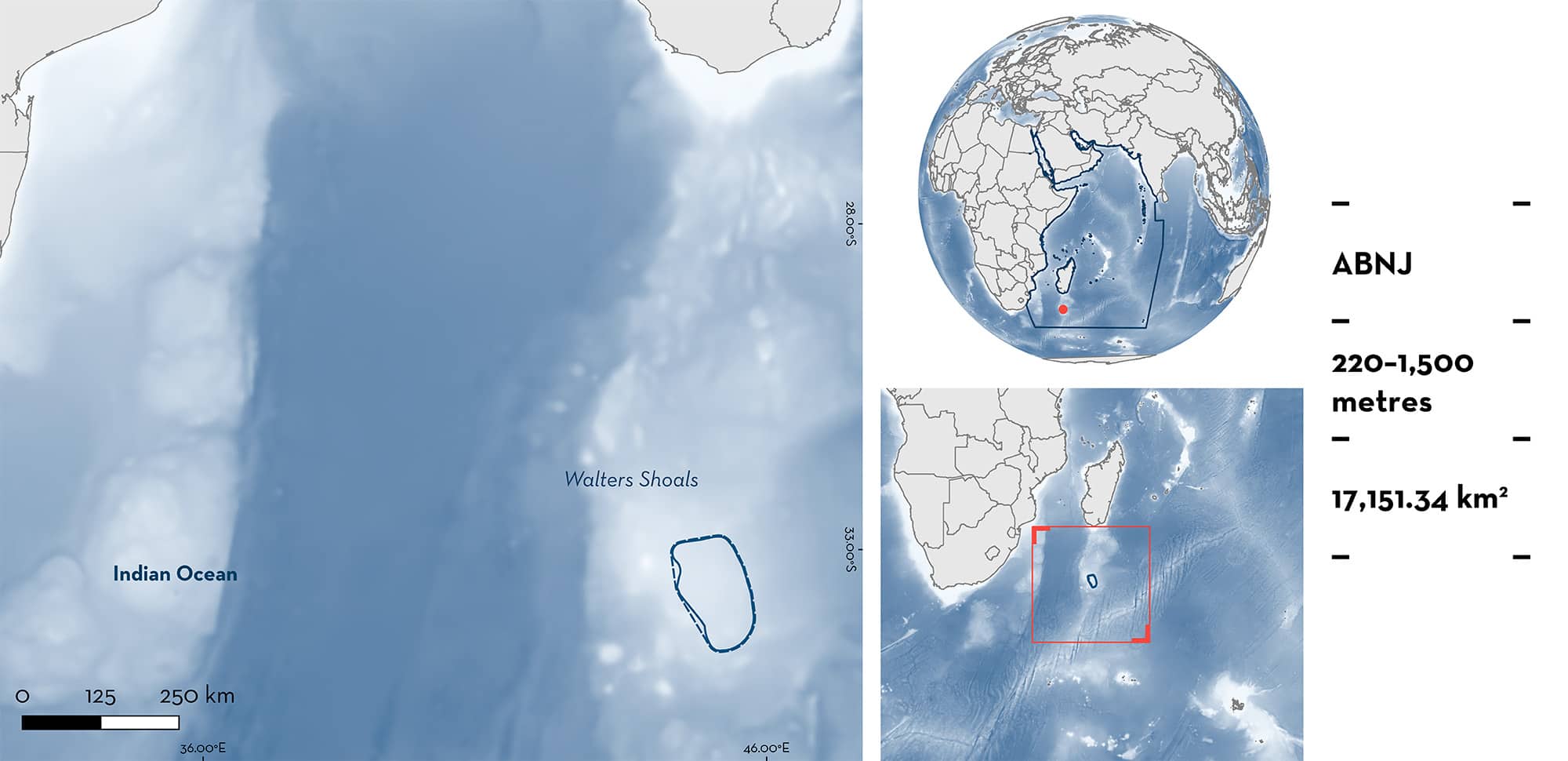
Walters Shoals is located in the high seas, ~850 km south of Madagascar on the Madagascar Ridge. Walters Shoals is characterised by a deep plateau with abyssal plains and hills. The area partly overlaps with the Walters Shoals Ecologically or Biologically Significant Marine Area. Within this area there are: range-restricted species (Bach’s Catshark Bythaelurus bachi); reproductive areas (Bach’s Catshark); and undefined aggregations (Southern Lanternshark Etmopterus granulosus).
Download factsheet
Walters Shoals
DESCRIPTION OF HABITAT
Walters Shoals is located in the high seas, ~850 km south of the southern tip of Madagascar on the Madagascar Ridge in the Western Indian Ocean. The Madagascar Ridge is 1,300 km long and shallow (maximum 2,000 m depth) compared to adjacent waters that can reach >5,000 m depth. The area is characterised by abyssal plains and hills that sit on a deep plateau.
Walters Shoals is near the southern boundary of a large subtropical gyre where currents are relatively low (Vianello et al. 2020). It has some of the highest primary productivity enrichment in the high seas of the southwestern Indian Ocean (Demarcq et al. 2020).
The area partly overlaps with the Walters Shoals Ecologically or Biologically Significant Marine Area (EBSA; CBD 2023) and with a Benthic Protected Area (BPA; Rogers et al. 2017).
This Important Shark and Ray Area is benthic and extends from 220–1,500 m based on the depth ranges of the Qualifying Species and the bathymetry of the area.
CRITERION B
RANGE RESTRICTED
This area holds the regular presence of one shark species as a resident range-restricted species.
Surveys in the region have been limited, but opportunistic data collected indicate the regular and predictable presence of Bach’s Catsharks in the area. The species was captured exclusively in Walters Shoals, despite surveys including nearby areas, such as the Southwest Indian Ocean Ridge and the northern part of the Madagascar Ridge. Bach’s Catsharks were recorded during surveys in 1988 (n = 32), 2012 (n = 1), and 2014 (n = 11; Weigmann et al. 2016). Although the species does not fall within a Large Marine Ecosystem (LME), its range is much smaller than the area of the nearby LME, highlighting their limited range.
CRITERION C
SUB-CRITERION C1 – REPRODUCTIVE AREAS
Walters Shoals is an important reproductive area for one shark species.
Bach’s Catsharks have only ever been recorded from this area despite surveys in adjacent areas (Weigmann et al. 2016). Of 44 specimens caught in survey trawls in 1988, 2012, and 2014, three were pregnant females with one fully developed egg case in each uterus, and three were neonates. Of the other 38 specimens, 24 were juveniles (1:1 female to male ratio), 11 were adult females, and three were adult males (Weigmann et al. 2016). This indicates that the species undertakes their whole life cycle in the area, including mating, gestating, and pupping.
CRITERION C
SUB-CRITERION C5 – UNDEFINED AGGREGATIONS
Walters Shoals is an important area for undefined aggregations of one shark species.
Southern Laternsharks are regularly caught in large numbers in the area. They were the most commonly captured shark species (n = 1,609) on a 49-day benthic trawl fishing trip in the area in June–July 2009 targeting Orange Roughy Hoplostethus atlanticus, during which a total of 2,099 deepwater sharks were caught and measured (Sanders 2023). The species has been regularly recorded during exploratory research surveys and as bycatch in fisheries operating around Walters Shoal since the 1970s (e.g., Parin et al. 1993; Clerkin 2017). The relative abundance of Southern Lanternshark observed as fisheries bycatch in trawl fisheries on Walters Shoals in 2012 and 2014 (n = 97 tows) was 3.15 sharks per tow of ~60 min, respectively (Clerkin 2017). It is likely that this area is important for feeding and reproduction, but the purpose of these aggregations is currently unknown.
Download factsheet
SUBMIT A REQUEST
ISRA SPATIAL LAYER REQUEST
To make a request to download the ISRA Layer in either a GIS compatible Shapefile (.shp) or Google Earth compatible Keyhole Markup Language Zipped file (.kmz) please complete the following form. We will review your request and send the download details to you. We will endeavor to send you the requested files as soon as we can. However, please note that this is not an automated process, and before requests are responded to, they undergo internal review and authorization. As such, requests normally take 5–10 working days to process.
Should you have questions about the data or process, please do not hesitate to contact us.


