ISRA FACTSHEETS
ISRA FACTSHEETS
NEW ZEALAND & PACIFIC ISLANDS REGION
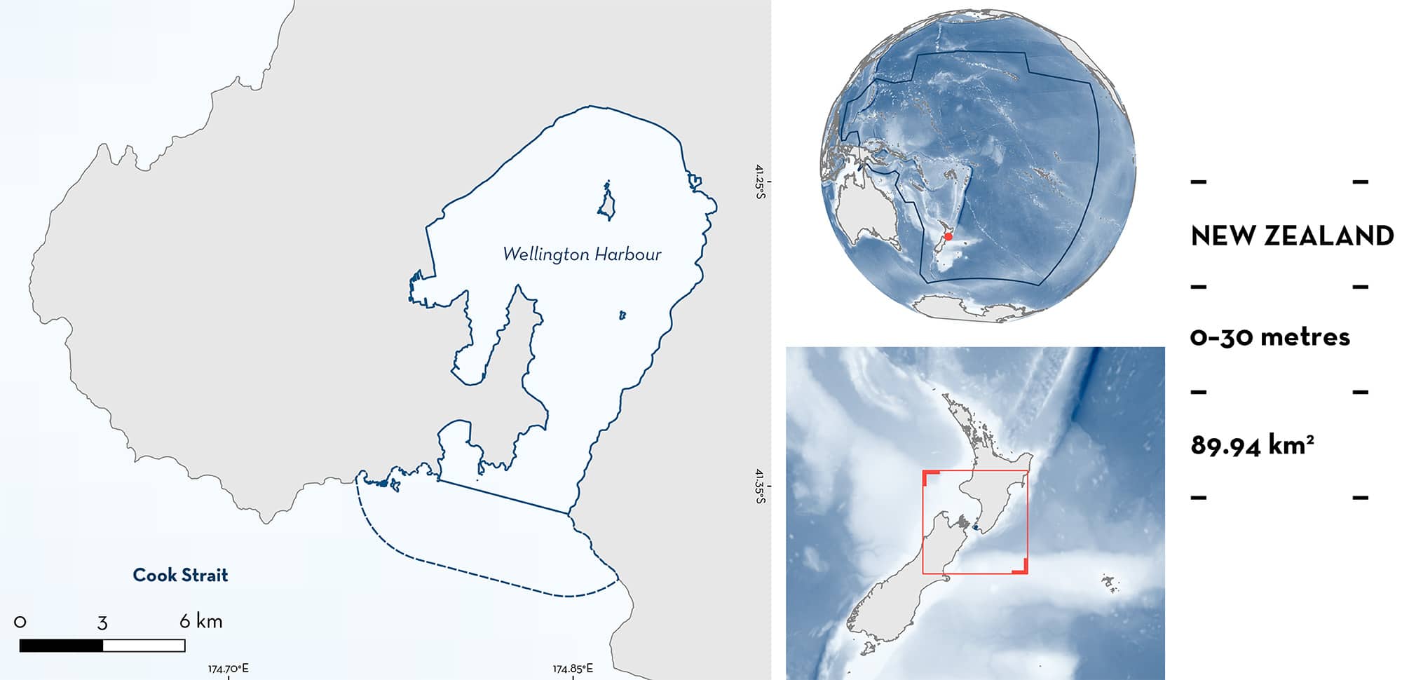
Wellington Harbour
Summary
Wellington Harbour is located on the southern tip of the North Island of New Zealand. The area is a subtidal estuary with multiple bays, creeks, small islands, and rivers flowing into it. It is characterised by muddy substrates with benthic communities dominated by bivalves, polychaetes, and crustaceans. The area overlaps with the Cook Strait Key Biodiversity Area. Within this area there are: reproductive areas (Elephant Fish Callorhinchus milii) and resting areas (Southern Eagle Ray Myliobatis tenuicaudatus).
Download factsheet
Wellington Harbour
DESCRIPTION OF HABITAT
Wellington Harbour is located on the southern tip of the North Island of New Zealand. It is a subtidal estuary with a maximum length of ~11 km and a width of 9 km. The area has multiple bays (e.g., Evans Bay, Lambton Harbour, Balaena Bay, Days Bay, and Lyall Bay), creeks, small islands (Somes Island, Ward Island, and Mokopuna Island) and rivers flowing into it (e.g., Hutt River, Kaiwharawhara Stream, Korokoro Stream, and Waiwhetū Stream). Wellington Harbour is characterised by muddy substrates with benthic communities dominated by bivalves, polychaetes, and crustaceans (Cummings et al. 2022). Circulation in the area is largely dominated by tidal dynamics. Lower sea surface temperatures are reported in austral winter (~11°C) while higher temperatures occur in summer (~17°C; Tam 2012).
The area overlaps with the Cook Strait Key Biodiversity Area (KBA 2024).
This Important Shark and Ray Area is benthic and pelagic and is delineated from inshore and surface waters (0 m) to 30 m based on the bathymetry of the area.
CRITERION C
SUB-CRITERION C1 – REPRODUCTIVE AREAS
Wellington Harbour is an important reproductive area for one chimaera species.
Elephant Fish egg cases (identified by the egg morphology; Lyon et al. 2011), juveniles, and adults are regularly reported by recreational fishers, swimmers, and from washed up egg cases around Wellington Harbour, particularly in late summer (February and March; Jones & Hadfield 1985; B Finucci pers. obs. 2024). Contemporary records since 2021 (>97 egg cases) show Elephant Fish egg cases observed by divers and snorkelers at depths <6 m and washing up every month on multiple beaches in the area, including Oriental Parade, Balaena Bay, Breaker Bay, Robinson Bay, Scorching Bay, Hataitai Beach, Days Bay, and Lyall Bay (B Finucci pers. obs. 2024; iNaturalist 2024a). Egg cases are observed year-round; they are likely deposited by females in the summer and remain on the seafloor for 6-8 months before hatching like in other places in New Zealand (Francis et al. 1997; Lyon et al. 2011). Juveniles and adult Elephant Fish are more abundant in the area during late austral spring and summer, when they are caught each week by recreational fishers nearshore, but they can be found in the harbour year-round, particularly in deeper waters off Ward Island to Seatoun (https://www.petelambfishing.co.nz; B Finucci unpubl. data 2024).
CRITERION C
SUB-CRITERION C3 – RESTING AREAS
Wellington Harbour is an important resting area for one ray species.
Since 2015, Southern Eagle Rays have been frequently observed during summer months (December–February) but are present in the area from ~October–April. Southern Eagle Rays are regularly and predictably observed in the area ~two times per week in pairs or in larger aggregations of up to 12 individuals, particularly in Whairepo Lagoon. While in some locations in the area, Southern Eagle Rays are observed swimming in the surface, most of the observed individuals are often found resting in shallow (and presumably warm) waters on soft substrates or in human-made submerged platforms during high tide (B Finucci pers. obs. 2024; iNaturalist 2024b). This behavior has not been previously reported for this species (Araujo et al. 2024) highlighting the importance of the area.
Download factsheet
SUBMIT A REQUEST
ISRA SPATIAL LAYER REQUEST
To make a request to download the ISRA Layer in either a GIS compatible Shapefile (.shp) or Google Earth compatible Keyhole Markup Language Zipped file (.kmz) please complete the following form. We will review your request and send the download details to you. We will endeavor to send you the requested files as soon as we can. However, please note that this is not an automated process, and before requests are responded to, they undergo internal review and authorization. As such, requests normally take 5–10 working days to process.
Should you have questions about the data or process, please do not hesitate to contact us.


