ISRA FACTSHEETS
ISRA FACTSHEETS
MEDITERRANEAN AND BLACK SEAS REGION
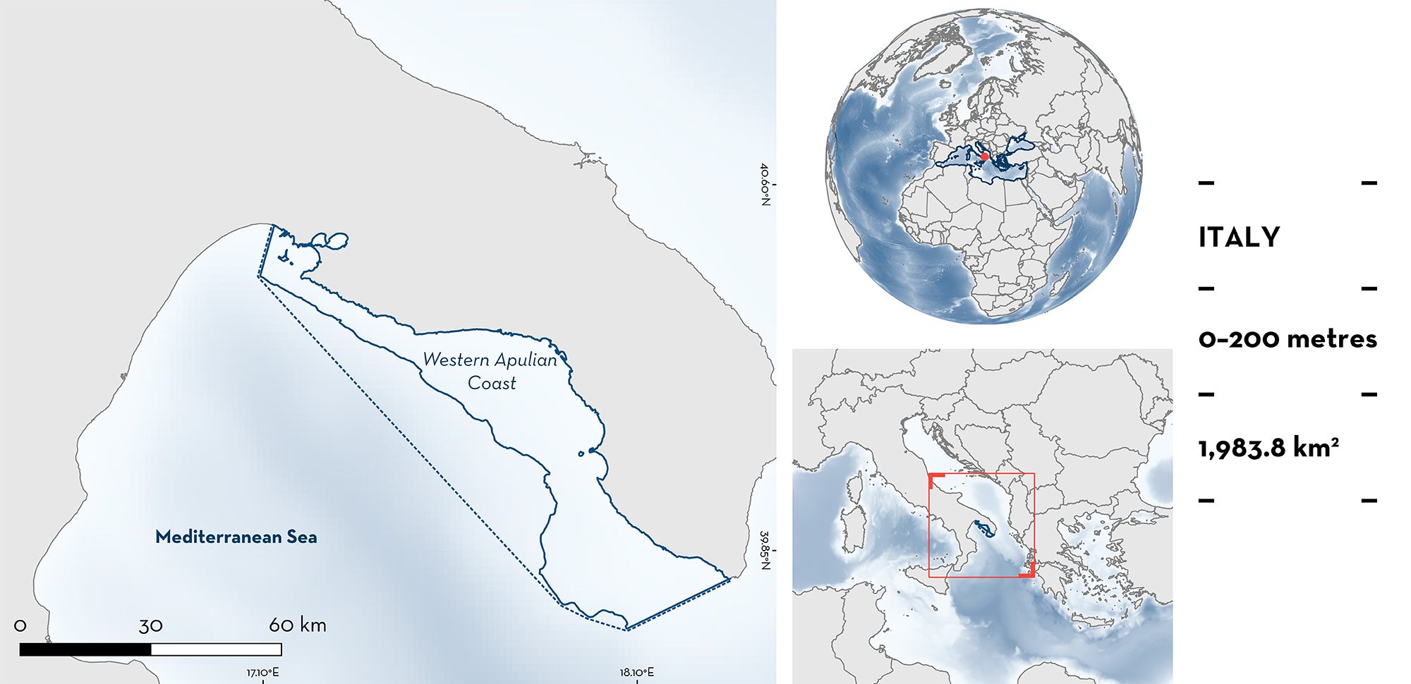
Western Apulian Coast
Summary
Western Apulian Coast is located in southeastern Italy. It constitutes the eastern part of the largest gulf in Italy, the Gulf of Taranto. The area includes pelagic waters over the continental shelf. Offshore of the area, there is a deep submarine canyon leading to the ‘Taranto Valley’, an area reaching 2,200 m depth. This characteristic causes a complex flow pattern of water masses and the occurrence of upwelling events with significant seasonal variability. The area includes Porto Cesareo marine protected area, and the southern part falls within the South Adriatic Ionian Straight Ecologically or Biologically Significant Marine Area. Within this area there are: threatened species and areas important for feeding (Basking Shark Cetorhinus maximus).
Download factsheet
Western Apulian Coast
DESCRIPTION OF HABITAT
Western Apulian Coast is located in southeastern Italy, in the northern Ionian Sea. It extends from Santa Maria di Leuca to Taranto and borders the Salento (Apulia) peninsula.
The area encompasses pelagic waters over a wide continental shelf. Offshore of the area, the Gallipoli Canyon leads to a deep central trench >2,000 m deep, the Taranto Valley, that connects to the eastern Mediterranean Sea.
The basin‐scale circulation is dominated by cyclonic and anticyclonic gyres, generating both mesoscale and sub-mesoscale eddies, upwelling (anticyclonic gyres), and downwelling (cyclonic gyres). This circulation is likely to be the main driver of ecosystem variability (Pinardi et al. 2016).
This Important Shark and Ray Area is pelagic and is delineated from surface waters (0 m) to 200 m based the bathymetry of the area.
CRITERION A
VULNERABILITY
The one Qualifying Species within the area is considered threatened with extinction according to the IUCN Red List of Threatened SpeciesTM. The Basking Shark is assessed as Endangered (Rigby et al. 2021).
CRITERION C
SUB-CRITERION C2 – FEEDING AREAS
Western Apulian Coast is an important feeding area for one shark species.
Regular seasonal sightings of Basking Sharks occur in late boreal winter/early spring. Aggregations of up to four individuals ranging in size between 300–900 cm total length (TL), make the Gulf of Taranto a known hotspot of Basking Shark occurrence in the Mediterranean Sea (Carlucci et al. 2014; de Sabata et al. 2014; Mancusi et al. 2020; de Sabata unpubl. data 2023).
Seven (February–March 2013) and 57 (mostly January–March 1977–2013) Basking Shark individuals have been reported in the area. These were reported in Taranto, off Torre Borraco and in the marine protected area of Porto Cesareo (Carlucci et al. 2014); and in Porto Cesareo/Gallipoli, a 30 km long stretch within the area, at the mouth of the canyon leading to the Taranto Valley (de Sabata et al. 2014).
Many individuals were directly observed cruising on the surface with their mouth open, which is a typical feeding behaviour for this species (Carlucci et al. 2014; de Sabata unpubl. data 2023). Such feeding behaviour in late winter/early spring has been shown to correlate to seasonal and interannual variations of phytoplankton biomass in northeastern Sardinia (de Sabata et al. 2013) and it is likely that similar correlations occur in Western Apulian Coast.
Download factsheet
SUBMIT A REQUEST
ISRA SPATIAL LAYER REQUEST
To make a request to download the ISRA Layer in either a GIS compatible Shapefile (.shp) or Google Earth compatible Keyhole Markup Language Zipped file (.kmz) please complete the following form. We will review your request and send the download details to you. We will endeavor to send you the requested files as soon as we can. However, please note that this is not an automated process, and before requests are responded to, they undergo internal review and authorization. As such, requests normally take 5–10 working days to process.
Should you have questions about the data or process, please do not hesitate to contact us.


