ISRA FACTSHEETS
ISRA FACTSHEETS
MEDITERRANEAN AND BLACK SEAS REGION
Formentera Island
Summary
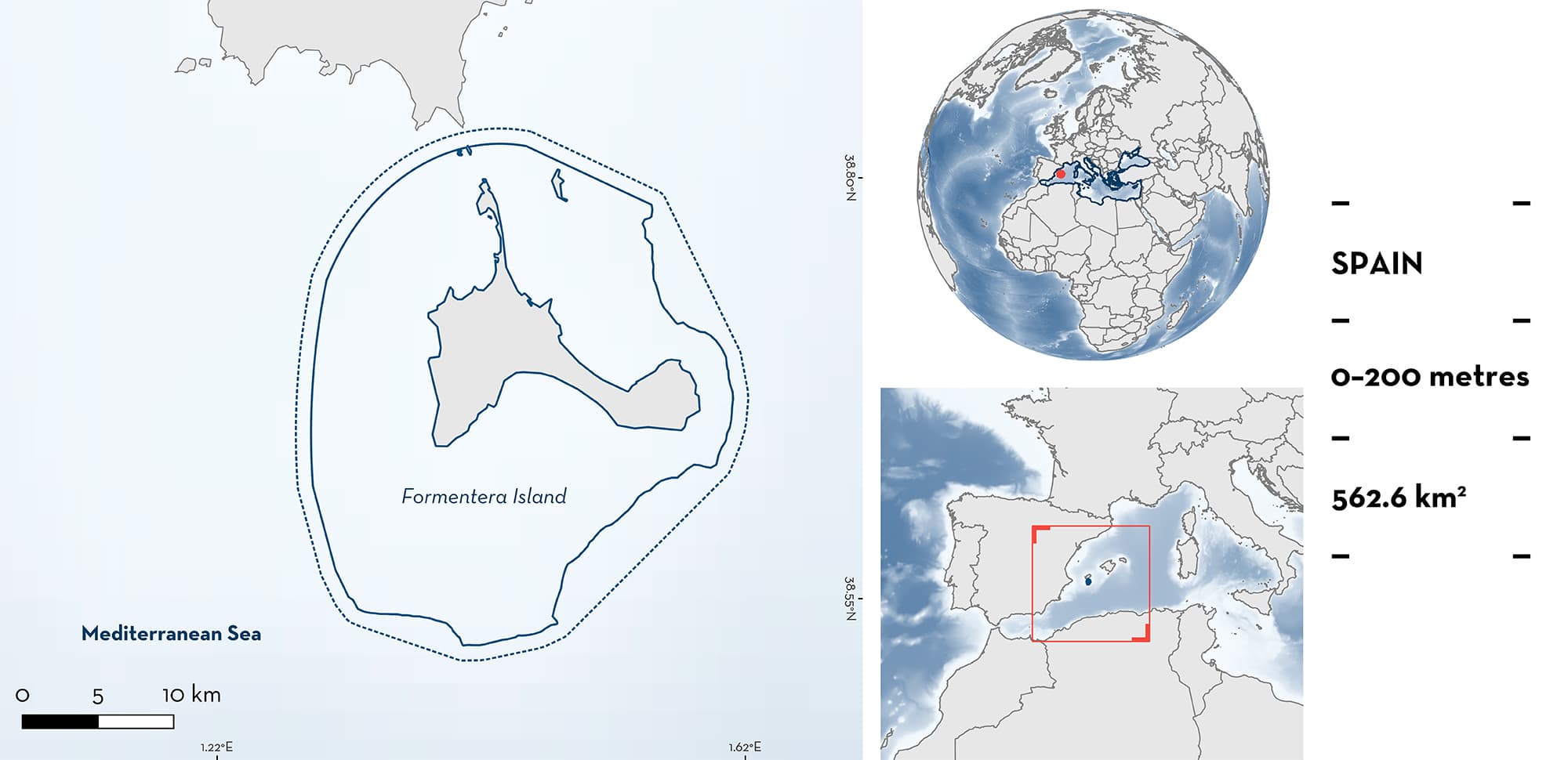
Formentera Island, the southernmost island of the Balearic Archipelago, is located east of the Iberian Peninsula of Spain. The area is characterised by benthic habitats that include extensive Neptune Grass Posidonia oceanica, rocky shores, sandy substrates, maërl beds, and coralligenous areas, as well as some flat and low seamounts in its southern part. The area overlaps with the Freus d’Eivissa I Formentera and the Punta de sa Creu Marine Reserves, seven Natura 2000 areas, and the North-western Mediterranean Benthic Ecosystems Ecologically or Biologically Significant Marine Area. Within this area there are: threatened species (e.g., White Skate Rostroraja alba); range-restricted species (Rough Skate Raja radula); and undefined aggregations (White Skate).
Download factsheet
Formentera Island
DESCRIPTION OF HABITAT
Formentera Island is the southernmost island of the Balearic Archipelago, located in the northwestern Mediterranean and east of the Iberian Peninsula of Spain. This area is separated from Ibiza Island by a channel of <4 km wide.
The coastline of Formentera Island consists of a succession of sandy beaches and rocky shores, that form high cliffs in some sectors. The substrate around the island is mostly detrital (sandy), with Neptune Grass Posidonia oceanica forming large meadows down to 35 m depth (Julià et al. 2019). Deeper habitats consist of maërl beds and coralligenous habitats (dominated by algae). Three seamounts are located in the southern part of Formentera Island with Baix Fondo the most significant. This seamount is located 2.5 km south of the southernmost tip of the island and occupies ~25 km2. It constitutes a flat seamount elevated from the circalittoral sedimentary bottoms at 65 m to the rocky infralittoral bottoms at 33 m, although most of its shallowest part is formed by sandy bottoms with abundant algae. The bay located in the southern part of Formentera is dominated by sandy substrates (Coll et al. 2017).
The area overlaps with the Freus d’Eivissa i Formentera and the Punta de sa Creu Marine Reserves, seven Natura 2000 areas, and the North-western Mediterranean Benthic Ecosystems Ecologically or Biologically Significant Marine Areas (CBD 2023).
This Important Shark and Ray Area is benthic and is delineated from the surface and inshore waters (0 m) to 200 m depth based on the depth range of Qualifying Species.
CRITERION A
VULNERABILITY
Two Qualifying Species considered threatened with extinction according to the IUCN Red List of Threatened SpeciesTM regularly occur in the area. These are the Endangered Rough Skate (Mancusi et al. 2016) and White Skate (Dulvy et al. 2006).
CRITERION B
RANGE RESTRICTED
This area holds the regular presence of the Rough Skate as a resident range-restricted species. Rough Skate is the second most abundant species among coastal sharks and rays in the Balearic Islands (Morey et al. 2006). Furthermore, its relative contribution to the coastal shark and ray assemblage is higher in Formentera Island in comparison to Mallorca and Menorca islands. The species has been repeatedly reported in different surveys in Formentera Island, whether through experimental trammel net hauls or scuba diving surveys (Coll et al. 2017). Rough Skate only occurs in the Mediterranean Sea Large Marine Ecosystem.
CRITERION C
SUB-CRITERION C5 – UNDEFINED AGGREGATIONS
This area is an important aggregation site for one species of ray.
Formentera Island hosts the highest known density of White Skate in the Balearic Islands. Until 2015, when the species became legally protected in Spain, a regular and seasonal fishery targeted White Skate in Formentera Island using trammel nets. In 2009 and 2010, preliminary monitoring of this small-scale fishery showed a mean catch-per-unit-effort (CPUE ± standard error) of 0.9 individuals ± 0.25 /100 m of net (range: 0.3–3.3; sample size: 13 hauls) (G. Morey unpubl. data 2023) with a mean size from 38 specimens of 131 ± 22 cm total length (TL) (range: 67–171 cm TL). The fishery ceased in 2015, and no further monitoring has been conducted. More recent information of 10 specimens captured in a single haul of a 500 m trammel net in April 2023 (with all the skates being released alive; G. Morey pers. obs.), indicates that the species is aggregating around the island, but the reasons for these aggregations remain unknown.
The species is rarely recorded as bycatch in the Mediterranean Sea (Serena et al. 2010), emphasising the importance of Formentera Island. Landings data from neighbouring Mallorca Island, in 2009 resulted in an estimation of ~100 individuals captured around the island in one year (estimation calculated from 27 specimens recorded during 65 sampling days in Palma’s Central fish auction wharf) (Morey & Navarro 2010), confirming that the abundance of White Skate in Formentera Island is considerably higher.
Download factsheet
SUBMIT A REQUEST
ISRA SPATIAL LAYER REQUEST
To make a request to download the ISRA Layer in either a GIS compatible Shapefile (.shp) or Google Earth compatible Keyhole Markup Language Zipped file (.kmz) please complete the following form. We will review your request and send the download details to you. We will endeavor to send you the requested files as soon as we can. However, please note that this is not an automated process, and before requests are responded to, they undergo internal review and authorization. As such, requests normally take 5–10 working days to process.
Should you have questions about the data or process, please do not hesitate to contact us.


