ISRA FACTSHEETS
ISRA FACTSHEETS
MEDITERRANEAN AND BLACK SEAS REGION
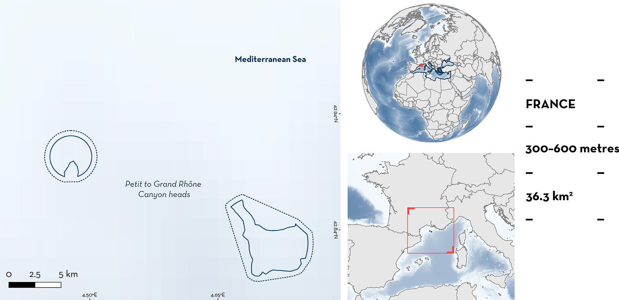
Petit to Grand Rhône Canyon heads
Summary
Petit to Grand Rhône Canyon Heads is located on the continental slope of the Gulf of Lion, in French waters of the northwestern Mediterranean Sea. The area is situated on steep slopes off the continental shelf edge and is characterised by a muddy seafloor. It partly overlaps with a proposed site of community importance and sits within two Ecologically or Biologically Significant Marine Areas. Within this area there are: reproductive areas (Blackmouth Catshark Galeus melastomus).
Download factsheet
Petit to Grand Rhône Canyon heads
DESCRIPTION OF HABITAT
Petit to Grand Rhône Canyon Heads is located in the Gulf of Lion, northwestern Mediterranean Sea. The area is situated on steep slopes off the continental shelf edge and is characterised by a muddy seafloor. The waters are within the Levantine Intermediate Water, which is characterised by a maximum salinity of 38.5 parts per thousand and a temperature of 14–15 °C. The Rhône River is the main source of the terrigenous material, accounting for about 80% of the overall riverine input into the Gulf of Lion (Durrieu de Madron et al. 2000).
The area partly overlaps with a proposed site of community importance and sits within two Ecologically or Biologically Significant Marine Areas (EBSAs): North-western Mediterranean Benthic Ecosystems EBSA (CBD 2016a) and North-western Mediterranean Pelagic Ecosystems (CBD 2016b).
This Important Shark and Ray Area is benthopelagic and is delineated from 300 to 600 m depth based on the bathymetry of the area.
CRITERION C
SUB-CRITERION C1 – REPRODUCTIVE AREA
Petit to Grand Canyon Heads is an important reproductive area for one shark species.
Since the boreal spring 2020, surveys have been undertaken in the area to monitor catches of Blackmouth Catshark from one benthic trawler operating in the area. Fishing events (n = 18) have been recorded monthly, from April/May to November each year (I. Nuez & M. Gazo unpubl. data 2023). A total of 799 Blackmouth Catsharks measuring <30 cm total length (TL) were captured. These represented more than 85% of total catches for this species in the area. In a subsample from one boarding event in 2020, the average size of 25 individuals was 25 cm TL (min = 14.8 cm, max = 29.9 cm TL) and included 7 individuals of <23 cm TL. Young-of-the-year individuals of this species are reported to have a size of <23 cm TL, while juveniles measure 23–34 cm TL (Zicarelli et al. 2023).
Similarly, data collected from surveys undertaken through the Mediterranean International Trawl Survey (MEDITS) between 1999–2010 suggest several areas in the Gulf of Lion including Petit to Grand Canyon Heads are important for Blackmouth Catshark reproduction (Giannoulaki et al. 2013). Each year, this species was captured in 12–19% of hauls (104–345 specimens per year) with animals measuring approximately 18 cm TL and several areas determined to be important for neonates and young-of-the-year.
Download factsheet
SUBMIT A REQUEST
ISRA SPATIAL LAYER REQUEST
To make a request to download the ISRA Layer in either a GIS compatible Shapefile (.shp) or Google Earth compatible Keyhole Markup Language Zipped file (.kmz) please complete the following form. We will review your request and send the download details to you. We will endeavor to send you the requested files as soon as we can. However, please note that this is not an automated process, and before requests are responded to, they undergo internal review and authorization. As such, requests normally take 5–10 working days to process.
Should you have questions about the data or process, please do not hesitate to contact us.


