ISRA FACTSHEETS
ISRA FACTSHEETS
MEDITERRANEAN AND BLACK SEAS REGION
Sulcis
Summary
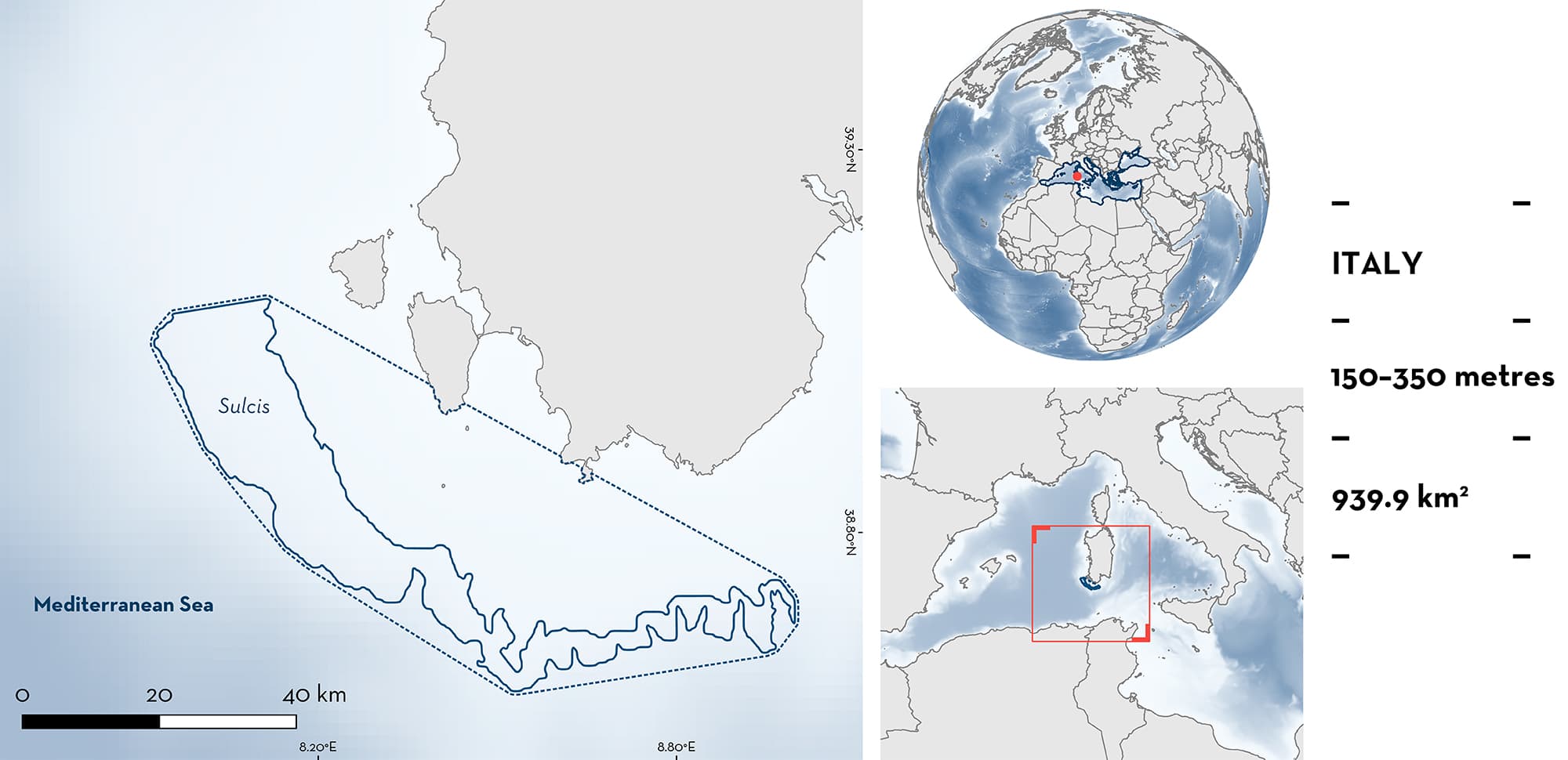
Sulcis is in the southwestern waters of Sardinia Island, Italy. It sits within the Algerian-Provençal Basin and the Sardinia Channel. The area is influenced by the Modified Atlantic Water and Levantine Intermediate Water currents. The substrate is characterised by muddy, silty, or rocky bottoms. Rich gorgonian and black coral assemblages dominate the benthos on most hard substrates of the area. Within this area there are: reproductive areas (Longnose Spurdog Squalus blainville).
Download factsheet
Sulcis
DESCRIPTION OF HABITAT
Sulcis is in the southwestern waters of Sardinia Island, Italy. The area belongs to the Algerian-Provençal Basin and the Sardinia Channel. The area is influenced by the Modified Atlantic Water and/or the Levantine Intermediate Water currents which spread throughout the Mediterranean Sea at surface and intermediate depths, respectively, and circulate around Sardinia Island from the southeast to the southwest before flowing northward (Casella 2009; Iacono et al. 2021). The continental shelf is wide in this area with a gradual decline. On the shelf and along the upper slope, numerous rocky elevations emerge from a flat muddy or silty substrate (Gori et al. 2017). Rich gorgonian and black coral assemblages dominate the benthos on most hard substrates of the area (Cau et al. 2015; Gori et al. 2017). Dense meadows of the Critically Endangered Bamboo Coral Isidella elongata are found in deep muddy areas (Bo et al. 2015).
This Important Shark and Ray Area is benthopelagic and is delineated from 150 to 350 m based on the bathymetry of the area.
CRITERION C
SUB-CRITERION C1 – REPRODUCTIVE AREAS
Sulcis is an important reproductive area for one shark species.
Pregnant female Longnose Spurdog (n = 33 out of 493 individuals) were captured exclusively in this area during fishing surveys undertaken around Sardinia. Animals ranged in size between 65.5–84 cm total length (TL). These were defined according to three stages including (1) early pregnancy and actively spawning, (2) mid-pregnancy, or (3) late pregnancy (Marongiu et al. 2020). They were caught in all seasons within the area during trawl surveys from 2008–2018 (Marongiu et al. 2020). They were mostly captured in the boreal spring and summer and those individuals bearing pups were captured primarily in the summer and autumn. Pregnant females were confirmed to be actively spawning or pregnant by counting the number of ripe oocytes in mature females (mean ± SD = 11.2 ± 5.4) and the number of embryos in females at mid-term pregnancy (4.4 ± 2.3) or at late pregnancy (4.3 ± 1.5).
All captured individuals (n = 493) were caught between depths of 50–600 m, however mature and pregnant females were found primarily at depths of 150–350 m (Marongiu et al. 2020).
Download factsheet
SUBMIT A REQUEST
ISRA SPATIAL LAYER REQUEST
To make a request to download the ISRA Layer in either a GIS compatible Shapefile (.shp) or Google Earth compatible Keyhole Markup Language Zipped file (.kmz) please complete the following form. We will review your request and send the download details to you. We will endeavor to send you the requested files as soon as we can. However, please note that this is not an automated process, and before requests are responded to, they undergo internal review and authorization. As such, requests normally take 5–10 working days to process.
Should you have questions about the data or process, please do not hesitate to contact us.


