ISRA FACTSHEETS
ISRA FACTSHEETS
WESTERN INDIAN OCEAN REGION
Musandam
Summary
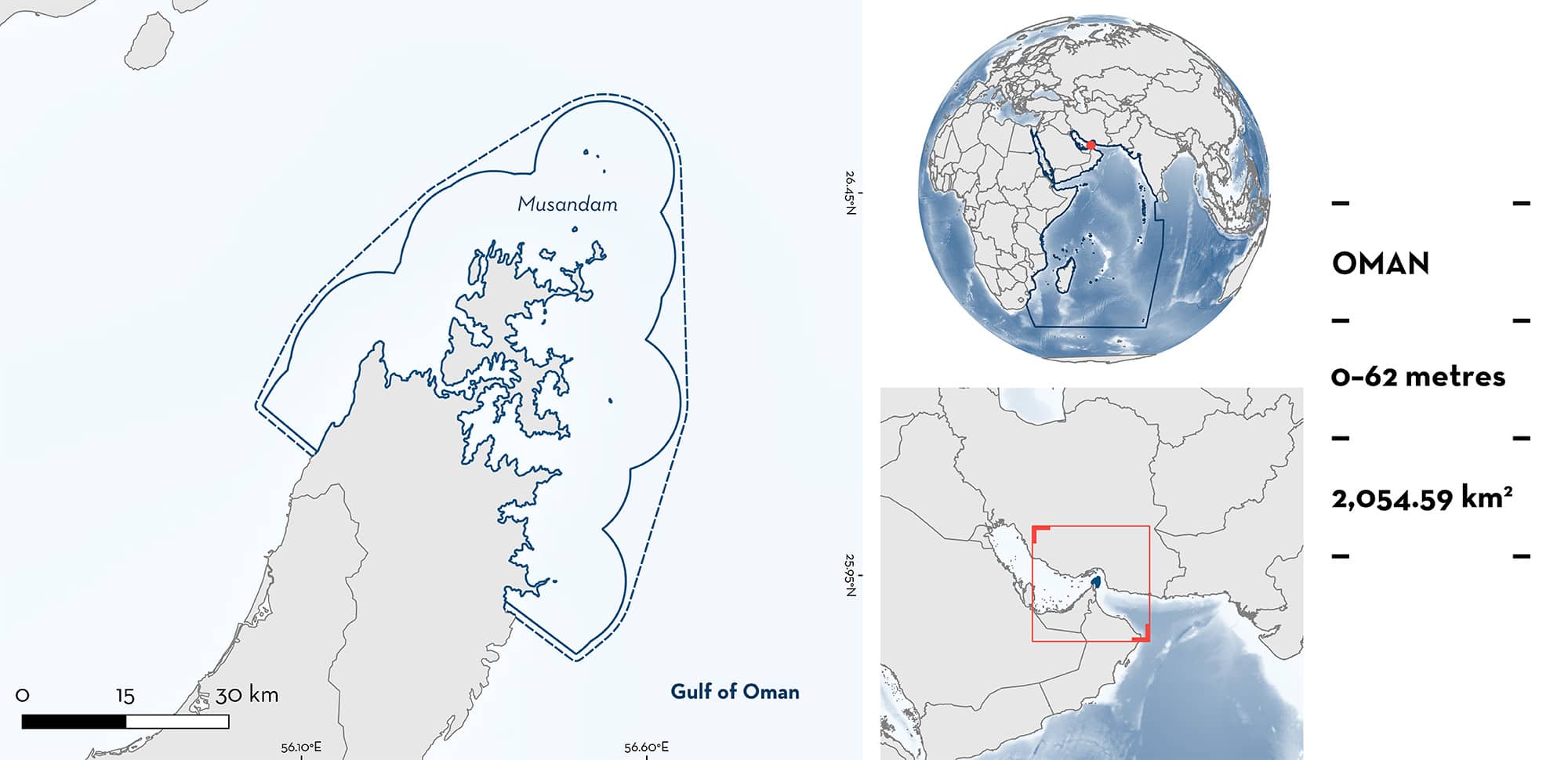
Musandam is located in northern Oman and is adjacent to the Gulf of Oman, the Strait of Hormuz and the Persian/Arabian Gulf. The area is characterised by hard corals, rocky shores, islands, coral gardens, sandy substrates, and deep drop-offs which create areas of nutrient-rich, cold-water upwelling. This area overlaps with the Musandam Islands Key Biodiversity Area. Within the area there are: threatened species (e.g., Whale Shark Rhincodon typus); reproductive areas (Indo-Pacific Leopard Shark Stegostoma tigrinum); and undefined aggregations (Whale Shark).
Download factsheet
Musandam
DESCRIPTION OF HABITAT
Musandam is located on the Oman coast. This area is met by the Gulf of Oman to the east and is fed by the Indian Ocean up to Lima Rock, while the west part is on the Persian/Arabian Gulf (hereafter referred to as ‘the Gulf’) coast and the north limit is the Strait of Hormuz (Sheppard & Salm 1988). The coastline is made up of steep cliffs that form intricate inlets. The area is dominated by hard corals in the shallow water with a mixture of soft and hard corals down to 30 m as well as rocky shores and islands, coral gardens, sandy substrates, and deep drop-offs which create areas of nutrient-rich, cold-water upwelling (Sheppard & Salm 1988; Salm 1993). This area has the highest coral cover in Oman (Burt et al. 2016) and many underwater caves carved out of the limestone rocks (Salm 1993). Currents in the area are strong, particularly influenced by tidal flow in and out of the Gulf (Salm 1993).
The area overlaps with the Musandam Islands Key Biodiversity Area (KBA 2023).
This Important Shark and Ray Area is benthopelagic and is delineated from inshore and surface waters (0 m) to 62 m based on the maximum depth range of the Qualifying Species and bathymetry of the area.
CRITERION A
VULNERABILITY
Two Qualifying Species considered threatened with extinction according to the IUCN Red List of Threatened SpeciesTM regularly occur in the area. These are the Endangered Whale Shark (Pierce & Norman 2016) and Indo-Pacific Leopard Shark (Rigby et al. submitted).
CRITERION C
SUB-CRITERION C1 – REPRODUCTIVE AREAS
Musandam is an important reproductive area for one shark species.
Indo-Pacific Leopard Sharks of both sexes at different stages of maturity are regularly observed by divers visiting Musandam. Over multiple years (2015, 2022, 2023) observations have been made indicating pre-mating behaviours, including males chasing and biting females (R Jabado unpubl. data 2015; Freestyle Divers 2022; Nguyen 2023). Additionally, Indo-Pacific Leopard Shark egg cases have been observed, photographed, and filmed on multiple years in the area between May–June at depths of 30 m (Baverstock 2011; D Robinson in 2012; Henderson & Reeve 2014; Ras Musandam Divers 2018; Stevens 2018; Oman Aggressor 2020; D Robinson pers. obs. 2023; C Chellapermal pers. comm. 2023; Freestyle Divers pers. comm. 2023; Khawla Al Shehhi pers. comm. 2023). In addition, a neonate (based on size and coloration) was also photographed in the area (Al Marsa Musandam 2019). While Indo-Pacific Leopard Shark reproduction has been well studied in human care, knowledge of their reproduction in the wild is much scarcer. Specifically, mating sites or areas where eggs are found have not yet been identified for the species, highlighting the importance of this area.
CRITERION C
SUB-CRITERION C5 – UNDEFINED AGGREGATIONS
Musandam is an important area for undefined aggregations of one shark species.
Based on records starting in 2004, 46 Whale Sharks have been identified by photo-identification from 95 encounters in Musandam (Robinson et al. 2016). Most sightings were recorded at Lima Rock (64 encounters) followed by Octopus Rock (19 encounters; Robinson et al. 2016). Based on density analysis of photo-identified individuals recorded between 2011–2014, Musandam was identified as the second regional (Persian/Arabian Gulf, Strait of Hormuz, and Gulf of Oman) hotspot of Whale Sharks, after Al Shaheen (249 individuals). Fishers have reported aggregations of up to 50 individuals and frequency reports were highest in July and October (Robinson et al. 2016; D Robinson unpubl. data 2023). This area could be used as a stopover point on their migrations or as a feeding area. More information is required to determine the nature and function of this aggregation.
Download factsheet
SUBMIT A REQUEST
ISRA SPATIAL LAYER REQUEST
To make a request to download the ISRA Layer in either a GIS compatible Shapefile (.shp) or Google Earth compatible Keyhole Markup Language Zipped file (.kmz) please complete the following form. We will review your request and send the download details to you. We will endeavor to send you the requested files as soon as we can. However, please note that this is not an automated process, and before requests are responded to, they undergo internal review and authorization. As such, requests normally take 5–10 working days to process.
Should you have questions about the data or process, please do not hesitate to contact us.


