ISRA FACTSHEETS
ISRA FACTSHEETS
WESTERN INDIAN OCEAN REGION
Najwat Bul Thamah
Summary
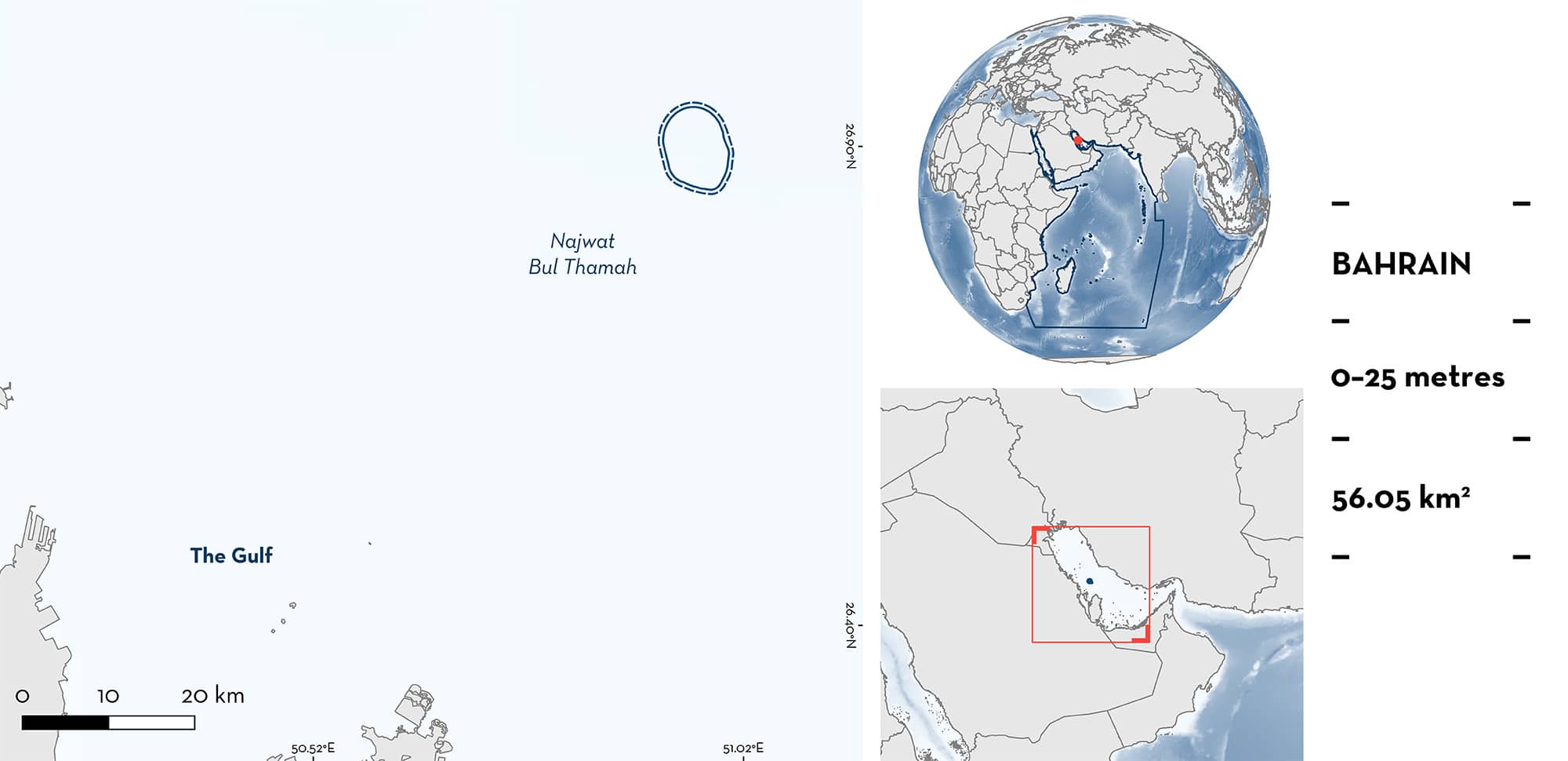
Najwat Bul Thamah is located in northeastern Bahrain. The area is characterised by coral reef habitats and is connected to Hayr Bul Thamah which is dominated by oyster beds. The area overlaps with a marine protected area, the Najwat Bul Thamah reserve. Within this area there are: threatened species and undefined aggregations (Whale Shark Rhincodon typus).
Download factsheet
Najwat Bul Thamah
DESCRIPTION OF HABITAT
Najwat Bul Thamah is located in northeastern Bahrain island. The area lies within the Persian/Arabian Gulf (hereafter ‘Gulf’), a region characterised by high variation in environmental conditions (Sheppard et al. 2010). The area consists of coral reef habitat rich in marine biota such as algae, sponges, and anemones. The area has the highest diversity of living hard coral coverage in Bahrain with corals interspaced with oyster beds. The sea surface temperature in the area is subject to large seasonal variation (between 16–36°C; AlMealla et al. 2023).
Najwat Bul Thamah was designated as a Marine Protected Area in 2017, and a UNESCO World Heritage site since 2012.
This Important Shark and Ray Area is pelagic and is delineated from inshore and surface waters (0 m) to 25 m based on the depth use of Qualifying Species in the area.
CRITERION A
VULNERABILITY
The one Qualifying Species within the area is considered threatened with extinction according to the IUCN Red List of Threatened SpeciesTM. The Whale Shark is assessed as Endangered (Pierce & Norman 2016).
CRITERION C
SUB-CRITERION C5 – UNDEFINED AGGREGATIONS
Najwat Bul Thamah is an important area for undefined aggregations of one shark species.
Aggregations of Whale Sharks have been observed every year between 2020 and 2023, generally in May and September (R AlMealla unpubl. data 2023). For example, in September 2021, over 30 Whale Sharks were observed in the area, and interviews with local fishers confirm this number of sharks is regularly observed. Sightings in May and September coincide with the beginning and end of the annual movement of Whale Sharks that feed in Qatari waters of Al Shaheen during the boreal summer (Robinson et al. 2013, 2017). Available video footage demonstrates surface feeding behaviour, however it is also possible that the Whale Sharks use this area as a stopover point during migration. More information is required to determine the nature and function of this aggregation.
Download factsheet
SUBMIT A REQUEST
ISRA SPATIAL LAYER REQUEST
To make a request to download the ISRA Layer in either a GIS compatible Shapefile (.shp) or Google Earth compatible Keyhole Markup Language Zipped file (.kmz) please complete the following form. We will review your request and send the download details to you. We will endeavor to send you the requested files as soon as we can. However, please note that this is not an automated process, and before requests are responded to, they undergo internal review and authorization. As such, requests normally take 5–10 working days to process.
Should you have questions about the data or process, please do not hesitate to contact us.


