ISRA FACTSHEETS
ISRA FACTSHEETS
POLAR WATERS REGION
Great Fisher Bank
Summary
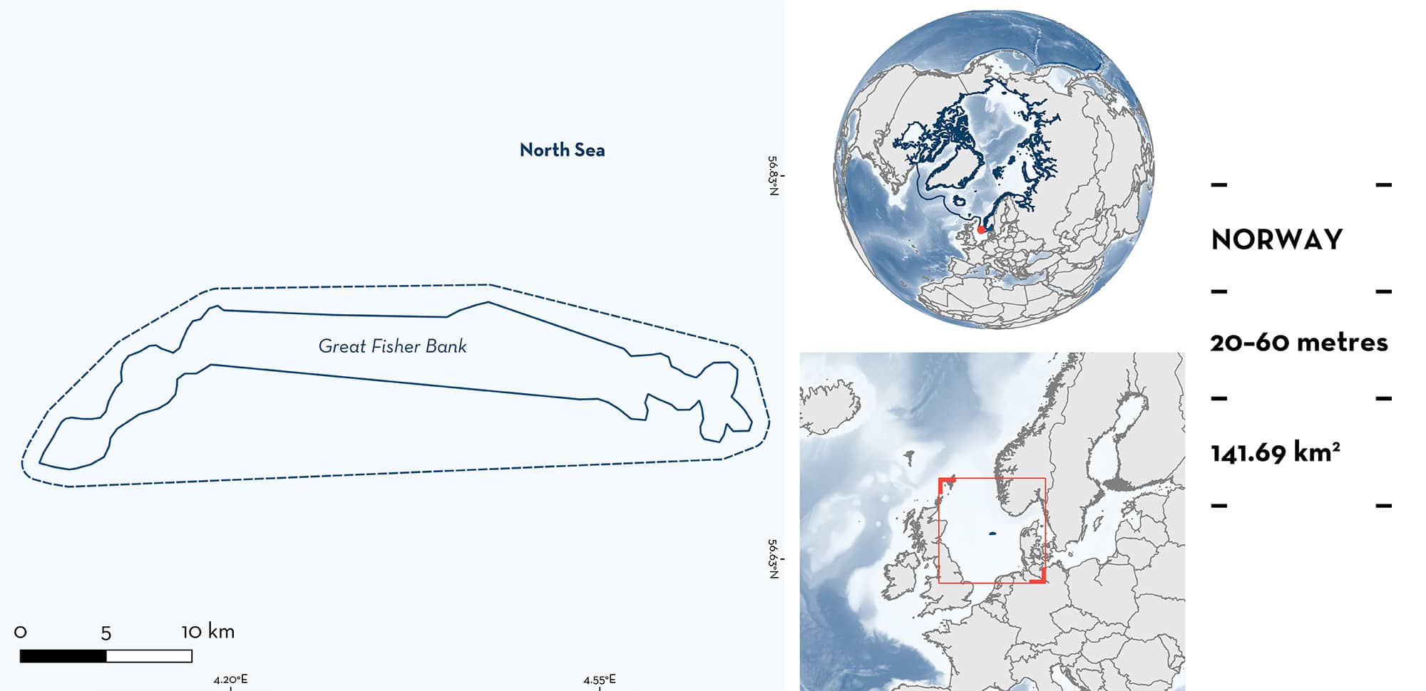
Great Fisher Bank is located in Norwegian waters of the central North Sea. This area is a wide and shallow sand bank. It is highly influenced by the input of Atlantic oceanic waters and by westerly winds. Within this area there are: threatened species and undefined aggregations (Thorny Skate Amblyraja radiata).
Download factsheet
Great Fisher Bank
DESCRIPTION OF HABITAT
Great Fisher Bank is located within the Norwegian exclusive economic zone and sits within the North Sea. This area is a wide and shallow sand bank within the central North Sea (Cohen et al. 2017).
The area is highly influenced by the input of Atlantic oceanic waters and by westerly winds (Ducrotoy et al. 2000; Emeis et al. 2015). Sea bottom temperatures range between 6–10°C (Hiddink et al. 2015).
This Important Shark and Ray Area is benthic and subsurface and is delineated from 20–60 m based on the depth range of Qualifying Species in the area.
CRITERION A
VULNERABILITY
One Qualifying Species considered threatened with extinction according to the IUCN Red List of Threatened Species regularly occurs in the area. This is the Vulnerable Thorny Skate (Kulka et al. 2020).
CRITERION C
SUB-CRITERION C5 – UNDEFINED AGGREGATIONS
Great Fisher Bank is an important area for undefined aggregations of one ray species.
Skates are known to aggregate, with temporal changes related to sex and life-stage segregations (Swain & Benoît 2006; Frisk 2010; Hoff 2010). The presence of these aggregations is usually related to high density areas where large catch quantities of these species occur (Bizzarro et al. 2014). Based on fishery-independent trawl surveys done around the British Isles and the North Sea between 1993–2022 (some surveys were only conducted over a fraction of the period) at depths of 20–200 m, Great Fisher Bank was identified as a hotspot for mid-juvenile stages of Thorny Skate (Ellis et al. 2024). Mid-juveniles were defined as individuals measuring 14–28 cm total length (TL). The reported size-at-hatching for the species is 6–12 cm TL (Ellis et al. 2005; Heessen et al. 2015; Last et al. 2016). Surveys were conducted at fixed stations and at randomly sampled stations. At fixed stations, relative abundances (catch-per-unit-effort [CPUE] = number of individuals per hour; ind/h-1) and the frequency of occurrence (percentage of survey years in which the species was reported) were estimated. Great Fisher Bank had the largest CPUE (~10 ind/h-1) of mid-juveniles in all the North Sea and a frequency of occurrence of ~75% which was the second largest in all the North Sea (Ellis et al. 2024). More information is needed to confirm the nature of these aggregations.
Download factsheet
SUBMIT A REQUEST
ISRA SPATIAL LAYER REQUEST
To make a request to download the ISRA Layer in either a GIS compatible Shapefile (.shp) or Google Earth compatible Keyhole Markup Language Zipped file (.kmz) please complete the following form. We will review your request and send the download details to you. We will endeavor to send you the requested files as soon as we can. However, please note that this is not an automated process, and before requests are responded to, they undergo internal review and authorization. As such, requests normally take 5–10 working days to process.
Should you have questions about the data or process, please do not hesitate to contact us.


