ISRA FACTSHEETS
ISRA FACTSHEETS
NEW ZEALAND & PACIFIC ISLANDS REGION
Bikar Atoll
Summary
Bikar Atoll is located in the northern Marshall Islands in the central Pacific Ocean. It is a remote and uninhabited island. The reefs have high benthic hard coral cover (~60%). Within this area there are: threatened species and undefined aggregations (Grey Reef Shark Carcharhinus amblyrhynchos).
Download factsheet
Bikar Atoll
DESCRIPTION OF HABITAT
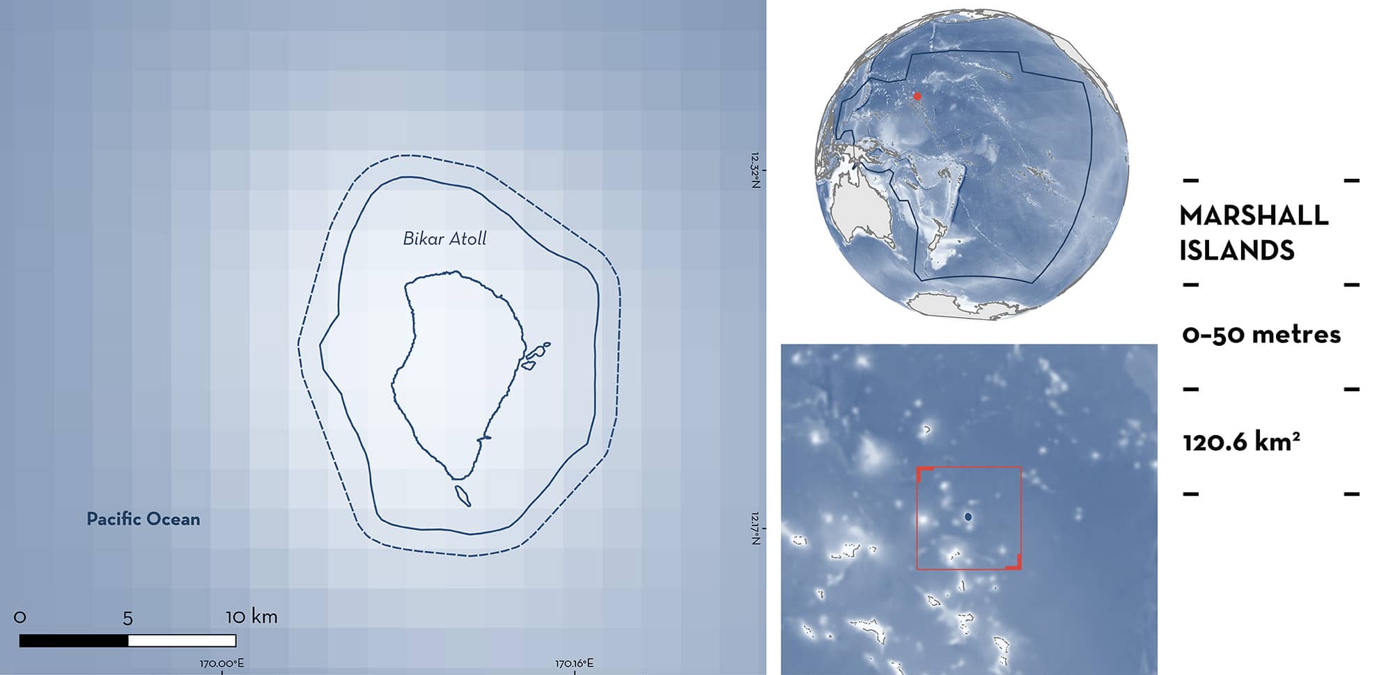
Bikar Atoll is located in the northern Marshall Islands in the central Pacific Ocean. It is a remote and uninhabited island located 579 km north of Majuro Atoll, the capital of the Marshall Islands, 320 km south-southeast of Bokak, and 115 km north of Utirik, the nearest inhabited atoll. It is part of the Ratak Chain.
Bikar Atoll is the second most northern atoll of the Marshall Islands. Its reef is oval in shape, ~11 km long, and ~7 km wide. There are three islands and a few small gravel bars. The reefs had a benthic cover of hard coral approaching nearly 60% with one of the highest coral covers in the Pacific Ocean (Pristine Seas 2024). The exception was the 20 m depth contour at Bikar Atoll where benthic cover was dominated by erect algae—specifically, a unique community of a native erect green alga Caulerpa bikinensis, which covered over 50% of the benthos at several sites (Pristine Seas 2024).
This Important Shark and Ray Area is benthopelagic and is delineated from inshore and surface waters (0 m) to 50 m based on the depth range of Qualifying Species in the area.
CRITERION A
VULNERABILITY
One Qualifying Species considered threatened with extinction according to the IUCN Red List of Threatened Species regularly occurs in the area. This is the Endangered Grey Reef Shark (Simpfendorfer et al. 2020).
CRITERION C
SUB-CRITERION C5 – UNDEFINED AGGREGATIONS
Bikar Atoll is an important area for undefined aggregations of one shark species.
Aggregations of Grey Reef Sharks are regularly observed in this area, as documented by underwater visual censuses, baited remote underwater video station (BRUVS) surveys, and citizen science.
In September and October 2023, underwater visual census surveys were conducted at 10 and 20 m depth at 22 sites around the atoll (Pristine Seas 2024). During each survey, divers counted all sharks encountered along fixed-length (25 m) corridor transects. The underwater visual censuses showed that Grey Reef Sharks were seen in 22.2% of surveys. An average of 13 (SD = ±26.3) individuals per 0.01 km2 were recorded (Pristine Seas unpubl. data 2024). In one survey, 100 sharks per 0.01 km2 were recorded, and in five surveys, 50 individuals per 0.01 km2 were recorded (Pristine Seas unpubl. data 2024).
BRUVS surveys were also conducted during this period at depths between 10–50 m on the reef substrate (n = 16) and in mid-water (n = 7) (Pristine Seas 2024). The MaxN (maximum number of individuals of a species observed in a single frame) was recorded. The reef BRUVS surveys estimated that Grey Reef Sharks were observed in every single camera deployment (100% frequency) with a maximum MaxN of 17, and an average MaxN of 4.5 individuals. The highest concentration of sharks can be found around the northwest and southwest tips of the atolls, as well as at the entrance to the leeward channels. These areas, characterised by strong currents and tidal flows, create dynamic environments that serve as aggregators of reef predators (Pristine Seas 2024).
Mid-water BRUVS surveys revealed that the assemblage was dominated by Grey Reef Sharks and Runner Rainbow Elagatis bipinnulata. BRUVS surveys had an average MaxN of five individuals. At survey sites near the tips of the islands MaxN were highest with 32 Grey Reef Sharks. These densities of Grey Reef Sharks are noteworthy in a global context as the maximum MaxN observed at Bikar Atoll is the highest in the global dataset of over 8,990 BRUVS deployments of the Pristine Seas project (Pristine Seas 2024).
In July 2014, citizen scientists reported large aggregations of Grey Reef Sharks during two different dives with at least 30 individuals sighted in one dive (Marshall Islands Guide 2014), supporting the long-term and predictable nature of aggregations in the area.
Download factsheet
SUBMIT A REQUEST
ISRA SPATIAL LAYER REQUEST
To make a request to download the ISRA Layer in either a GIS compatible Shapefile (.shp) or Google Earth compatible Keyhole Markup Language Zipped file (.kmz) please complete the following form. We will review your request and send the download details to you. We will endeavor to send you the requested files as soon as we can. However, please note that this is not an automated process, and before requests are responded to, they undergo internal review and authorization. As such, requests normally take 5–10 working days to process.
Should you have questions about the data or process, please do not hesitate to contact us.


