ISRA FACTSHEETS
ISRA FACTSHEETS
NEW ZEALAND & PACIFIC ISLANDS REGION
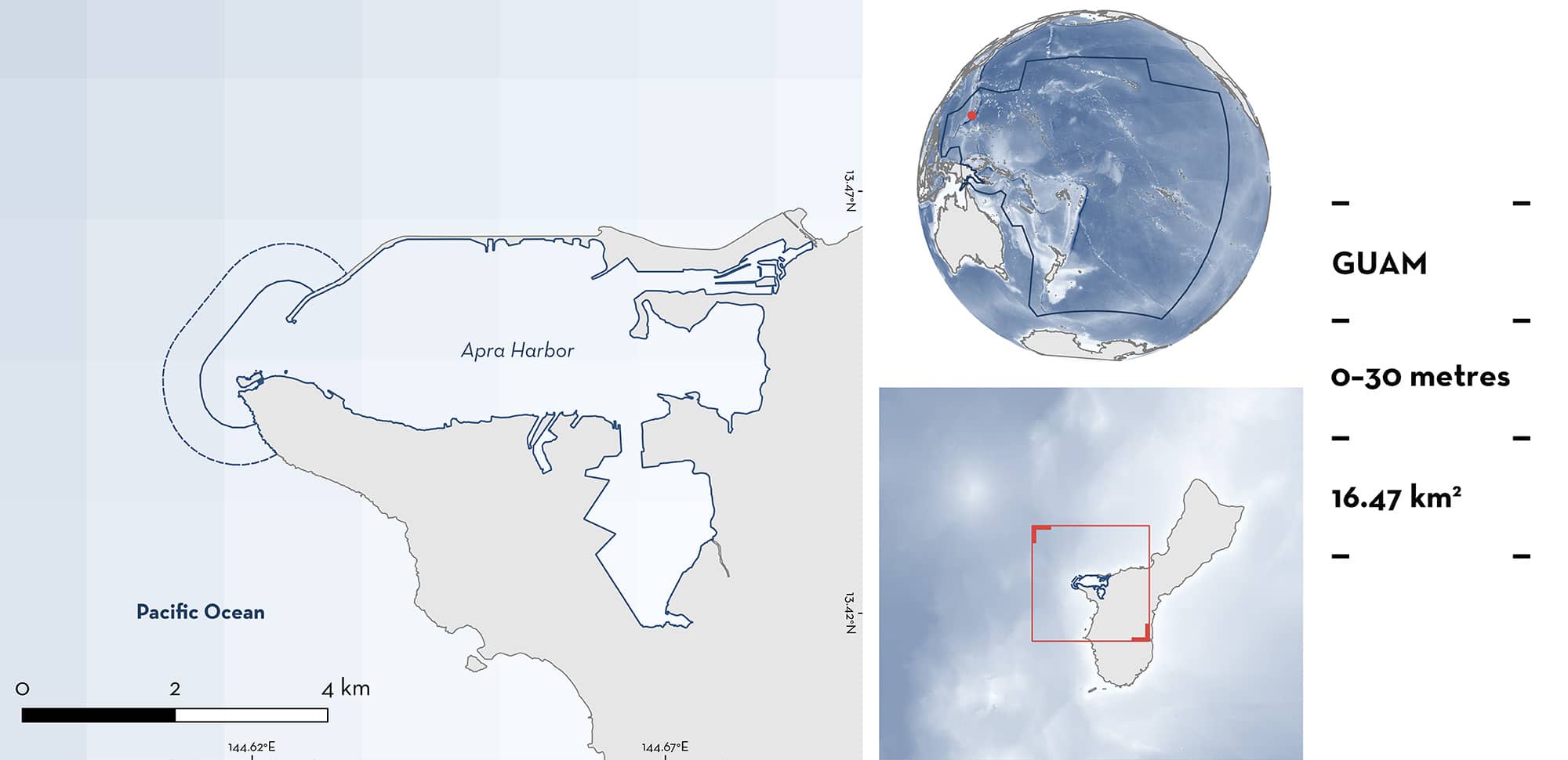
Apra Harbor
Summary
Apra Harbor is a coastal area located in Guam. It is characterised by a variety of soft and hard substrates, including well-developed reefs, and silty soft-bottom mangrove areas. The area is influenced by freshwater input from ten rivers, and low wave exposure. It has the highest coral coverage and the largest mangrove forests in Guam. This area overlaps with the Sasa Bay (Marine) Preserve. Within this area there are: threatened species (e.g., Mangrove Whipray Urogymnus granulatus); feeding areas (Reef Manta Ray Mobula alfredi); and resting areas (Mangrove Whipray).
Download factsheet
Apra Harbor
DESCRIPTION OF HABITAT
Apra Harbor is situated on the west coast of Guam. It is the southernmost island of the Mariana Islands. It is connected to the only deep (60 m) lagoon in the Mariana Islands. The area is influenced by a rainy season (July–November) and a dry season (January–May), with December and June being transitional months. Apra Harbor is also influenced by freshwater input from ten rivers and is protected from high wave exposure. The combination of insulation from oceanic waves and freshwater inputs has supported the formation of well-developed reefs and extensive mangrove forests. The area is characterised by some of the highest coral coverage in Guam (Paulay 2003). It also includes the largest contiguous mangrove system in Guam (Mizerek & Hagatna 2020). Two prominent coral formations, Western Shoals and Jade Shoals, are located west of Sasa Bay (within this area). Apra Harbor is characterised by exposed and oceanic reef flats closer to the entrance of the harbour, to patchy reefs and mangroves in Apra Harbor (Paulay 2003).
This area overlaps with the Sasa Bay (Marine) Preserve (Protected Planet 2024).
This Important Shark and Ray Area is benthopelagic and is delineated from inshore and surface waters (0 m) to 30 m based on the bathymetry of the area.
CRITERION A
VULNERABILITY
Two Qualifying Species considered threatened with extinction according to the IUCN Red List of Threatened Species regularly occurs in the area. These are the Endangered Mangrove Whipray (Manjaji Matsumoto et al. 2020) and the Vulnerable Reef Manta Ray (Marshall et al. 2022).
CRITERION C
SUB-CRITERION C2 – FEEDING AREAS
Apra Harbor is an important feeding area for one ray species.
Reef Manta Rays are regularly observed by recreational divers and local boat captains operating within the area. Between 2012–2024, at least 73 Reef Manta Ray sightings were documented from around Guam. Most of these sightings (56%, n = 41) were recorded from this area (J Hartup unpubl. data 2024). The presence of Reef Manta Rays in this area is driven by feeding behaviour. Most of the Reef Manta Rays (93%, n = 38 individuals) recorded in this area were observed engaging in feeding activities, the other three individuals were travelling. The observed feeding strategies by Reef Manta Rays in Apra Harbor are surface-feeding or somersault-feeding. Observations of Reef Manta Rays within this area were recorded from Middle Reef (n = 17), Cabras Opening (n = 15), Outhouse Beach (n = 4), American Tanker (n = 3), and Hidden Reef (n = 2) (J Hartup unpubl. data 2024). Current data do not allow seasonality of this behaviour to be determined. Anecdotal reports suggest Reef Manta Rays occur year-round in Guam, with an increase in the frequency of sightings between late February and early May (Guampedia 2024). This area is less frequently used than other locations around Guam by recreational divers, wherein dives are undertaken in Apra Harbor if the sea conditions outside the harbour are unfavourable. Despite this, there are still regular and predictable observations of Reef Manta Rays feeding in this area (J Hartup pers. obs. 2024).
CRITERION C
SUB-CRITERION C3 – RESTING AREAS
Apra Harbor is an important resting area for one ray species.
Mangrove Whiprays regularly rest in this area during the day in groups of up to five individuals (B Tibbatts pers. comm. 2024). Opportunistic observations have been made by biologists, local management agencies, and participants in boat activities occurring in the area (DOAG 2021; LM Flem pers. obs. 2024). Since at least 1999, Mangrove Whiprays have been observed on nearly every visit to Sasa Bay, within the area (B Tibbatts pers. comm. 2024). Sasa Bay was visited 3–4 times per between 2021–2024, with fewer visits per year prior to that time. There is no clearly defined seasonality to their presence (LM Flem pers. obs. 2024). The mangroves in Sasa Bay provide a food source and refuge for Mangrove Whiprays, especially for juveniles (B Tibbatts pers. comm. 2023). The observation of the species resting amongst the mangroves during the day and moving out during the night (presumably to feed) is consistent with the species’ known behaviour outside of Guam. Mangroves can provide reliable food resources for juvenile Mangrove Whiprays (Kanno et al. 2019) which also feed in sandflats adjacent to mangroves (Martins et al. 2022). Although Mangrove Whiprays are occasionally observed outside of this area in Guam, Apra Harbor is the only location where Mangrove Whiprays (and this behaviour) are regularly and predictably reported (LM Flem pers. obs. 2024).
Download factsheet
SUBMIT A REQUEST
ISRA SPATIAL LAYER REQUEST
To make a request to download the ISRA Layer in either a GIS compatible Shapefile (.shp) or Google Earth compatible Keyhole Markup Language Zipped file (.kmz) please complete the following form. We will review your request and send the download details to you. We will endeavor to send you the requested files as soon as we can. However, please note that this is not an automated process, and before requests are responded to, they undergo internal review and authorization. As such, requests normally take 5–10 working days to process.
Should you have questions about the data or process, please do not hesitate to contact us.


