ISRA FACTSHEETS
ISRA FACTSHEETS
SOUTH AMERICAN INLAND WATERS
Boyacá & Serviez
Summary
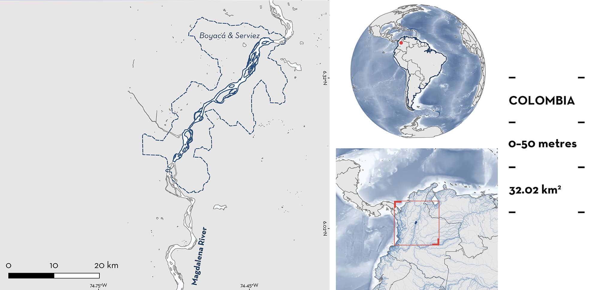
Boyacá & Serviez is located in the middle Magdalena River basin in Colombia. It is situated between the localities of Puerto Nare, Department of Antioquia, and Puerto Serviez, Department of Boyacá. This area is within the fluvial system with the highest production and transport of sediments worldwide. The climate is characterised by a bimodal rainfall regime. Within this area there are: range-restricted species (Magdalena Freshwater Stingray Potamotrygon magdalenae).
Download factsheet
Boyacá & Serviez
DESCRIPTION OF HABITAT
Boyacá & Serviez is located in the middle Magdalena River basin in Colombia. It is situated between the localities of Puerto Nare, Department of Antioquia, and Puerto Serviez, Department of Boyacá (125 m elevation). This area is found within the Tropical Moist Forest life zone (Holdridge 1987). The Magdalena River is the most important and extensive drainage system of the Andean-Caribbean region with one of the highest production and transport of sediments (710 t/km2 per year) worldwide of any fluvial system (Graca et al. 2025).
This area is located in extensive lowland alluvial plains with many marginal lakes covering an estimated area of 22,000 km2 which constitute temporary or permanent habitats for aquatic communities (Garzón & Gutiérrez 2013). The climate is characterised by a bimodal rainfall regime. December–March and June–September are dry periods, and April–May and October–November are rainy periods (IDEAM 2015, 2016). The two wet seasons are comparable in length and intensity. The mean annual precipitation is 2,917 mm, the mean annual temperature is 27.9°C (IDEAM 2016).
This Important Shark and Ray Area is benthic and is delineated from surface waters (0 m) to 50 m based on the depth range of Qualifying Species in the area.
CRITERION B
RANGE RESTRICTED
This area holds the regular presence of the Magdalena Freshwater Stingray as resident range-restricted species. This species occurs year-round in the area and is regularly encountered and captured in local fisheries (Márquez-Velásquez et al. 2019).
In Boyacá & Serviez, Magdalena Freshwater Stingrays were collected as the incidental catch of a local fishery during the dry (June–July and December) and rainy (October–November) seasons in 2015 and 2016 (Márquez-Velásquez 2017; Márquez-Velásquez et al. 2019). During this period, a total of 73 individuals (females = 40, males = 30, unidentified sex = 3) were collected. The body sizes ranged between 7.5–22.5 cm disc width (DW) (mean = 14.1 ± 3.9 SD) for females, and 7.6–21 cm DW (mean = 13.3 ± 2.7 SD) for males. Of the total, 44 were immature, and included 11 neonate or young-of-the-year individuals (7.5–10.5 cm DW), and 26 mature individuals. Males mature at a minimum size of 16 cm DW (Ramos-Socha & Grijalba-Bendeck 2011). In the middle Magdalena River, females mature at 14 cm DW, and the size-at-birth for this species is of 8.0–8.5 cm DW (Pedreros et al. 2016; Mejia-Falla et al. 2024).
Magdalena Freshwater Stingray is endemic to Colombia where it is restricted to three basins: Magdalena-Cauca basin including the Magdalena, Cauca, San Jorge rivers; Atrato basin composed of the Atrato River; and Sinú basin composed of the Sinú River (Mejia-Falla et al. 2024). This species is found in rivers, swamps, wetlands, and dams along these basins (Mejia-Falla et al. 2024).
Download factsheet
SUBMIT A REQUEST
ISRA SPATIAL LAYER REQUEST
To make a request to download the ISRA Layer in either a GIS compatible Shapefile (.shp) or Google Earth compatible Keyhole Markup Language Zipped file (.kmz) please complete the following form. We will review your request and send the download details to you. We will endeavor to send you the requested files as soon as we can. However, please note that this is not an automated process, and before requests are responded to, they undergo internal review and authorization. As such, requests normally take 5–10 working days to process.
Should you have questions about the data or process, please do not hesitate to contact us.


