ISRA FACTSHEETS
ISRA FACTSHEETS
WESTERN INDIAN OCEAN REGION
Amirantes Bank-Northern Madagascar
Summary
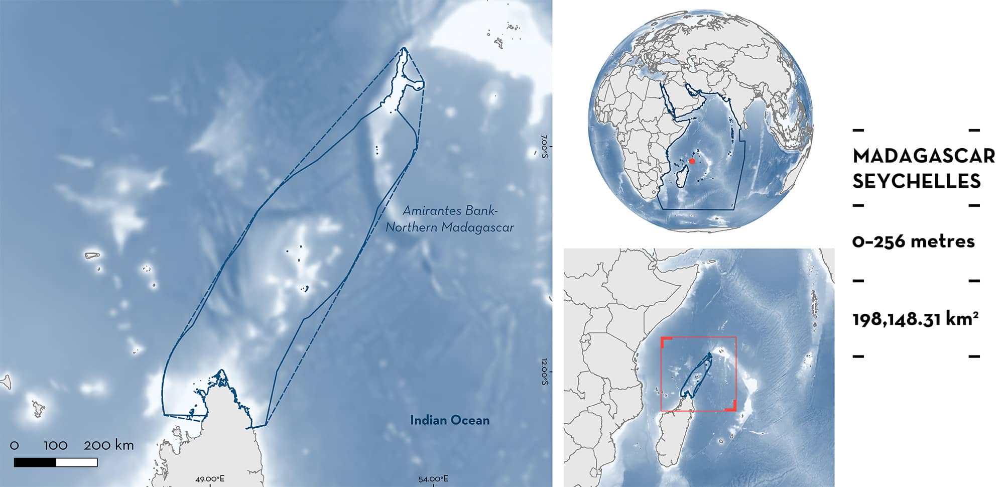
Amirantes Bank-Northern Madagascar is a marine corridor between Seychelles and Madagascar. The oceanography of this area predictably shifts with the two monsoon seasons. The area is characterised by oceanic pelagic waters linking various islands. This area overlaps with nine marine protected areas, three Ecologically or Biologically Significant Marine Areas, and thirteen Key Biodiversity Areas. Within this area, there are: threatened species and areas important for movement (Bull Shark Carcharhinus leucas).
Download factsheet
Amirantes Bank-Northern Madagascar
DESCRIPTION OF HABITAT
Amirantes Bank-Northern Madagascar extends from the bank on the Seychelles to the coastal areas from northern Madagascar. Amirantes Bank is a cluster of coral islands in the Outer Islands group of Seychelles. It includes three atolls with 18 islets. Water depths reach a maximum of 70 m in the centre of the bank before rising to a shallower outer rim of 11–27 m, and then steeply dropping to depths > 1,000 m (Hamylton et al. 2012). Dominant benthos across the Amirantes Bank includes nearshore, fringing, and platform reefs (turf, macro-algae, coralline algae, and scleractinian corals) and atoll reef flats, as well as large seagrass meadows consisting mostly of Sickle-leaved Cymodocea Thalassadendron ciliatum and Turtle Grass Thalassia hemprichii, reef platforms, and open sand areas (Stoddart et al. 1979). Northern Madagascar is characterised by a large number of bays and islands, coral reefs, mangroves, and seagrasses. The corridor between Amirantes Bank and Madagascar is an oceanic habitat characterised by the presence of seamounts, canyons, and ridges.
Environmental conditions across the area predictably shift with the two monsoon seasons, with the lighter and less-persistent winds of the wet northwest monsoon blowing from March to October, and the stronger, steadier southeasterly winds of the dry southeast monsoon prevailing from April through to September (Schott & McCreary 2001; Komdeur & Daan 2005).
This area overlaps with nine marine protected areas, three Ecologically or Biologically Significant Marine Areas (CBD 2023), and thirteen Key Biodiversity Areas (KBA 2023).
This Important Shark and Ray Area is pelagic and is delineated from inshore and surface waters (0 m) to 256 m based on the global depth range of the Qualifying Species.
CRITERION A
VULNERABILITY
The one Qualifying Species within the area is considered threatened with extinction according to the IUCN Red List of Threatened SpeciesTM. The Bull Shark is assessed as Vulnerable (Rigby et al. 2021).
CRITERION C
SUB-CRITERION C4 – MOVEMENT
Amirantes Bank-Northern Madagascar is an important movement area for one shark species.
Between May 2014 and August 2019, 14 Bull Sharks (13 females and 1 male; average length = 272 cm total length [TL], min = 242 cm TL, max = 300 cm TL) were tagged with pop-up satellite-linked archival transmitter (PSAT) tags on Amirantes Bank (more precisely, in areas around D’Arros Island, and St Joseph Atoll; J Lea unpubl. data 2023). PSAT data were calibrated by acoustic tracking data for the duration of the PSAT tracks (Lea et al. 2015). Track durations ranged from 80 to 183 days (mean = 144.5). Both transmitters showed high residency for Bull Sharks to the Bank, where animals remained for prolonged periods.
In addition, PSAT data revealed predictable seasonal migrations back and forth between Amirantes Bank and Madagascar for five of the individuals tagged (Lea et al. 2015; J Lea unpubl. data 2023). These five individual migrations to Madagascar represented movement distances of ~2,000 km and included the track of a pregnant female (Lea et al. 2015; J. Lea unpubl. data 2023). This shark remained on Amirantes Bank until at least October 2014. Between October–November, the shark travelled south from Amirantes Bank and across open ocean to the northern tip of Madagascar. In December 2014, the shark returned north reaching the tagging area in January 2015 (Lea et al. 2015). Movements seem to be connecting potential feeding areas in the Seychelles and potential reproductive areas in eastern Madagascar. Whilst using the waters of Madagascar, the pregnant female remained in shallow waters (< 5 m depth), possibly using the area for parturition (Lea et al. 2015).
Such repeated, annual breeding migrations have been shown in this species elsewhere (e.g., Brunnschweiler et al. 2010; Daly et al. 2014; Espinoza et al. 2016). Bull Sharks are likely to move away from Amirantes Bank to other areas suitable for pupping in Madagascar (areas with estuaries and rivers, which do not exist on Amirantes Bank) and the regular and predictable movement through Amirantes Bank between these critical migrations further highlights the significant importance of the site that contributes to the connectivity of important areas in this region of the Western Indian Ocean.
Download factsheet
SUBMIT A REQUEST
ISRA SPATIAL LAYER REQUEST
To make a request to download the ISRA Layer in either a GIS compatible Shapefile (.shp) or Google Earth compatible Keyhole Markup Language Zipped file (.kmz) please complete the following form. We will review your request and send the download details to you. We will endeavor to send you the requested files as soon as we can. However, please note that this is not an automated process, and before requests are responded to, they undergo internal review and authorization. As such, requests normally take 5–10 working days to process.
Should you have questions about the data or process, please do not hesitate to contact us.


