ISRA FACTSHEETS
ISRA FACTSHEETS
ASIA REGION
Burmanallah
Summary
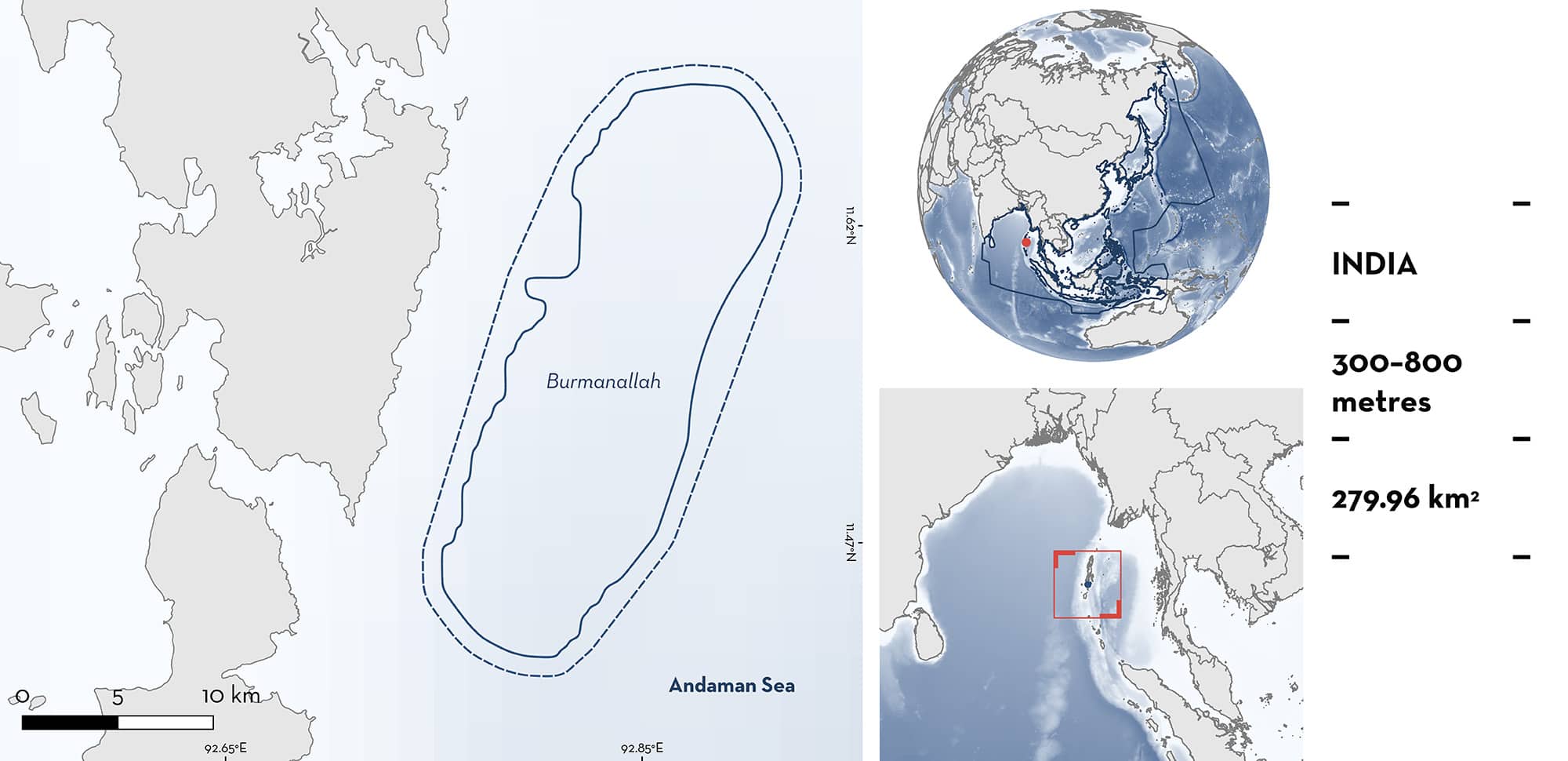
Burmanallah encompasses deepwater habitat off South Andaman Island in the Andaman and Nicobar Islands of India. Substrates comprise soft sediments. Within this area there are: threatened species (e.g., Dwarf Gulper Shark Centrophorus atromarginatus); range-restricted species (Indian Swellshark Cephaloscyllium silasi); and reproductive areas (e.g., Pygmy Ribbontail Catshark Eridacnis radcliffei).
Download factsheet
Burmanallah
DESCRIPTION OF HABITAT
Burmanallah is located in the Andaman and Nicobar Islands of India. It encompasses deepwater habitat off South Andaman Island and is situated roughly between Netaji Subhash Chandra Bose Island and Rutland Island. The substrate comprises soft sediments including sand, sand-silt, silt-sand, and clay-silt which vary with depth (Venkatesh 1978).
The coastal circulation within the Andaman Sea and around the islands is primarily driven by equatorial forcing, with local winds forcing a weak sea-level signal (Chatterjee et al. 2017). The Andaman Sea has a complex oceanographic environment characterised by strong monsoonal patterns, currents, and upwelling. The climate is tropical, with two distinct seasons, the southwest monsoon (July–September) and the northeast monsoon (October–December).
This Important Shark and Ray Area is subsurface and benthopelagic and is delineated from 300 to 800 m based on the bathymetry of the area.
CRITERION A
VULNERABILITY
Two Qualifying Species considered threatened with extinction according to the IUCN Red List of Threatened Species regularly occur in the area. These are the Critically Endangered Dwarf Gulper Shark (Rigby et al. 2020) and Indian Swellshark (Dulvy et al. 2020).
CRITERION B
RANGE RESTRICTED
Burmanallah holds the regular presence of Indian Swellshark as a resident range-restricted species. A combination of semi-structured interviews with commercial demersal trawl (n = 3) and longline (n = 16) fishers targeting gulper sharks, and landing site surveys during 2019–2023 (n = 62 surveys; generally weekly) regularly documented the occurrence of Indian Swellshark in the area. This species is encountered by fishers in Burmanallah mostly during the post-monsoon season (October–March). Individuals of 25–41 cm total length (TL) (n = 26) were recorded in fishery port monitoring surveys and exploratory surveys (Kumar 2019; Bineesh KK unpubl. data 2024; Nashad M unpubl. data 2024). Burmanallah, along with Wadge Bank and Kollam Slope, are the primary areas where Indian Swellshark is regularly encountered in India (Akhilesh et al. 2014; Bineesh KK unpubl. data 2023; Nashad M unpubl. data 2024). Indian Swellsharks are restricted to the Arabian Sea Large Marine Ecosystem (LME) and Bay of Bengal LME.
CRITERION C
SUB-CRITERION C1 – REPRODUCTIVE AREAS
Burmanallah is an important reproductive area for two shark species.
The primary data come from fishery monitoring of landing sites (Burmanallah and Junglighat) where fisheries operating in Burmanallah land their catch (Kumar 2019; Bineesh KK unpubl. data 2023).
Dwarf Gulper Shark are caught in both targeted fisheries and as incidental catch in the area (Bineesh KK unpubl. data 2023; Ebeena pers. comm. 2023). During landing site monitoring between 2017–2023, 142 individuals with a size range of 56–88 cm TL were examined including 16 pregnant females (11.3% of individuals examined) and six neonates of 32–36 cm TL (Bineesh KK unpubl. data 2023). Size-at-birth for the species is 28–36 cm TL (Ebert et al. 2021). Burmanallah is the only area in the world apart from Kollam Slope off the west coast of India where numbers of pregnant females have been encountered and there is no published literature on reproductive biology from anywhere else in its wide (but patchy) Indo-West Pacific geographic range.
Pygmy Ribbontail Catshark are an incidental catch of deepwater shrimp trawlers in the area (Kumar 2019; Bineesh KK unpubl. data 2023). Landing centre monitoring at Junglighat adjacent to Burmanallah between February 2014 and December 2017 recorded 73 individuals of which 82.2% (n = 60) were pregnant. Of these, 30% were carrying early-stage embryos and 70% were carrying fully developed foetuses (Kumar 2019). This is the only location in the Andaman and Nicobar Islands where reproductive activities have been recorded for this species.
Download factsheet
SUBMIT A REQUEST
ISRA SPATIAL LAYER REQUEST
To make a request to download the ISRA Layer in either a GIS compatible Shapefile (.shp) or Google Earth compatible Keyhole Markup Language Zipped file (.kmz) please complete the following form. We will review your request and send the download details to you. We will endeavor to send you the requested files as soon as we can. However, please note that this is not an automated process, and before requests are responded to, they undergo internal review and authorization. As such, requests normally take 5–10 working days to process.
Should you have questions about the data or process, please do not hesitate to contact us.


