ISRA FACTSHEETS
ISRA FACTSHEETS
NEW ZEALAND & PACIFIC ISLANDS REGION
Dakui Point
Summary
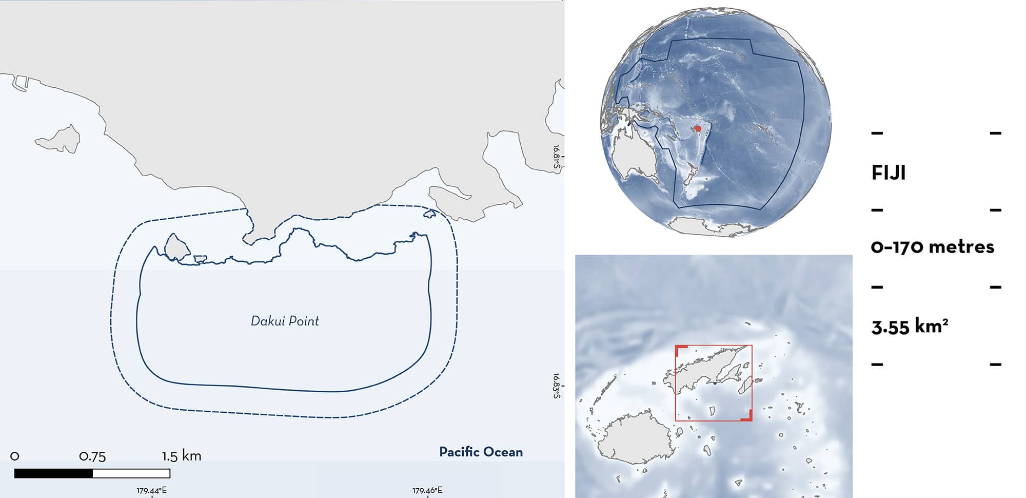
Dakui Point is located off the southern coast of Vanua Levu Island in Fiji. The area is characterised by a steep reef wall and pelagic waters. The tidal cycle influences the currents, which flow eastward on the incoming tide, causing upwelling at the reef wall. Within this area there are: threatened species and undefined aggregations (Scalloped Hammerhead Sphyrna lewini).
Download factsheet
Dakui Point
DESCRIPTION OF HABITAT
Dakui Point is located off the southern coast of Vanua Levu Island in Fiji. The area is a famous dive site also known as ‘Dreamhouse’. The habitat is characterised by a fringing reef that forms a steep drop-off and includes pelagic waters off the reef. The tidal cycle influences the currents in this area, with the current flowing eastward during the incoming tide, resulting in upwelling at the reef wall (C Skipper pers. obs. 2024). The area is influenced by a tropical marine climate with a wet/cyclone season (November–April) and a dry season (May–October; Jorquera et al. 2020).
This Important Shark and Ray Area is benthic and pelagic and is delineated from surface waters (0 m) to 170 m based on the bathymetry of the area.
CRITERION A
VULNERABILITY
One Qualifying Species considered threatened with extinction according to the IUCN Red List of Threatened Species regularly occurs in the area. This is the Critically Endangered Scalloped Hammerhead (Rigby et al. 2019).
CRITERION C
SUB-CRITERION C51 – UNDEFINED AGGREGATIONS
Dakui Point is an important area for undefined aggregations of one shark species.
Recreational divers have observed schools of Scalloped Hammerheads in this area since 2005 and it has become a sought-after dive site due to their regular presence (C Skipper pers. obs. 2024). Aggregations range in group size from small (2–5 individuals) to large (up to 120 individuals). Scalloped Hammerheads are usually seen on the incoming tide when there is an eastward current. They are observed in ~80% of dives during this tidal phase, with ~4–5 dives conducted per week throughout the year by one operator (C Skipper pers. obs. 2024). Sightings are year-round with no apparent seasonality. The aggregation consists of males and females, but no individuals visually estimated at <1 m total length are observed (C Skipper pers. obs. 2024). It is possible that females pup nearby, with anecdotal reports of Scalloped Hammerhead pups caught by local fishers several kilometres east of the area. Further information is required to understand the nature and function of these aggregations.
Download factsheet
SUBMIT A REQUEST
ISRA SPATIAL LAYER REQUEST
To make a request to download the ISRA Layer in either a GIS compatible Shapefile (.shp) or Google Earth compatible Keyhole Markup Language Zipped file (.kmz) please complete the following form. We will review your request and send the download details to you. We will endeavor to send you the requested files as soon as we can. However, please note that this is not an automated process, and before requests are responded to, they undergo internal review and authorization. As such, requests normally take 5–10 working days to process.
Should you have questions about the data or process, please do not hesitate to contact us.


