ISRA FACTSHEETS
ISRA FACTSHEETS
MEDITERRANEAN AND BLACK SEAS REGION
Edremit Bay
Summary
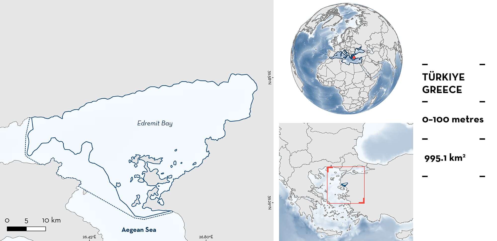
Edremit Bay is located in the northern Aegean Sea off the coast of Türkiye. The northern coast of the bay is bordered by high mountain ranges and the southern coasts exhibit an insular coastal topography. The western part, where the bay connects with the open sea, is bordered by Lesbos Island (Greece). The area is characterised by a narrow continental shelf on the northern part and wider shelf on the southern part of the bay, with depths increasing quickly on the western side. The coastline is covered by seagrass meadows and gorgonian beds in the southern part. The area overlaps with an Ecologically or Biologically Significant Marine Area (Central Aegean Sea) and three Key Biodiversity Areas. Within this area there are: threatened species and reproductive areas (White Shark Carcharodon carcharias).
Download factsheet
Edremit Bay
DESCRIPTION OF HABITAT
Edremit Bay is located in the Aegean Gulf and borders the Balıkesir Province of Türkiye. The northern limit is the Biga Peninsula, and the western entrance is enclosed by the northern portion of the Greek island of Lesbos. The bay is 70 km long in the northern part and 40 km along its southern coast. In general, the maximum depth in the bay area is <100 m. At its western entrance, the depth suddenly increases, creating a steep slope. At its southern entrance (Dikili channel), the maximum depth is <50 m. The substrate is characterised by the presence of seagrass meadows comprised of Neptune Grass (Posidonia oceanica) all along the coastline, and gorgonian beds (Paramuricea spp. and Eunicella spp.) in the south (Albayrak et al. 2007).
The area overlaps with the Central Aegean Sea Ecologically or Biologically Significant Marine Area (CBD 2023). In addition, the area includes three Key Biodiversity Areas: Babakale – Asos Coast, Ayvalık and Tokmakia islets, and Lesvos (KBA 2023a, 2023b, 2023c).
This Important Shark and Ray Area is delineated from inshore and surface waters (0 m) to 100 m based on the maximum depth of the bay.
CRITERION A
VULNERABILITY
The one Qualifying Species within the area is considered threatened with extinction according to the IUCN Red List of Threatened SpeciesTM. The White Shark is assessed as Vulnerable (Rigby et al. 2022).
CRITERION C
SUB-CRITERION C1 – REPRODUCTIVE AREAS
Edremit Bay is an important reproductive area for one shark species.
Data from incidental catches between 2008—2022 indicate that 25 neonates, young-of-the-year, and juvenile White Sharks were found in shallow waters within the bay during the boreal spring and summer (Kabasakal et al. 2018, 2022; Kabasakal 2020). Sharks ranged between 85—200 cm total length (TL). Neonates were identified by the presence of an umbilical scar and were close to the reported size-at-birth for the species (107—160 cm TL; Ebert et al. 2021). In the bay area, young-of-the-year White Sharks occur mostly during summer. The occurrence of juveniles is more prominent in early autumn, and from early winter to early summer.
Due to the insular and peninsular coastal topography of the area, Edremit Bay offers an advantageous and secure location for young animals to move between coastal and open waters before undergoing long-distance migrations. Very few adult White Sharks are observed in the area and subadults are recorded in bays and waters that are to the north or south of Edremit Bay. In addition, juveniles may occur within the bay but are more frequently reported from the northern Aegean Sea. This suggests that Edremit Bay is predominantly inhabited by neonates and juveniles and is the only area within the Aegean Sea where these life stages have been observed (Kabasakal & Özgür-Gedİkoğlu 2008; Kabasakal et al. 2018, 2022; Türker et al. 2018; Kabasakal 2020). Besides this area, within the Mediterranean Sea, young-of-the-year have only been regularly reported in the Strait of Sicily and in the Adriatic Sea (Boldrocchi et al. 2017).
Download factsheet
SUBMIT A REQUEST
ISRA SPATIAL LAYER REQUEST
To make a request to download the ISRA Layer in either a GIS compatible Shapefile (.shp) or Google Earth compatible Keyhole Markup Language Zipped file (.kmz) please complete the following form. We will review your request and send the download details to you. We will endeavor to send you the requested files as soon as we can. However, please note that this is not an automated process, and before requests are responded to, they undergo internal review and authorization. As such, requests normally take 5–10 working days to process.
Should you have questions about the data or process, please do not hesitate to contact us.


