ISRA FACTSHEETS
ISRA FACTSHEETS
MEDITERRANEAN AND BLACK SEAS REGION
Gdor Kurkar Ridges
Summary
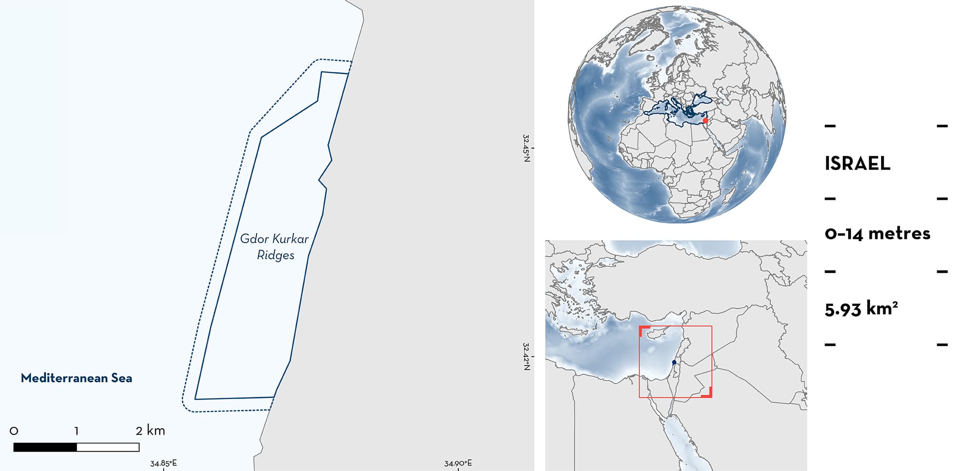
Gdor Kurkar Ridges is a ~5 km long coastal area in Israel. It is characterised by diverse and rich habitats which include detached abrasion tables, shallow sandy lagoons, a submerged Kurkar rocky bottom, and patches of sand among the rocky substrates. It includes most of the Gdor Marine Protected Area (0–300 m from shore). Within this area there are: threatened species (e.g., Common Stingray Dasyatis pastinaca); reproductive areas (e.g., Marbled Stingray Dasyatis marmorata); and undefined aggregations (e.g., Blackchin Guitarfish Glaucostegus cemiculus).
Download factsheet
Gdor Kurkar Ridges
DESCRIPTION OF HABITAT
Gdor Kurkar Ridges is a coastal area situated in Israel in the eastern Mediterranean Sea. Kurkar is the regional name for an aeolian quartz sandstone with carbonate cement, found on the Levantine coast of the Mediterranean Sea from Türkiye to the northern Sinai Peninsula. The Kurkar ridges of Gdor stretch from Michmoret in the south to Givat Olga in the north.
This ~5 km long coastal area consists of varied habitats including detached abrasion tables, shallow sandy lagoons, a submerged Kurkar rocky bottom, and patches of sand among the rocky substrates. The seascape complexity of the rocky substrate is characterised by many concave and convex configurations, including prominent overhangs, burrows, and crevices. This complex structure creates many niches and is therefore rich in algae, crabs, snails, and other invertebrates. The shallow ridge in Gdor spreads from the shoreline to ~300 m offshore to depths of ~7 m, while the deeper ridge lies between 600–1,100 m from the coast at depths of 8–14 m. The area overlaps with the small Gdor Marine Protected Area (MPA) (0–300 m from shore) and its planned extension, the Gdor Harhava MPA (300–1,000 m from shore).
This Important Shark and Ray Area is benthopelagic and is delineated from inshore and surface waters (0 m) to 14 m based on the bathymetry and occurrence of the Qualifying Species in the area.
CRITERION A
VULNERABILITY
Three Qualifying Species considered threatened with extinction according to the IUCN Red List of Threatened SpeciesTM regularly occur in the area. These are the Critically Endangered Blackchin Guitarfish (Kyne & Jabado 2019) and Lusitanian Cownose Ray (Jabado et al. 2021a), and the Vulnerable Common Stingray (Jabado et al. 2021b).
CRITERION C
SUB-CRITERION C1 – REPRODUCTIVE AREAS
Gdor Kurkar Ridges is an important reproductive area for two ray species.
One-hundred visual in-water surveys along two 800–1,200 m long transects were conducted between 2016–2018 (Chaikin et al. 2020; Chaikin 2023). The surveys showed that Common Stingrays and Marbled Stingrays mate and give birth in the area between March and June, when courtship events, females with mating scars, and advanced gravid females were recorded. Males arrive in the area first, followed by the arrival of females (Chaikin et al. 2020). The proportion of advanced gravid females for both species increased over the boreal spring, and most gravid females were seen in May (Chaikin et al. 2020).
A mean of ~15 Common Stingrays were encountered per transect in May, with a maximum of 55 individuals in a transect (Chaikin et al. 2020). Marbled Stingrays had a mean of ~10 individuals, with a maximum of 20 in a transect. Later during autumn (September–November), citizen science reports showed that neonates and young-of-the-year of both species were seen in the shallow (2 m deep) habitats of the area, particularly in the sandy habitats surrounded by rocky reefs (Barash et al. 2018; Chaikin 2023). Common Stingray sizes were estimated to be close to the known size-at-birth of 12 cm disc width (Saadaoui et al. 2015).
CRITERION C
SUB-CRITERION C5 – UNDEFINED AGGREGATIONS
Gdor Kurkar Ridges hosts undefined aggregations of two ray species.
Blackchin Guitarfish seasonally aggregate in Gdor Kurkar Ridges in large numbers, both on the shallow and the deeper ridge. Visual surveys along transects from 2016–2018 showed that Blackchin Guitarfish occupy the area from April–June, with numbers peaking in June at a mean of six, and up to 26 individuals, recorded per transect (Chaikin et al. 2020). Based on the known size-at-maturity, most Blackchin Guitarfish individuals that could be visually assessed were mature females. However, due to the species’ tendency to burrow into the sand, it was not always possible to check whether females were gravid. Therefore, the driver for this seasonal aggregation is still not fully understood (Barash et al. 2018; Chaikin et al. 2020; Chaikin 2023).
Lusitanian Cownose Rays have been documented in large numbers in the northern part of the area. Citizen scientists reported a group of 350 individuals that remained in the area for 3 weeks in 2022, and a large group of ~1,000 individuals was recorded along the reef for two weeks in spring of 2023 (the MECO project unpubl. data 2023). The reason for these large, seasonal aggregations is not yet understood.
Download factsheet
SUBMIT A REQUEST
ISRA SPATIAL LAYER REQUEST
To make a request to download the ISRA Layer in either a GIS compatible Shapefile (.shp) or Google Earth compatible Keyhole Markup Language Zipped file (.kmz) please complete the following form. We will review your request and send the download details to you. We will endeavor to send you the requested files as soon as we can. However, please note that this is not an automated process, and before requests are responded to, they undergo internal review and authorization. As such, requests normally take 5–10 working days to process.
Should you have questions about the data or process, please do not hesitate to contact us.


