ISRA FACTSHEETS
ISRA FACTSHEETS
ASIA REGION
Gili Manuk
Summary
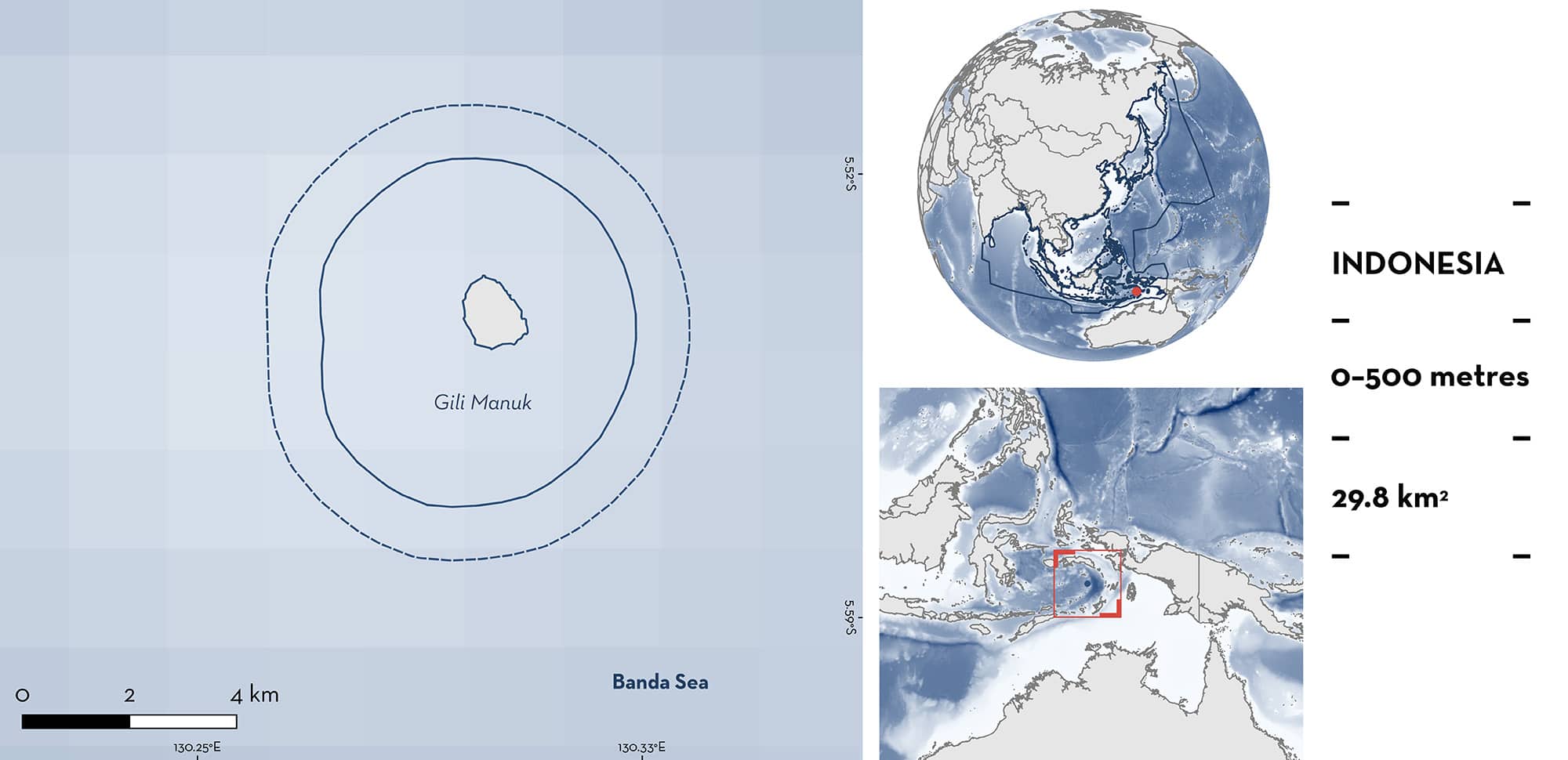
Gili Manuk is located in the Banda Sea, in eastern Indonesia. This is the easternmost of the islands in the Banda Sea and is characterised by the presence of coral reefs and pinnacles. The area overlaps with the Pulau Manuk Key Biodiversity Area and with the Pulau Manuk Wildlife Reserve. Within this area there are: threatened species and undefined aggregations (Scalloped Hammerhead Sphyrna lewini).
Download factsheet
Gili Manuk
DESCRIPTION OF HABITAT
Gili Manuk is located in the Banda Sea, in the Maluku province of Indonesia. The area surrounds the easternmost of the islands in the Banda Sea, which sits in an active volcano rising from 5,000 m depth. It is characterised by the presence of coral reefs and pinnacles.
The Banda Sea is highly influenced by monsoon winds (Moore et al. 2003). The southeast monsoon (June to September) produces lower sea surface temperatures and large-scale upwelling on the eastern side of the Banda Sea, where Gili Manuk is located, while the northwest monsoon (December to March) brings higher temperatures and a depression of the thermocline (Moore et al. 2003; Iskandar 2010).
The area overlaps with the Pulau Manuk Key Biodiversity Area (KBA 2024) and with the Pulau Manuk Wildlife Reserve.
This Important Shark and Ray Area is benthopelagic and is delineated from inshore and surface waters (0 m) to 500 m based on the bathymetry of the area.
CRITERION A
VULNERABILITY
One Qualifying Species within the area is considered threatened with extinction according to the IUCN Red List of Threatened Species. The Scalloped Hammerhead is assessed as Critically Endangered (Rigby et al. 2019).
CRITERION C
SUB-CRITERION C5 – UNDEFINED AGGREGATIONS
Gili Manuk is an important area for undefined aggregations of one shark species.
Since 2015, annual aggregations of Scalloped Hammerheads have been observed in the area between September and November (A Sianipar & J Hennicke unpubl. data 2023). In the eastern Banda Sea, Manuk Island in one of the most prominent sites where aggregations of Scalloped Hammerheads are regularly observed (A Sianipar & J Hennicke pers. obs. 2023). Aggregations are comprised of 20–50 individuals with a maximum of ~80 individuals. Encounters are most common at the southwestern tip of Manuk Island, particularly around a deep pinnacle located in that vicinity (J Hennicke per. obs. 2023). The presence of these aggregations was confirmed during dives undertaken to explore the behaviour of Scalloped Hammerheads at four islands within the Banda Sea, including Manuk Island in October 2021 (Mukharror & Ibrahim 2022). The regularity of these aggregations in Gili Manuk was also confirmed by multiple dive centres operating in the area and liveaboards that regularly visited the area during the aggregation season. More information is needed to confirm the nature and function of these aggregations.
Download factsheet
SUBMIT A REQUEST
ISRA SPATIAL LAYER REQUEST
To make a request to download the ISRA Layer in either a GIS compatible Shapefile (.shp) or Google Earth compatible Keyhole Markup Language Zipped file (.kmz) please complete the following form. We will review your request and send the download details to you. We will endeavor to send you the requested files as soon as we can. However, please note that this is not an automated process, and before requests are responded to, they undergo internal review and authorization. As such, requests normally take 5–10 working days to process.
Should you have questions about the data or process, please do not hesitate to contact us.


