ISRA FACTSHEETS
ISRA FACTSHEETS
WESTERN INDIAN OCEAN REGION
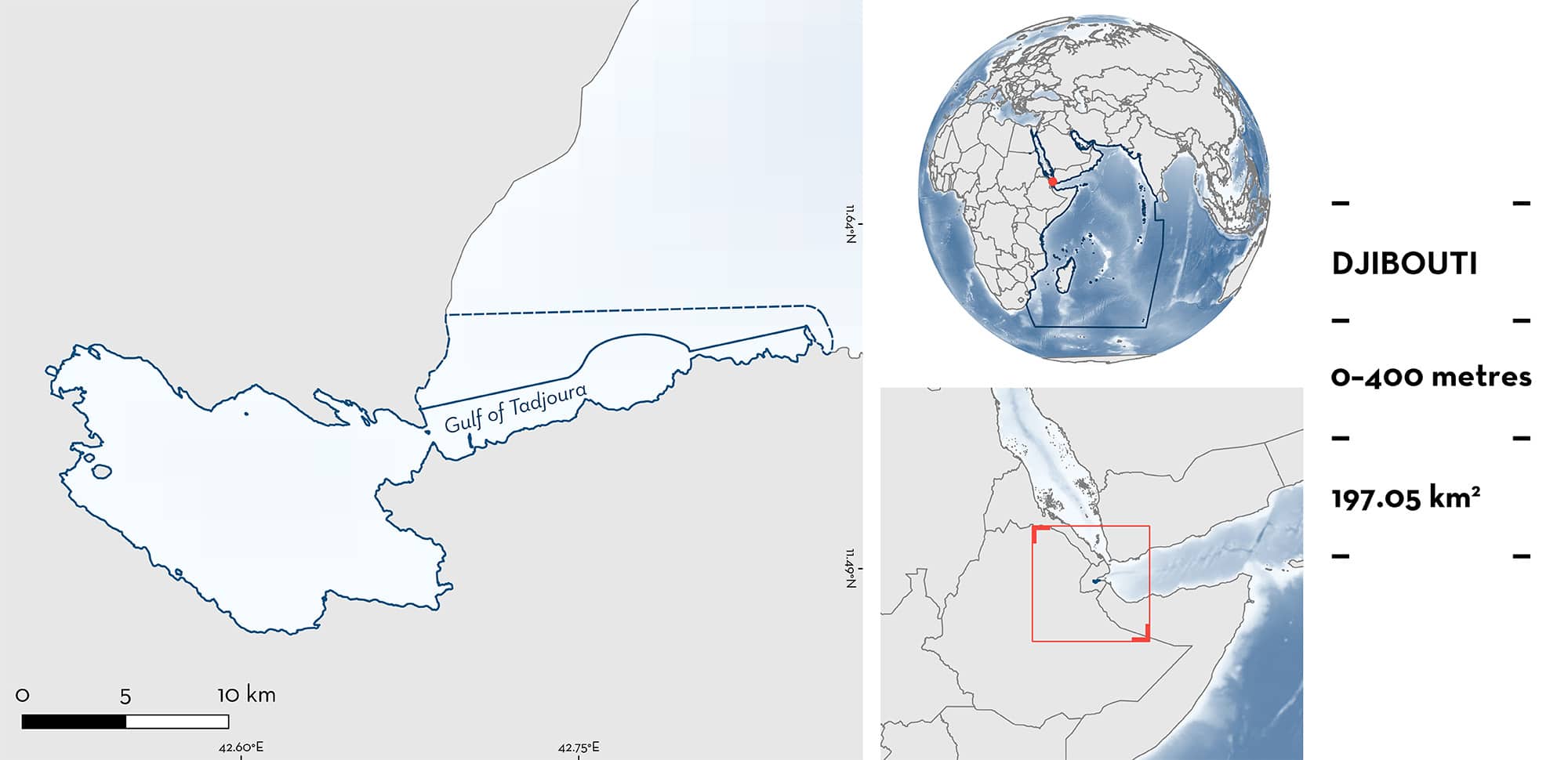
Gulf of Tadjoura
Summary
Gulf of Tadjoura is located within the Gulf of Aden, Djibouti. It is characterised by extensive coastal coral reefs, seagrass beds, salt pans, and mangroves. Within this area there are: threatened species (e.g., Bowmouth Guitarfish Rhina ancylostomus); reproductive areas (Scalloped Hammerhead Sphyrna lewini); feeding areas (Whale Shark Rhincodon typus); and undefined aggregations (Bowmouth Guitarfish).
Download factsheet
Gulf of Tadjoura
DESCRIPTION OF HABITAT
Gulf of Tadjoura is located within the Gulf of Aden and has a maximum width of ⁓15 km and a length of ⁓45 km. The area is bounded by Djibouti except for a small border on the southern side with Somalia. It is characterised by marine habitats including extensive coastal coral reefs, seagrass beds, salt pans, and mangroves. The depth drops rapidly near the coast to a maximum of 400 m. This steep decline is thought to cause upwellings resulting in highly productive coastal waters (Boldrocchi et al. 2020; D Rowat unpubl. data 2023).
This Important Shark and Ray Area is benthopelagic and is delineated from surface and inshore waters (0 m) to a maximum depth of 400 m based on the bathymetry of the area and the depth of the Qualifying Species.
CRITERION A
VULNERABILITY
Three Qualifying Species considered threatened with extinction according to the IUCN Red List of Threatened Species™ are known to occur in the area. These are the Critically Endangered Scalloped Hammerhead (Rigby et al. 2019) and Bowmouth Guitarfish (Kyne et al. 2019), and the Endangered Whale Shark (Pierce & Norman 2016).
CRITERION C
SUB-CRITERION C1 – REPRODUCTIVE AREAS
Gulf of Tadjoura is an important reproductive area for one shark species.
Scalloped Hammerheads have historically been among the most dominant species in Red Sea and Gulf of Aden shark fisheries (Bonfil 2003). These fisheries catch large amounts of juvenile sharks of many species, including young-of-the-year (YOY) Scalloped Hammerheads which are often landed in Djibouti city by gillnet fishers targeting mackerel (Bonfil 2003). Neonate and YOY individuals continue to be predictably found in this area. Scalloped Hammerheads are regularly recorded during fish market surveys or observed while fishers are using handlines or nets (Boldrocchi et al. 2019, 2021). Based on historical and contemporary data collected during Djibouti fish market surveys, the majority of Scalloped Hammerheads fished in waters within this area measured 50–60 cm TL (Bonfil 2003; Boldrocchi et al. 2019, 2021; Boldrocchi pers comms. 2023). The size-at-birth of this species is 31–57 cm total length (TL) (Ebert et al. 2021). Neonate and YOY Scalloped Hammerheads (50–75 cm TL) were observed in almost every survey (carried out twice per week for 2–3 months per year) between 2016–2023 (Boldrocchi pers. obs. 2023). From November to February each year, on multiple occasions, at least 30 individuals have been observed landed at the Djibouti fish market on the same day (Boldrocchi pers. comm. 2023). Landings are from small-scale fishers that operate within a short distance from the landing site.
CRITERION C
SUB-CRITERION C2 – FEEDING AREAS
Gulf of Tadjoura is an important feeding area for one shark species.
Aggregations of Whale Sharks surface feed on dense patches of zooplankton (Rowat et al. 2006; Boldrocchi et al. 2020) and baitfish (Boldrocchi & Bettinetti 2019). Whale Sharks aggregate in localised coastal areas of the Gulf of Tadjoura, including the Bay of Goubet and between Ras Eiro and La Faille, to feed on dense patches of zooplankton thought to be present due to high productivity caused by upwellings that occur close to the coast. These seasonal feeding aggregations take place predictably between November and February. Annual counts of Whale Sharks since 2003 indicate up to 181 individuals per season. Whale Sharks present in these aggregations are mostly juvenile males (84.6%) (Boldrocchi et al. 2020; J Schmidt unpubl. data 2023). They also represent the smallest cohort in terms of body size of any recorded aggregation around the world, with a body size range of 1.8–7 m TL, a mean of 3.9 m TL, and a median of 3.7 m TL (Rowat et al. 2013, 2016; Leblond & Rowat 2016; Rowat & Robinson 2019).
CRITERION C
SUB-CRITERION C5 – UNDEFINED AGGREGATIONS
Gulf of Tadjoura is an important area for undefined aggregations of one ray species.
Bowmouth Guitarfish aggregate in groups of at least seven individuals each year (Caprodossi pers. comm. 2023) from November-February. These observations are regularly made at Ras Korali and Ras Eiro within the area. There are no data available for March-October. Most records of this species from around the world have been opportunistic encounters of single individuals. The Gulf of Tadjoura is therefore particularly significant as it is one of the only location where these aggregations have been recorded. These aggregations have been reported each year since monitoring began from 2015 to 2022, with the exception of 2020 when monitoring was affected by travel restrictions (Boldrocchi et al. 2023). Additional information is required on the nature and function of these aggregations.
Download factsheet
SUBMIT A REQUEST
ISRA SPATIAL LAYER REQUEST
To make a request to download the ISRA Layer in either a GIS compatible Shapefile (.shp) or Google Earth compatible Keyhole Markup Language Zipped file (.kmz) please complete the following form. We will review your request and send the download details to you. We will endeavor to send you the requested files as soon as we can. However, please note that this is not an automated process, and before requests are responded to, they undergo internal review and authorization. As such, requests normally take 5–10 working days to process.
Should you have questions about the data or process, please do not hesitate to contact us.


