ISRA FACTSHEETS
ISRA FACTSHEETS
SOUTH AMERICAN ATLANTIC REGION
Ilhabela
Summary
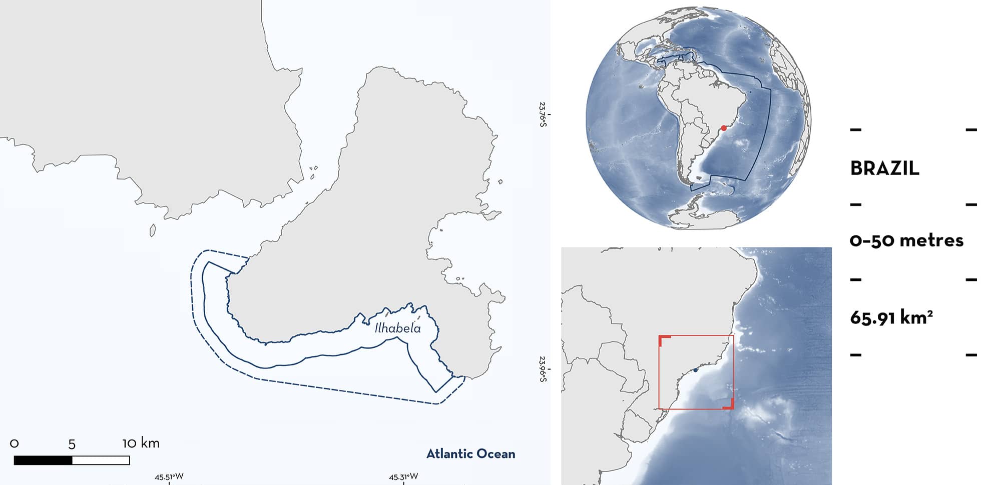
Ilhabela is located in São Paulo State, Brazil. It is situated on the southern and southwestern sides of Sao Sebastian Island and is characterised by sandy substrates and rocky macroalgal reefs. Within the area there are: threatened species (e.g., Oceanic Manta Ray Mobula birostris), feeding areas (Oceanic Manta Ray), and undefined aggregations (Spinetail Devil Ray Mobula mobular).
Download factsheet
Ilhabela
DESCRIPTION OF HABITAT
Ilhabela is located in São Paulo State, Brazil. This area is situated on the southern and southwestern sides of Sao Sebastiao Island in the Southern Brazilian Bight. There are three different water masses that characterise the region: the warm tropical water carried by the Brazilian Current, the cool South Atlantic Central Water, and the coastal water resulting from the mixture of shelf waters and continental waters (Lopes et al. 2006). Ilhabela is characterised by sandy and muddy substrates and rocky macroalgal reefs (G Kodja pers. obs. 2025). Cyclonic eddies of the Brazil Current are common mesoscale processes throughout the year in the region (Lopes et al. 2006). During austral winter, these eddies are short-lived and restricted spatially.
This Important Shark and Ray Area is benthic and pelagic and is delineated from inshore and surface waters (0 m) to 50 m based on the bathymetry of the area.
CRITERION A
VULNERABILITY
Two Qualifying Species considered threatened with extinction according to the IUCN Red List of Threatened Species regularly occur in the area. These are the Endangered Oceanic Manta Ray (Marshall et al. 2022a) and Spinetail Devil Ray (Marshall et al. 2022b).
CRITERION C
SUB-CRITERION C2 – FEEDING AREAS
Ilhabela is an important feeding area for one ray species.
Between 2020–2024, 164 boat surveys were conducted in the area during the winter months (April–September). Between 2022–2024, boat surveys were complemented with the use of drones.
Oceanic Manta Rays were recorded on the surface seasonally during the winter months 52 times in the area, with 26 individuals confirmed using photo identification (R Mesquita unpubl. data 2025). Sightings were more commonly of animals observed alone, however, aggregations of 3–5 individuals were recorded during ~25% of sightings. Surface feeding comprised ~35% of all sightings. During surface feeding, animals were observed swimming along with their mouth open, their cephalic lobes in a funnel-like shape, and their dorsal surface and pectoral fins breaking the water (G Kodja pers. obs. 2025). The water in the area is green and the visibility is poor, largely due to the high densities of zooplankton in the water, so all records are of surface orientated animals, potentially underestimating the number of Oceanic Manta Rays present below the surface (G Kodja pers. obs. 2025). In addition, 13 tourism vessels operate in the area year-round and anecdotal sightings of this species reported by citizen scientists and via social media confirm the winter seasonality of their feeding aggregation in this area.
Surveys have been conducted all around Sao Sebastiao Island with only occasional encounters of these species outside the area, demonstrating the importance of this area for feeding.
CRITERION C
SUB-CRITERION C5 – UNDEFINED AGGREGATIONS
Ilhabela is an important area for undefined aggregations of one ray species.
Between 2020–2024, 164 boat surveys were conducted in the area during the winter months (April–September). Between 2022–2024, boat surveys were complemented with the use of drones.
Spinetail Devil Rays were recorded in ~30% of surveys, with aggregations ranging between 3–30 individuals swimming in a tight group (R Mesquita unpubl. data 2025). Feeding behaviour was observed in ~30% of aggregations, and often this species was sighted on the same days that feeding Oceanic Manta Rays were observed. Sightings are more frequent during the winter months and concentrated within this area rather than the surrounding region (G Kodja pers. obs. 2025). However more information is needed to determine the function and nature of this aggregation.
Download factsheet
SUBMIT A REQUEST
ISRA SPATIAL LAYER REQUEST
To make a request to download the ISRA Layer in either a GIS compatible Shapefile (.shp) or Google Earth compatible Keyhole Markup Language Zipped file (.kmz) please complete the following form. We will review your request and send the download details to you. We will endeavor to send you the requested files as soon as we can. However, please note that this is not an automated process, and before requests are responded to, they undergo internal review and authorization. As such, requests normally take 5–10 working days to process.
Should you have questions about the data or process, please do not hesitate to contact us.


