ISRA FACTSHEETS
ISRA FACTSHEETS
ASIA REGION
Lower Musi
Summary
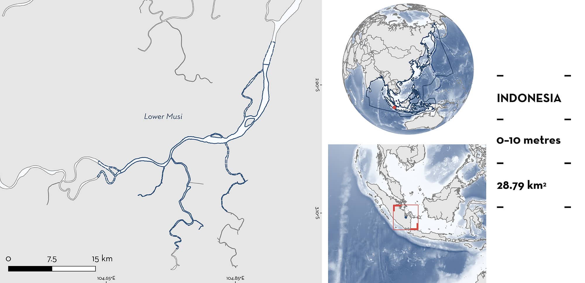
Lower Musi is located in a tropical lowland river system that drains into the South China Sea in South Sumatra, Indonesia. The area encompasses the lower extent of the Musi River freshwater environment above the estuary, around the confluence of the Ogan/Komering River tributary. The area is characterised by highly turbid waters and the banks are dominated by human development, with patchy riparian vegetation. Within this area there are: threatened species (e.g., Giant Freshwater Whipray Urogymnus polylepis), and the area sustains a high diversity of sharks (five species).
Download factsheet
Lower Musi
DESCRIPTION OF HABITAT
Lower Musi is located in a tropical lowland river system in the southeast of Sumatra Island in Indonesia. The Musi River is one of the largest rivers of Sumatra Island (Fitri 2019). The river flows from the southern Barisan Mountains tropical rainforest area, that has an average annual rainfall of 2,579 mm. The main channel of the Musi River is ~750 km in length, draining into the Bangka Strait and subsequently to the South China Sea. Lower Musi encompasses the lower extent of the freshwater environment of the Musi River Basin, around the confluence of the Ogan/Komering River tributary. The area is characterised by highly turbid waters and the banks are dominated by human development and patchy riparian vegetation. At its mouth, intensive agriculture land use is widespread, with only small stretches of the former mangrove forests remaining (Pramilus et al. 2022).
This Important Shark and Ray Area is benthic and delineated from surface waters (0 m) to 10 m based on the bathymetry of the area.
CRITERION A
VULNERABILITY
Five Qualifying Species considered threatened with extinction according to the IUCN Red List of Threatened Species regularly occur in the area. Threatened sharks comprise one Vulnerable species; threatened rays comprise four Endangered species (IUCN 2024).
CRITERION D
SUB-CRITERION D2 – DIVERSITY
Lower Musi sustains a high diversity of Qualifying Species (5 species). This equals the regional freshwater diversity threshold (five species) for the Asia region (classified as freshwater obligate and euryhaline generalist species; Grant et al. 2019). Three freshwater obligate species (Roughback Whipray, Marbled Whipray, and White-edge Whipray) and two euryhaline generalist species (Bull Shark and Giant Freshwater Whipray) are regularly observed in the lower freshwater reach of the Musi River Basin, around the confluence of the Ogan/Komering River tributary.
Research on freshwater sharks and rays using a combination of market surveys, social media records, and fisher observations provided verifiable photo evidence that the Lower Musi area was a hotspot for all five Qualifying Species, while further up- and downstream had reduced diversity (Iqbal & Yustian 2016; Iqbal et al. 2017, 2018). Studies conducted between 2020–2023 focused on morphological characteristics of the Fluvitrygon species (Halim et al. 2022) and the socio-economic role of freshwater rays to the livelihoods of local fishers, including fishers within Lower Musi (Septiani et al. unpubl. data 2024). The latter found that freshwater rays accounted for 14–21% of fisheries income between dry (July–September) and wet (February–March) seasons and reportedly caught on most fishing trips, indicating their year-round presence (Septiani et al. unpubl. data 2024). While records for the Bull Shark are more limited, neonatal size classes from the Lower Musi are available across multiple years (Iqbal et al. 2019; Gausmann & Hasan 2022). Taken together, these studies indicate that the Lower Musi is the only part of the broader river basin where these five species overlap. Furthermore, this is the only known area within the Asia region with contemporary records of five freshwater species co-occurring. This is likely due to the unique physical characteristics of Lower Musi, whereby the two major tributary ‘arms’ of the basin converge close to the estuary, likely providing high productivity.
Download factsheet
SUBMIT A REQUEST
ISRA SPATIAL LAYER REQUEST
To make a request to download the ISRA Layer in either a GIS compatible Shapefile (.shp) or Google Earth compatible Keyhole Markup Language Zipped file (.kmz) please complete the following form. We will review your request and send the download details to you. We will endeavor to send you the requested files as soon as we can. However, please note that this is not an automated process, and before requests are responded to, they undergo internal review and authorization. As such, requests normally take 5–10 working days to process.
Should you have questions about the data or process, please do not hesitate to contact us.


