ISRA FACTSHEETS
ISRA FACTSHEETS
MEDITERRANEAN AND BLACK SEAS REGION
M’Diq and Cabo Negro
Summary
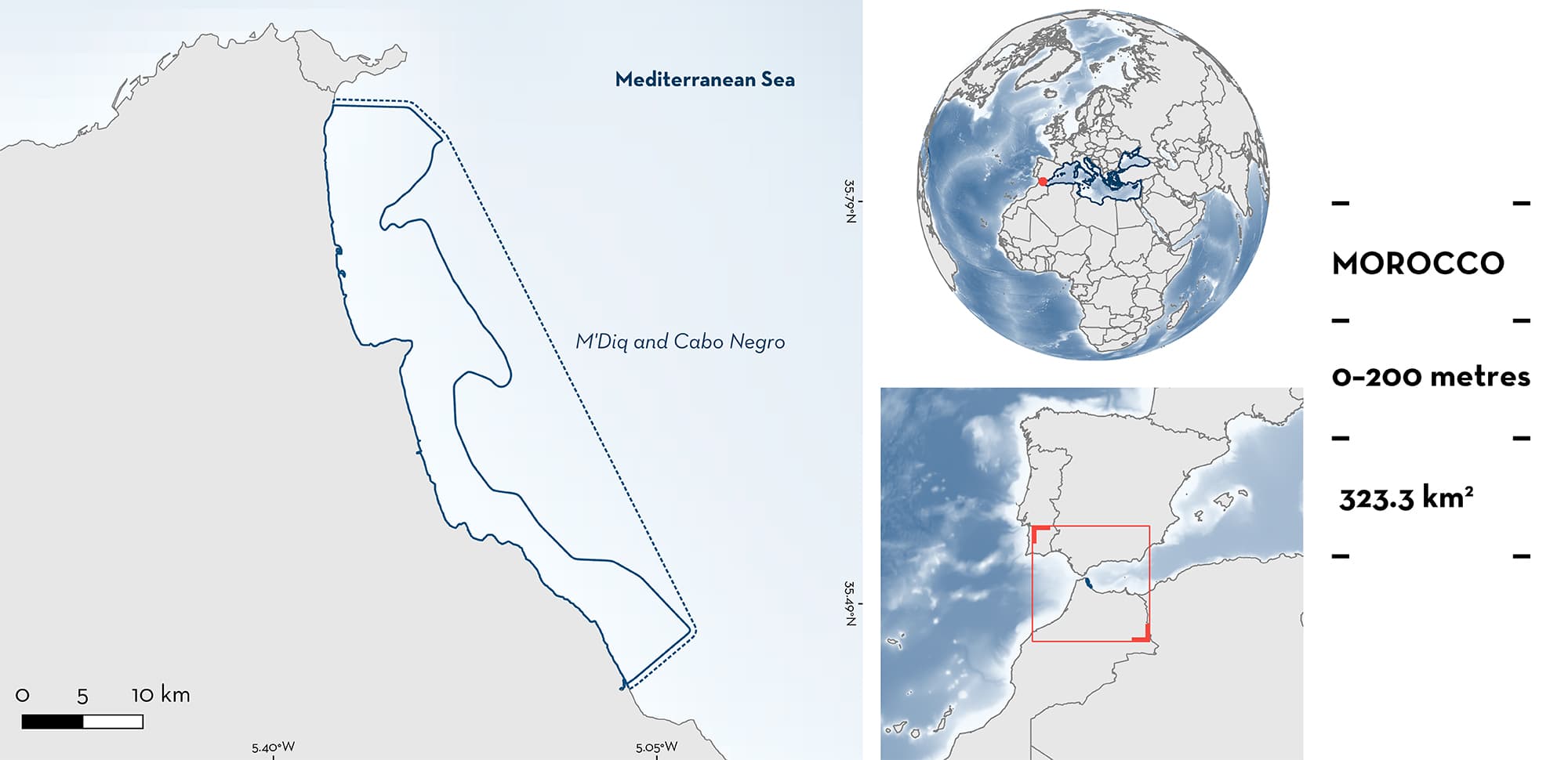
M’Diq and Cabo Negro is located in northern Morocco in the Alboran Sea (western Mediterranean Sea). The area is characterised by muddy and sandy substrates, made of quartz sediments, which make up wide spreading beaches. There are various soft substrate communities in the area, interspersed with gravel and rocky outcrops. Within this area there are range-restricted species (Starry Skate Raja asterias).
Download factsheet
M’Diq and Cabo Negro
DESCRIPTION OF HABITAT
M’Diq and Cabo Negro is located on the Tetouan coast of northern Morocco in the Alboran Sea (western Mediterranean Sea). It is characterised by muddy and sandy substrates, made of quartz sediments, which make up wide spreading beaches. There are various soft substrate communities in the area, which are broken up by gravel and rocky outcrops (from depths of ~20 m), particularly around Cabo Negro. In front of Cabo Negro, the rocky bottoms extend the cape underwater to a depth of ~30 m. The area is interspersed with coastal plains, dunes, and cliffs (Anfuso et al. 2007; Benkhattab et al. 2020). The Tetouan coast has limited influence from minor fluvial input from six small rivers (Satta et al. 2016).
This Important Shark and Ray Area is benthopelagic and is delineated from inshore and surface waters (0 m) to a depth of 200 m based on the bathymetry of the area.
CRITERION B
RANGE RESTRICTED
This area holds the regular presence of the Starry Skate as a resident range-restricted species. This species occurs year-round in the area and is regularly encountered and caught in local fisheries (Fatimetou et al. 2015, Fatimetou & Younes 2016). It was the dominant species caught from a coastal fleet of trawlers, sardine, and longliner boats between 2006–2010. Large quantities of individuals were caught in June to October, with a slight decrease in the middle of October to early November (Fatimetou et al. 2015). Additionally, 367 individuals were caught in artisanal fisheries (using trawls, longlines, and gillnets) between April 2013 and April 2014 (Fatimetou & Younes 2016). Starry Skate is distributed primarily in the Mediterranean Sea Large Marine Ecosystem (LME) and only very marginally in the Canary Current LME and Iberian Coastal LME.
Download factsheet
SUBMIT A REQUEST
ISRA SPATIAL LAYER REQUEST
To make a request to download the ISRA Layer in either a GIS compatible Shapefile (.shp) or Google Earth compatible Keyhole Markup Language Zipped file (.kmz) please complete the following form. We will review your request and send the download details to you. We will endeavor to send you the requested files as soon as we can. However, please note that this is not an automated process, and before requests are responded to, they undergo internal review and authorization. As such, requests normally take 5–10 working days to process.
Should you have questions about the data or process, please do not hesitate to contact us.


