ISRA FACTSHEETS
ISRA FACTSHEETS
NEW ZEALAND & PACIFIC ISLANDS REGION
Natadola Bay
Summary
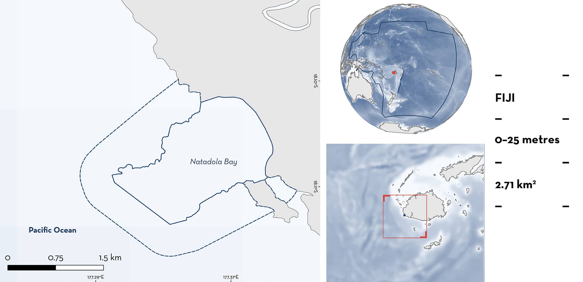
Natadola Bay is located on the southwest coast of Viti Levu Island in Fiji. The area includes a large gap in the coastal fringing reef, creating an environment sheltered from large waves. It is characterised by sandy substrates, coral reefs, seagrass beds, coastal beaches, and mangroves. Within this area there are: threatened species (Pink Whipray Pateobatis fai); range-restricted species (Oceania Fantail Ray Taeniura lessoni); and undefined aggregations (Pink Whipray).
Download factsheet
Natadola Bay
DESCRIPTION OF HABITAT
Natadola Bay is located on the southwestern coast of Viti Levu Island in Fiji. It is a large bay that creates a deep gap in the coastal fringing reef. Winds in Fiji are seasonally stronger during April–October and blow from the east and southeast (Kumar & Prasad 2010). The opening to the bay is ~1.2 km wide and faces southwest, meaning that the waters in the area are calm and not wavy. Water temperature fluctuates little, ranging between 25–28°C (R Macfarlane pers. obs. 2024). The habitat is characterised by sandy substrates, coral reefs, beds of Needle Seagrass Halodule uninervis, coastal beaches, and mangroves (McKenzie & Yoshida 2020).
This Important Shark and Ray Area is benthic and pelagic and is delineated from surface waters (0 m) to 25 m based on the bathymetry of the area.
CRITERION A
VULNERABILITY
One Qualifying Species considered threatened with extinction according to the IUCN Red List of Threatened Species regularly occurs in the area. This is the Vulnerable Pink Whipray (Sherman et al. 2024).
CRITERION B
RANGE RESTRICTED
This area holds the regular presence of the Oceania Fantail Ray as a resident range-restricted species. This species occurs year-round within Natadola Bay and has been regularly observed by divers since 2019 (I Ninio & A Cerrini pers. obs. 2024). Oceania Fantail Rays are seen in 10 out of 14 (71%) dive/snorkel trips undertaken in this area per week (R Macfarlane pers. obs. 2024). The species is not seen at dive sites immediately outside the area (R Macfarlane pers. obs. 2024), highlighting the importance of Natadola Bay for the species. The range of the Oceania Fantail Ray lies outside of Large Marine Ecosystems, but is small, including Fiji, the Solomon Islands, and Vanuatu (Last et al. 2016).
CRITERION C
SUB-CRITERION C5 – UNDEFINED AGGREGATIONS
Natadola Bay is an important area for undefined aggregations of one ray species.
Local dive centre operators regularly see aggregations of 5–10 Pink Whiprays in the area (R Macfarlane pers. obs. 2024). Between 2019–2024, approximately 14 dives per week were conducted year-round in this area. Aggregations of Pink Whiprays were observed on an estimated ~15% of dives (R Macfarlane pers. obs. 2024). Additional information is required to determine the nature and function of these aggregations.
Download factsheet
SUBMIT A REQUEST
ISRA SPATIAL LAYER REQUEST
To make a request to download the ISRA Layer in either a GIS compatible Shapefile (.shp) or Google Earth compatible Keyhole Markup Language Zipped file (.kmz) please complete the following form. We will review your request and send the download details to you. We will endeavor to send you the requested files as soon as we can. However, please note that this is not an automated process, and before requests are responded to, they undergo internal review and authorization. As such, requests normally take 5–10 working days to process.
Should you have questions about the data or process, please do not hesitate to contact us.


