ISRA FACTSHEETS
ISRA FACTSHEETS
NEW ZEALAND & PACIFIC ISLANDS REGION
Northwest Campbell Plateau
Summary
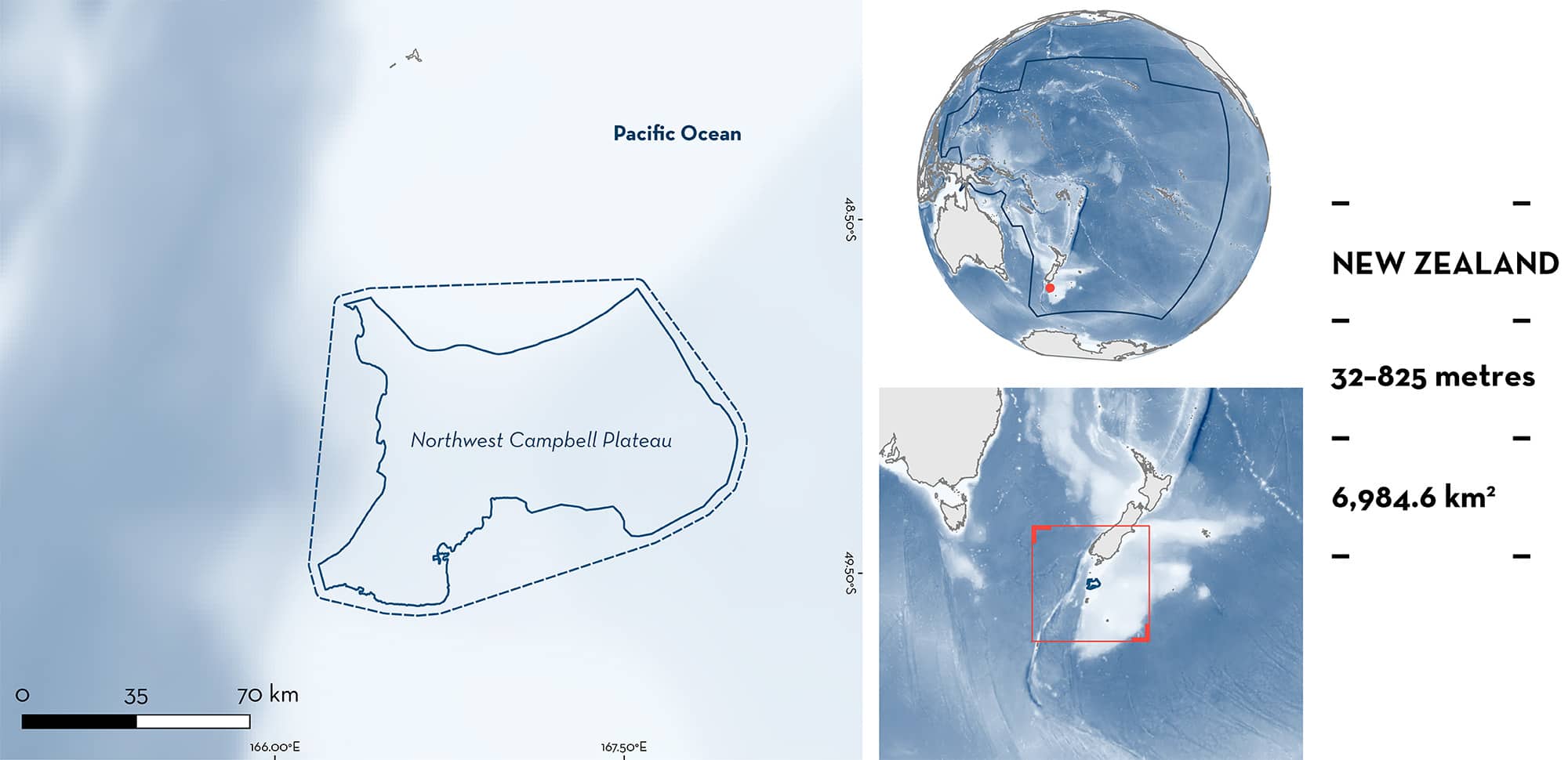
Northwest Campbell Plateau is located in southern New Zealand. It is part of the Campbell Plateau, a submarine plateau characterised by a steep continental slope that quickly descends into deep waters. The area is characterised by sandy, rocky, and muddy substrates. The area is influenced by the Subantarctic Surface Water and by warmer and more saline Subtropical Surface Waters. Within this area there are: range-restricted species (e.g., Smooth Deepsea Skate Brochiraja asperula) and reproductive areas (Pale Ghostshark Hydrolagus bemisi).
Download factsheet
Northwest Campbell Plateau
DESCRIPTION OF HABITAT
Northwest Campbell Plateau is located in southern New Zealand and ~150 km north of Auckland Islands. It is part of the Campbell Plateau, a submarine plateau in the south and southeast of New Zealand’s South Island that is mostly bathyal (600–1,000 m) but rises up to 250 m in some areas. The area is characterised by a steep continental slope that quickly descends into waters >1,000 m with sandy and rocky substrates in shallower areas and muddy substrates in deeper areas (Hayward et al. 2007; Forcén-Vázquez et al. 2021). The area is mostly influenced by the Subantarctic Surface Water that brings cool and nutrient rich waters and by warmer and more saline Subtropical Surface Waters (Hayward et al. 2007; Stephenson et al. 2021).
This Important Shark and Ray Area is benthic and subsurface and is delineated from 32–825 m based on the bathymetry of the area.
CRITERION B
RANGE RESTRICTED
This area holds the regular presence of the Smooth Deepsea Skate and Pale Ghostshark as resident range-restricted species. These species were regularly encountered in independent research surveys using demersal trawls conducted in the area during austral summer (November–December) in 1991–1993, 2000–2009, 2011, 2012, 2014, 2016, 2018, 2020, and 2022 (Bagley et al. 2014, 2017; O’Driscoll et al. 2018; MacGibbon et al. 2019; Stevens et al. 2022, 2024; B Finucci unpubl. data 2024).
For Smooth Deepsea Skate, 17 individuals were recorded in the area in 2007, 2011, 2012, 2016, 2018, 2019, and 2020 at depths of 538–743 m (B Finucci unpubl. data 2024). Northwest Campbell Plateau held the second largest catch for the species in all New Zealand after Chatham Rise. This species is assessed as Data Deficient (Finucci & Kyne 2018) making this area of global relevance. The Smooth Deepsea Skate is endemic to the New Zealand Shelf Large Marine Ecosystem (LME).
For Pale Ghostshark, 2,565 individuals were recorded at depths of 447–749 m (B Finucci unpubl. data 2024). Northwest Campbell Plateau held the second largest catch for the species in all New Zealand after Chatham Rise and individuals were recorded in all sampling years. The Pale Ghostshark is endemic to the New Zealand Shelf Large Marine Ecosystem (LME).
CRITERION C
SUB-CRITERION C1 – REPRODUCTIVE AREAS
Northwest Campbell Plateau is an important reproductive area for one chimaera species.
Independent research surveys using demersal trawls (200–1300 m depths) were conducted in the area during summer (November–December) in 1991 – 1993, 2000 – 2009, 2011, 2012, 2014, 2016, 2018, 2020, and 2022 (Bagley et al. 2014, 2017; O’Driscoll et al. 2018; MacGibbon et al. 2019; Stevens et al. 2022; Stevens et al. 2024). Contemporary data (since 2009) from these surveys recorded late-stage pregnant females (with egg cases ready to be deposited) of Pale Ghostshark that are regularly found in the area (B Finucci unpubl. data 2024). Of the 2,565 Pale Ghostshark recorded in the area, 170 (6.6%) were late-stage pregnant females caught at depths of 447–749 m (B Finucci unpubl. data 2024). Northwest Campbell Plateau held the second largest number of pregnant females caught in research surveys along all New Zealand in the surveyed years after the Chatham Rise (Bagley et al. 2014, 2017; O’Driscoll et al. 2018; MacGibbon et al. 2019; Stevens et al. 2022; Stevens et al. 2024; B Finucci unpubl. data 2024).
Download factsheet
SUBMIT A REQUEST
ISRA SPATIAL LAYER REQUEST
To make a request to download the ISRA Layer in either a GIS compatible Shapefile (.shp) or Google Earth compatible Keyhole Markup Language Zipped file (.kmz) please complete the following form. We will review your request and send the download details to you. We will endeavor to send you the requested files as soon as we can. However, please note that this is not an automated process, and before requests are responded to, they undergo internal review and authorization. As such, requests normally take 5–10 working days to process.
Should you have questions about the data or process, please do not hesitate to contact us.


