ISRA FACTSHEETS
ISRA FACTSHEETS
ASIA REGION
Peter the Great Bay
Summary
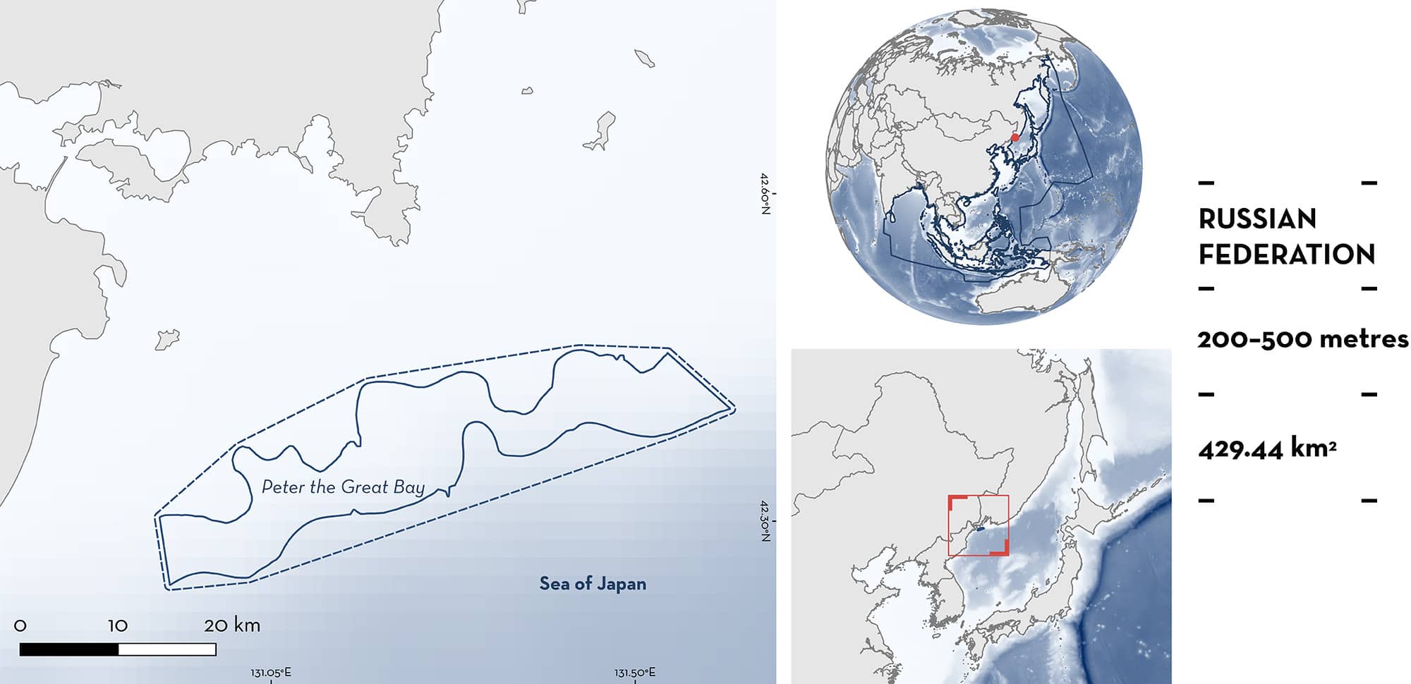
Peter the Great Bay is located in the northeast Sea of Japan in the waters of the Russian Federation. It is characterised by a shallow shelf and a steep continental slope with numerous underwater canyons. The area overlaps with an Ecologically or Biologically Significant Marine Area and one protected area. Within the area there are: feeding areas (Bottom Skate Bathyraja bergi).
Download factsheet
Peter the Great Bay
DESCRIPTION OF HABITAT
Peter the Great Bay is located on the southern coast of Primorsky Krai in the Russian Federation. It is the largest bay within the Sea of Japan. The waters of the wider bay extend from the mouth of the Tumannaya River to Cape Povorotny. The area includes many islands of various sizes concentrated mainly in its western part. The seafloor relief of Peter the Great Bay is characterised by a shallow shelf and a steep continental slope, with many underwater canyons. In the eastern part of the bay, the depths reach 100 m or deeper, and in the western part they do not exceed 100 m. On the continental slope, in a strip from 5 to 15 km wide, the depths vary from 200 to 2,000 m.
The water regime of Peter the Great Bay is mainly determined by water exchange with the open part of the Sea of Japan, the influence of river runoffs, and wind surges (Luchin et al. 2005). From November–December to March, a homogeneous distribution of water temperature is observed in the water column. The warm season is characterised by a decrease in water temperature towards the benthos. The maximum seasonal fluctuations in water temperature in Peter the Great Bay are characteristic of the surface layer, where they range from 20 to 23°C. The minimum seasonal fluctuations are observed in the marine areas of the bay (Luchin et al. 2005).
The area overlaps with Peter the Great Ecologically or Biologically Significant Marine Area (EBSA; CBD 2024) and with the Far Eastern Marine Biosphere Reserve.
This Important Shark and Ray Area is benthopelagic and subsurface and is delineated from 200 m to 500 m based on the depth range of the Qualifying Species in the area.
CRITERION C
SUB-CRITERION C2 – FEEDING AREAS
Peter the Great Bay is an important feeding area for one ray species.
Scientific surveys using benthic trawls between 1977–2021 showed that aggregations of the Bottom Skate regularly occur in Peter the Great Bay, particularly in March–May when they feed on Snow Crab Chionoecetes opilio (Panchenko et al. 2017; Orlov & Volvenko 2022, unpubl. data 2023). This area has the highest abundance of Bottom Skates (mean: 179 individuals/km2, max: 1,049 individuals/km2) in Russian waters of the Northwest Pacific based on surveys undertaken over 15 years (Orlov & Volvenko 2022, unpubl. data 2023). The species is found in the area year-round at depths of 37–577 m and temperatures of 0.3–3.8°C (Panchenko et al. 2017). However, seasonal and size-based patterns have been described, with larger individuals distributed in shallower areas than juveniles. Between June–September, individuals distribute closer to the continental shelf without forming aggregations and during this period, abundances are at their lowest. During the boreal autumn and winter (October–February) there is a migration to the slope and abundance increases to a maximum during spring (March–May), when the Bottom Skate occurs mostly between 200–500 m on feeding grounds (Panchenko et al. 2017). Stomach content analysis (n = 42) undertaken between 2014–2015 revealed that during spring, ~60% of its diet is composed of Snow Crabs, a percentage six-times higher than in northern areas where smaller abundances of the Bottom Skate have also been reported (Panchenko et al. 2017). The abundance of Snow Crab has increased in the region since the 2000s and juveniles are more abundant in Peter the Great Bay than in northern areas (Slizkin & Koblikov 2013) and have a vertical distribution that overlaps the distribution of Bottom Skates (Chuchukalo et al. 2011), confirming a high seasonal prey availability.
Download factsheet
SUBMIT A REQUEST
ISRA SPATIAL LAYER REQUEST
To make a request to download the ISRA Layer in either a GIS compatible Shapefile (.shp) or Google Earth compatible Keyhole Markup Language Zipped file (.kmz) please complete the following form. We will review your request and send the download details to you. We will endeavor to send you the requested files as soon as we can. However, please note that this is not an automated process, and before requests are responded to, they undergo internal review and authorization. As such, requests normally take 5–10 working days to process.
Should you have questions about the data or process, please do not hesitate to contact us.


