ISRA FACTSHEETS
ISRA FACTSHEETS
CENTRAL AND SOUTH AMERICAN PACIFIC REGION
Puerto Cabuyal
Summary
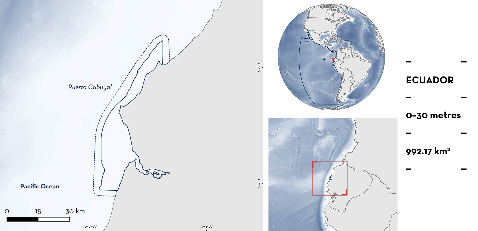
Puerto Cabuyal is located in coastal mainland Ecuador and comprises the Puerto Cabuyal-Punta San Clemente Marine Reserve. The area is situated in the Equatorial Front and is characterised as a transition zone that separates cold waters rich in nutrients from warmer waters, generating a zone of high productivity. It contains a variety of habitats, including soft, hard, and mixed benthos, rocky shallows, and coral formations to 30 m depth. Within the area there are: threatened species (e.g., Scoophead Shark Sphyrna media) and reproductive areas (e.g., Smooth Hammerhead Sphyrna zygaena).
Download factsheet
Puerto Cabuyal
DESCRIPTION OF HABITAT
Puerto Cabuyal is located in coastal mainland Ecuador and overlaps with the Puerto Cabuyal-Punta San Clemente Marine Reserve and is located in the province of Manabí. The area is situated in the Equatorial Front and is characterised as a transition zone that separates cold waters rich in nutrients from warmer waters, generating a zone of high productivity. Situated within the Pacific and Central-American Coastal Large Marine Ecosystem (LME), the area contains relatively shallow waters (< 30 m). Among the most important geographical features are the estuary of the Chone River, the peninsulas of Punta Ballena, Punta Cabuyal, Cabo Pasado, Punta Napo, Punta Bellaca, and La Gorda, Punta San Clemente. These geographical features cause a continuous sinuosity in the bathymetry of the area; likewise, there are submarine geographical faults, considered of importance for the diversity and abundance of biota (Iturralde et al. 2021a). The benthos varies between soft bottoms, and hard or mixed bottoms (rock, sand/rock). The area in front of Cabo Pasado, Punta Bellaca – Punta Bikini stands out for the presence shallow rocky reefs and coral formations.
The region’s climate has been defined as a dry to semi-humid tropical megathermal climate, characterised by annual rainfall between 500 and 1,000 mm, mainly between December and May. According to the National Institute of Meteorology and Hydrology (INAMHI), published with data up to 2013, the average temperature at the Bahía de Caráquez -PUCE- station is 25.1°C (ranging from 23.8 and 26.6°C), while rainfall is more variable with an average of 600 mm per year (247–906 mm annually) (Iturralde et al. 2021b).
This Important Shark and Ray Area is delineated from inshore and surface waters (0 m) to 30 m depth based on the depth ranges of Qualifying Species occurring in the area.
CRITERION A
VULNERABILITY
Three Qualifying Species considered threatened with extinction according to the IUCN Red List of Threatened SpeciesTM regularly occur in the area. These are the Critically Endangered Scalloped Hammerhead (Rigby et al. 2019a) and Scoophead Shark (Pollom et al. 2020), and the Vulnerable Smooth Hammerhead (Rigby et al. 2019b).
CRITERION C
SUB-CRITERION C1 – REPRODUCTIVE AREAS
Puerto Cabuyal Marine Reserve is an important reproductive area for four shark species. The area was designated based on its function as a shark nursery. Monitoring conducted in the area from 2019–2022 has identified this area as important for the reproduction of several species of hammerhead sharks: Scalloped Hammerhead Sphyrna lewini (544 individuals sampled), Smooth Hammerhead (87 individuals sampled), and Scoophead Shark (18 individuals sampled). All three species were caught in all monitoring years, with neonates and young-of-the-year identified by the presence of an umbilical scar. Neonate Scalloped Hammerheads have been considered as those measuring < 75 cm total length (TL) (Alejo-Plata et al. 2018). Pupping appears to commence in the first half of the year coinciding with peak catches, e.g., mean size of sampled Scalloped Hammerheads from January to May 2022 was 49.5 cm TL (Espinoza et al. 2021).
Similarly, for Tiger Shark, eight neonates and juveniles have been sampled in August and September over the last four years of monitoring surveys (Espinoza et al. 2021), with fishers also confirming the regular presence of this species, suggesting this area is also an important site for the early life-stages of this species.
Download factsheet
SUBMIT A REQUEST
ISRA SPATIAL LAYER REQUEST
To make a request to download the ISRA Layer in either a GIS compatible Shapefile (.shp) or Google Earth compatible Keyhole Markup Language Zipped file (.kmz) please complete the following form. We will review your request and send the download details to you. We will endeavor to send you the requested files as soon as we can. However, please note that this is not an automated process, and before requests are responded to, they undergo internal review and authorization. As such, requests normally take 5–10 working days to process.
Should you have questions about the data or process, please do not hesitate to contact us.


