ISRA FACTSHEETS
ISRA FACTSHEETS
CENTRAL AND SOUTH AMERICAN PACIFIC REGION
Salas y Gómez/Motu Motiro Hiva
Summary
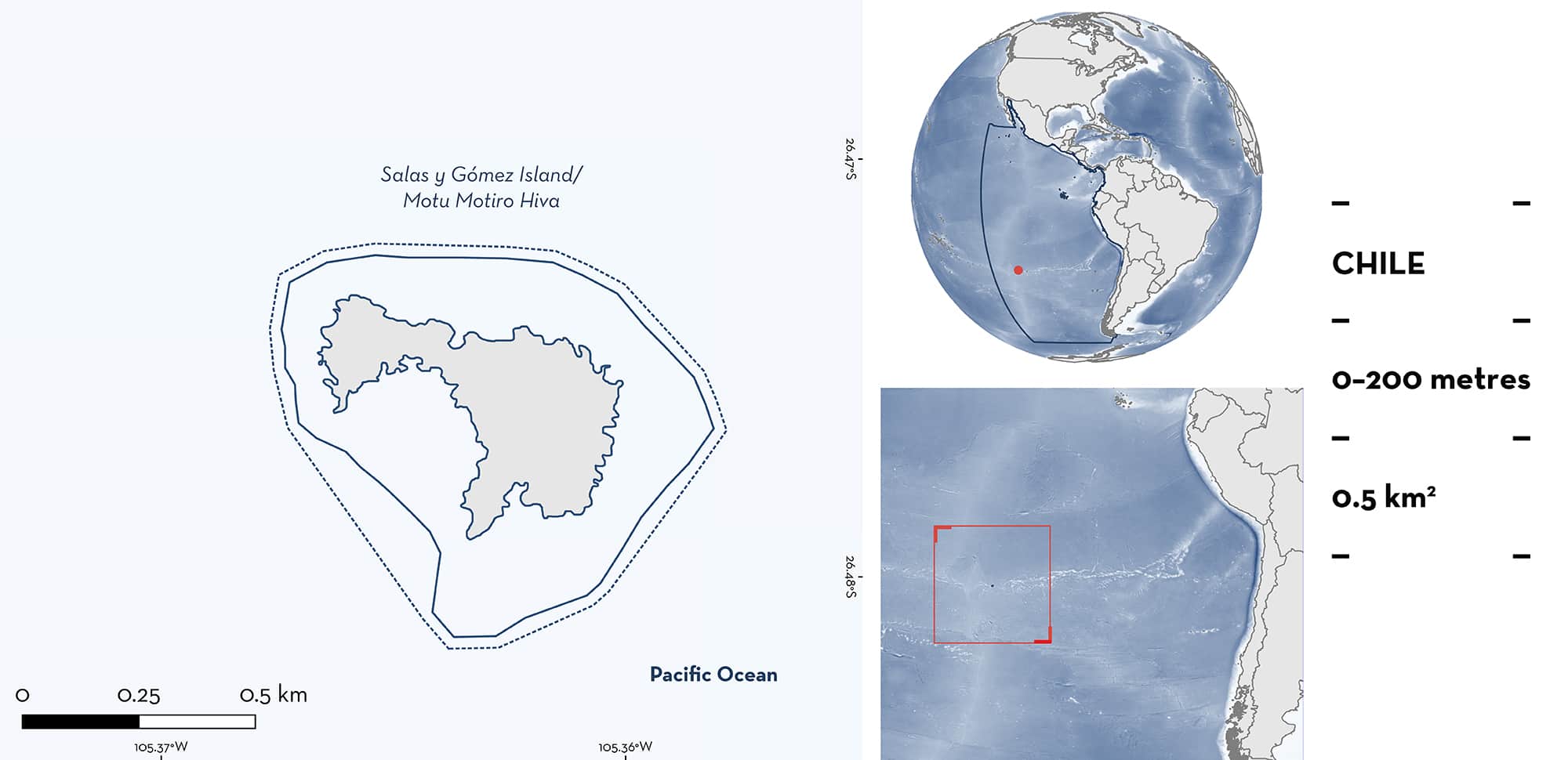
Salas y Gómez/Motu Motiro Hiva is located in the Southeast Pacific Ocean, 400 km west of Rapa Nui (Easter Island) of Chile. It falls within the Motu Motiro Hiva Marine Park and is a designated Ecologically or Biologically Significant Marine Area. The area contains the nearshore waters around Salas y Gómez Island. Salas y Gómez Island and Rapa Nui, along with several dozen seamounts, are part of the Salas y Gómez Ridge. The marine habitat around the island is characterised by the presence of rocky reefs with crustose coralline algae and coral species (e.g., cauliflower corals Pocillopora spp.). Within this area there are: reproductive areas (Galapagos Shark Carcharhinus galapagensis).
Download factsheet
Salas y Gómez/Motu Motiro Hiva
DESCRIPTION OF HABITAT
Salas y Gómez Island is located in the Valparaíso region and Easter Island ecoregion of Chile. It is situated 3,210 km west of the Chilean mainland, with an area of 0.15 km2 and a total length of 770 m. It is part of the Salas y Gómez Ridge, along with Rapa Nui (Easter Island) to the west, and these are the only places where this submarine mountain range rises above sea level (Newman & Foster 1983). The Salas y Gómez Ridge is considered an Ecologically or Biologically Significant Marine Area (CBD 2017). The marine habitat around the island is characterised by the presence of crustose coralline algae and coral species (e.g., cauliflower corals Pocillopora spp.) (Friedlander et al. 2013). Salas y Gómez is considered part of Polynesia, making it the easternmost landmass of Polynesia and the most south-eastern coral reef in the Pacific. This region contains unique biodiversity that is marked by one of the highest levels of marine endemism on Earth (Wagner et al. 2021). This area also provides important habitats and an ecological ‘stepping-stone’ for fishes, whales, sea turtles, corals, and a multitude of other ecologically important species, including 82 species that are threatened with extinction (Wagner et al. 2021).
This Important Shark and Ray Area is delineated from the surface (0 m) to 200 m and is pelagic due to the vertical distribution reported for the Qualifying Species within this area (Morales et al. 2021).
CRITERION C
SUB-CRITERION C1 – REPRODUCTIVE AREAS
Salas y Gómez/Motu Motiro Hiva is an important reproductive area for one shark species. Juvenile Galapagos Shark account for 26% of the fish biomass at Salas y Gómez Island (Friedlander et al. 2013). In three years of research (2011, 2015, and 2017) during the austral spring, young-of-the-year and juvenile sharks have been recorded (Friedlander et al. 2013; Morales et al. 2021). The estimated size of 48 individuals captured in this area ranged from 76 to 170 cm total length (TL) with a mean ± standard deviation of 106 ± 23 cm TL (Morales et al. 2021). The size-at-birth of this species is between 57–81 cm TL (Ebert et al. 2021). Individuals tagged with pop-up satellite archival tags (n = 4; 124–170 cm TL) showed strong fidelity to the area around the island (Morales et al. 2021). Moreover, three sharks tagged in 2015 were sighted in 2017 suggesting long-term residency (Naiti Morales pers. obs.). Baited Remote Underwater Video Surveys (BRUVS) around Salas y Gómez Island recorded mostly juvenile Galapagos Sharks as the most common high-trophic predator throughout the year (n=42 individuals; mean ± standard deviation: 98.9 ± 27.7 cm fork length [FL]) (Morales 2017). The shallow waters around Salas y Gómez are an important reproductive area for this species while adults have been recorded in deeper waters adjacent to Stott Reef (Oceana Chile 2012).
Download factsheet
SUBMIT A REQUEST
ISRA SPATIAL LAYER REQUEST
To make a request to download the ISRA Layer in either a GIS compatible Shapefile (.shp) or Google Earth compatible Keyhole Markup Language Zipped file (.kmz) please complete the following form. We will review your request and send the download details to you. We will endeavor to send you the requested files as soon as we can. However, please note that this is not an automated process, and before requests are responded to, they undergo internal review and authorization. As such, requests normally take 5–10 working days to process.
Should you have questions about the data or process, please do not hesitate to contact us.


