ISRA FACTSHEETS
ISRA FACTSHEETS
NEW ZEALAND & PACIFIC ISLANDS REGION
Sigatoka River
Summary
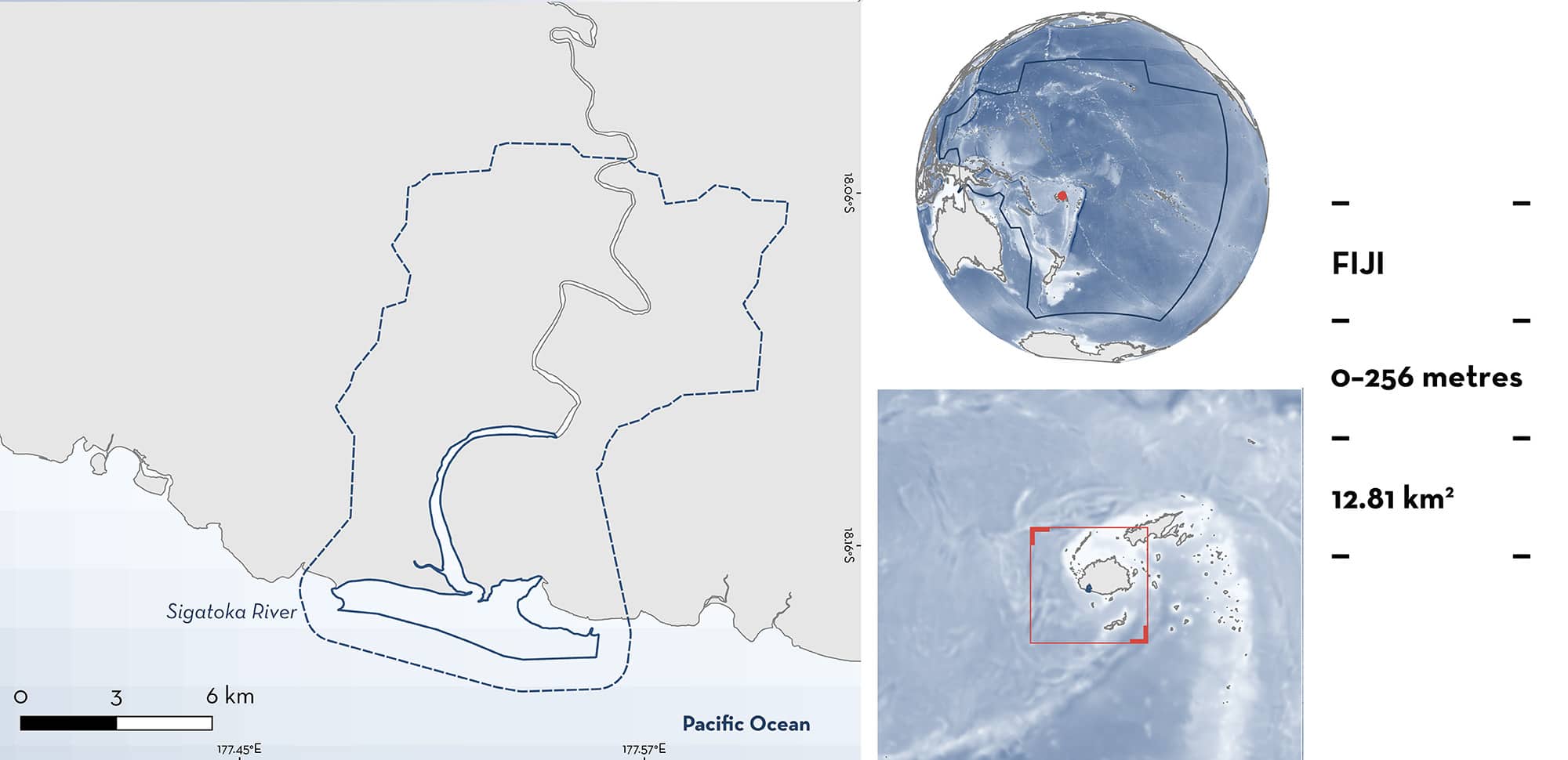
Sigatoka River is located on the south coast of Viti Levu Island in Fiji. It is one of Fiji’s longest rivers with a basin that is enriched by a deep deposit of alluvial soil. The habitat is characterised by tropical trees, mangroves, sandy beaches, sand dunes, and soft-mud substrates. Within this area there are: threatened species and reproductive areas (Bull Shark Carcharhinus leucas).
Download factsheet
Sigatoka River
DESCRIPTION OF HABITAT
Sigatoka River is located on the south coast of Viti Levu Island in Fiji. The river originates from the central highlands of Viti Levu and extends ~120 km to the Coral Coast in Fiji’s Western Division. Although it flows through the drier part of the island for much of its course, the river originates in the wetter part (Nunn & Kumar 2004). During the wet season from November–April winds are weaker, and river flow is higher (Kumar & Prasad 2010). The lower reaches feature floodplains and wetlands. Near the river mouth, mangrove forests are important for coastal protection and sediment trapping (Smith 1989). The lower reaches of the river are up to 13 m deep (Smith 1989) with alluvial charcoal substrates (Nunn & Kumar 2004), but tidal influences at the river mouth can create a relatively shallow bathymetry. The sediments eroded from the magnetite-bearing volcanic and intrusive rocks inland have formed iron sand deposits at the river mouth (Pearce et al. 2021). The closest coral reefs are 150 m off the estuary and are adapted to the high sediment loading in the water column. Areas of exposed bedrock are common, coral cover is patchy, and algae dominates the benthic cover, tending to be more abundant at the river channel and in the bay (Rowlands et al. 2005).
This Important Shark and Ray Area is benthic and pelagic and is delineated from inshore and surface waters (0 m) to 256 m based on the global depth range of the Qualifying Species.
CRITERION A
VULNERABILITY
One Qualifying Species considered threatened with extinction according to the IUCN Red List of Threatened Species regularly occurs in the area. This is the Vulnerable Bull Shark (Rigby et al. 2021).
CRITERION C
SUB-CRITERION C1 – REPRODUCTIVE AREAS
Sigatoka River is an important reproductive area for one shark species.
Neonate Bull Sharks are regularly seen and captured in this area (Glaus et al. 2019; Pearce et al. 2021). A fishing survey from November 2016 to January 2017 (91 h of effort), and from November 2017 to February 2018 (96 h), used gillnets (150 x 3 m) to survey the river for Bull Sharks during two parturition seasons (Glaus et al. 2019). In total, 10 Bull Sharks were captured, five in each season, including nine neonates with an open umbilical scar and one juvenile. Neonates ranged 71–86 cm total length (TL). The size-at-birth for the species ranges between 56–81 cm TL (Ebert et al. 2021). All captures were made in the lower parts of the estuary up to 7 km upstream (Glaus et al. 2019). Individuals were tagged with passive integrated transponder (PIT) tags, but no shark was recaptured. Traditional Ecological Knowledge supports that neonate Bull Sharks are regularly seen in this area, and the site underneath Sigatoka bridge is locally referred to as a ‘Bull Shark nursery’ (Pearce et al. 2021). The Research Division of Fisheries for the Sigatoka River reported that villagers sometimes encounter Bull Sharks during their daily fishing activities (N Marosi pers. obs. 2024). Moreover, pregnant Bull Sharks, with a visibly distended abdomen, were tracked into Sigatoka River during two parturition seasons in 2016–2017 and 2017–2018, presumably to pup in this area. Acoustic receivers placed in Sigatoka River recorded the presence of five of the 15 detected pregnant Bull Sharks that entered one of the four monitored rivers on Viti Levu (Brunnschweiler et al. unpubl. data 2024). Combined, these data show that Sigatoka River is an important area for pupping and the early life stages of Bull Sharks.
Download factsheet
SUBMIT A REQUEST
ISRA SPATIAL LAYER REQUEST
To make a request to download the ISRA Layer in either a GIS compatible Shapefile (.shp) or Google Earth compatible Keyhole Markup Language Zipped file (.kmz) please complete the following form. We will review your request and send the download details to you. We will endeavor to send you the requested files as soon as we can. However, please note that this is not an automated process, and before requests are responded to, they undergo internal review and authorization. As such, requests normally take 5–10 working days to process.
Should you have questions about the data or process, please do not hesitate to contact us.


