ISRA FACTSHEETS
ISRA FACTSHEETS
MEDITERRANEAN AND BLACK SEAS REGION
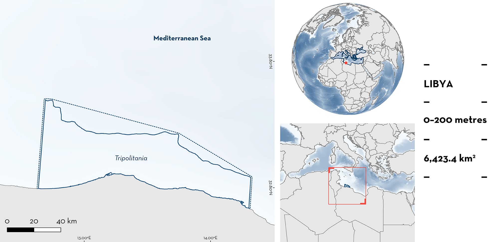
Tripolitania
Summary
Tripolitania is located along the coast of Libya in the southern Mediterranean Sea. The area is characterised by a wide continental shelf that joins the Libyan land mass to the Malta and Medina Banks with habitats such as seagrass beds, rocky ledges, and sand deposits. The area overlaps with an Ecologically or Biologically Significant Marine Area and a Key Biodiversity Area. Within this area there are: threatened species and reproductive areas (Common Smoothhound Mustelus mustelus).
Download factsheet
Tripolitania
DESCRIPTION OF HABITAT
Tripolitania stretches >150 km along the Libyan coast and has a wide continental shelf with a high diversity of ecosystems. It is characterised by rocky areas interspersed with sandy areas and includes seagrass meadows. Along the coast, there is a series of regular rocky ledges down to a depth of ~30 m, creating rocky platforms which are covered by sand deposits of varying thickness (Shakman & Kinzelbach 2007).
The area overlaps with the Sicilian Channel Ecologically or Biologically Significant Marine Area (CBD 2023), and the Karabolli Key Biodiversity Area (KBA 2023).
This Important Shark and Ray Area is benthopelagic and is delineated from inshore and surface waters (0 m) to 200 m based on the bathymetry of the area.
CRITERION A
VULNERABILITY
The one Qualifying Species within the area is considered threatened with extinction according to the IUCN Red List of Threatened SpeciesTM. The Common Smoothhound is assessed as Endangered (Jabado et al. 2021).
CRITERION C
SUB-CRITERION C1 – REPRODUCTIVE AREAS
Tripolitania is an important reproductive area for one shark species.
All lifecycle stages of the Common Smoothhound were observed at monthly landing site surveys conducted between November 2015 to December 2016 (Kara et al. 2019a). Libyan fishers use an artisanal fleet that operates within this area and therefore almost all sharks found at these landing sites are caught on the continental shelf. Of 370 individuals recorded, 190 (51%) were female and measured 46.8–168 cm total length (TL). Maximum size for the species in the region is 168 cm TL for females and 145 cm TL for males (Saïdi et al. 2008; Kara et al. 2019a).
Mature females made up to 53% of records in March and April 2016 (from a total of 63 individuals). Additionally, 19 pregnant females were recorded year-round (10% of females) with a total of 282 embryos (4–12 per female). Embryos measured between 12–29 cm TL (size-at-birth is 34–42 cm TL in the Mediterranean Sea; Saïdi et al. 2008). The smallest embryos were observed in September (7.5 cm TL), and the largest in March (29 cm TL), suggesting that parturition occurs in April-May (Kara et al. 2019a). Additionally, of the 370 individuals recorded, 62 could be considered young-of-the-year (17%) measuring 40–59 cm TL (Kara et al. 2019a). A further 92 immature individuals (25%) measured 60–69 cm TL (Kara et al. 2019a), likely aged 1–2 years.
Download factsheet
SUBMIT A REQUEST
ISRA SPATIAL LAYER REQUEST
To make a request to download the ISRA Layer in either a GIS compatible Shapefile (.shp) or Google Earth compatible Keyhole Markup Language Zipped file (.kmz) please complete the following form. We will review your request and send the download details to you. We will endeavor to send you the requested files as soon as we can. However, please note that this is not an automated process, and before requests are responded to, they undergo internal review and authorization. As such, requests normally take 5–10 working days to process.
Should you have questions about the data or process, please do not hesitate to contact us.


