ISRA FACTSHEETS
ISRA FACTSHEETS
POLAR WATERS REGION
Trondelag platform
Summary
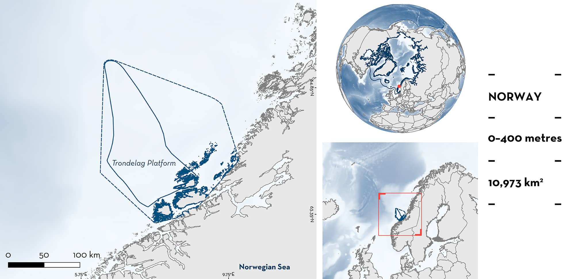
Trondelag Platform is located off the southwest coast of Norway. This area is influenced by the Norwegian Atlantic Current, a branch of the Gulf Stream flowing northwards along the Norwegian coast. It is within a transitional zone, where nutritious, saline, and relatively warm water flows into Arctic water bodies. This area overlaps with one marine protected area and three Key Biodiversity Areas. Within this area there are: threatened species and feeding areas (Basking Shark Cetorhinus maximus).
Download factsheet
Trondelag platform
DESCRIPTION OF HABITAT
Trondelag Platform is located on the southwest coast of Norway’s continental shelf. The area encompasses the continental shelf north of Møre and Halten Terrace. The Norwegian coastline is characterised by extensive fjord systems. Most of the continental shelf consists of fine and sandy mud, with coarser sediments on the slope (MAREANO 2015).
The area is dominated by two northward flowing currents: the North Atlantic Current (NAC) and the Norwegian Costal Current (NCC). The NCC is a low-salinity current that originates from the Baltic Sea and runs along the coast fed by freshwater runoff from the fjords (Sundby et al. 2013; Espinasse et al. 2017). The NAC is saltier and runs parallel to the west of the NCC. The NAC is an extension of the Gulf Stream, transporting warm Atlantic water northward and promoting mild climates at these high latitudes (MAREANO 2015).
The area is located north of the Norwegian Trench, a large topographic feature that funnels the crustacean zooplankton copepod Calanus finmarchicus into the shelf around Møre. Copepods are an important food source for many pelagic fishes in the Norway Sea. Trondelag, located just upstream, is one the main spawning grounds for the boreal spring-spawning Atlantic Herring Clupea harengus, a species highly dependent on copepod eggs and larvae as its primary prey during early life stages (Holst et al. 2004; Opdal & Vikebo 2016).
This area overlaps with the Sularevet Marine Protected Area (UNEP-WCMC & IUCN 2024) and with three Key Biodiversity Areas: Froan, Smøla Archipelago, and Humlingsvær (KBA 2024a, 2024b, 2024c).
This Important Shark and Ray Area is subsurface and pelagic and is delineated from surface and inshore waters (0 m) to 400 m based on the bathymetry of the area.
CRITERION A
VULNERABILITY
One Qualifying Species considered threatened with extinction according to the IUCN Red List of Threatened Species regularly occurs in the area. This is the Endangered Basking Shark (Rigby et al. 2021).
CRITERION C
SUB-CRITERION C2 – FEEDING AREAS
Trondelag Platform is an important feeding area for one shark species.
The area is an important seasonal feeding area for Basking Sharks during the boreal summer. Based on citizen science reports between 2019–2024, there were a total of 80 individual sightings of Basking Sharks. Observations were made in 2019 (n = 15), 2020 (n = 2), 2021 (n = 23), 2022 (n = 9), 2023 (n = 5), and May 2024 (n = 4). Most observations (95%) were reported between May and August (with 63.3% of the sightings reported in May and June) (Institute of Marine Research 2024). Basking Sharks are reported swimming calmly on the surface, and in 11.6% of the sightings, feeding with observations of animals with their mouths open or swimming back and forth in the same area. Basking Sharks are selective filter-feeders, foraging on the most profitable zooplankton patches rich in copepods, including fish eggs and fish larvae (Matthews 1950; Sims & Quayle 1998). Trondelag Platform is a highly productive area, with important plankton advections during spring and hosts the main spawning grounds for Atlantic Herring (Holst et al. 2004; Opdal & Vikebo 2016). This area comprises the second highest sighting density of Basking Sharks in Norway after Lofoten, including 16.7% of the citizen science sightings reported between 2007–2024 nationwide (Institute of Marine Research 2024).
Download factsheet
SUBMIT A REQUEST
ISRA SPATIAL LAYER REQUEST
To make a request to download the ISRA Layer in either a GIS compatible Shapefile (.shp) or Google Earth compatible Keyhole Markup Language Zipped file (.kmz) please complete the following form. We will review your request and send the download details to you. We will endeavor to send you the requested files as soon as we can. However, please note that this is not an automated process, and before requests are responded to, they undergo internal review and authorization. As such, requests normally take 5–10 working days to process.
Should you have questions about the data or process, please do not hesitate to contact us.


