ISRA FACTSHEETS
ISRA FACTSHEETS
NEW ZEALAND & PACIFIC ISLANDS REGION
Wakaya Reef
Summary
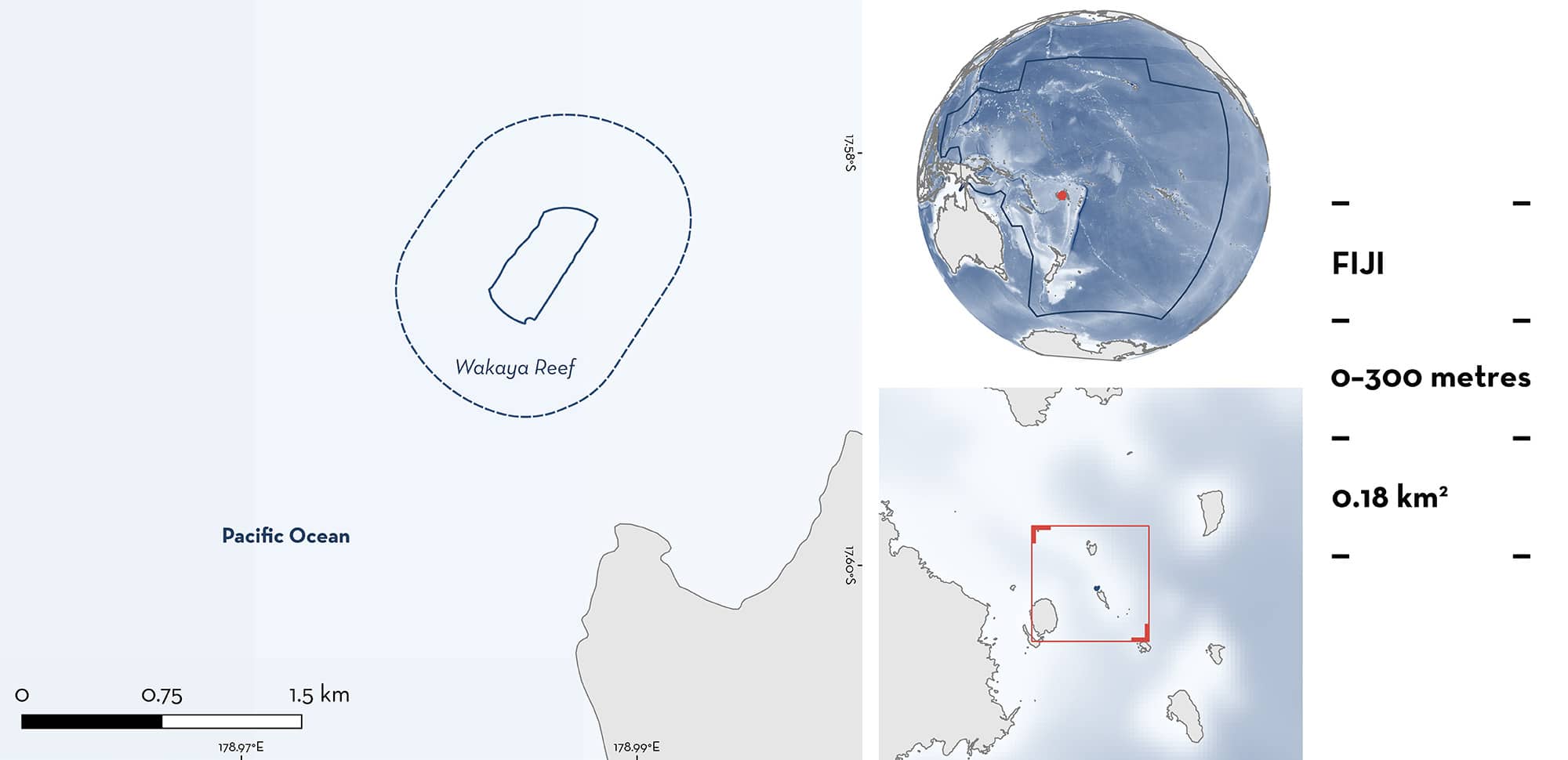
Wakaya Reef is located near Wakaya Island in the Lomaiviti Archipelago east of Viti Levu in Fiji. The habitat is characterised by a reef crest, forereef slopes, coral pinnacles, a channel entrance, and steep drop-offs. The area overlaps with the Wakaya Marine Reserve and the Vatu-i-Ra/Lomaiviti Ecologically or Biologically Significant Marine Area. Within this area there are: threatened species (e.g., Scalloped Hammerhead Sphyrna lewini); and undefined aggregations (e.g., Reef Manta Ray Mobula alfredi).
Download factsheet
Wakaya Reef
DESCRIPTION OF HABITAT
Wakaya Reef is located on the large barrier reef system of Wakaya Island in the Lomaiviti Archipelago east of Viti Levu in Fiji. The area experiences strong currents with the tidal cycle (L Gordon pers. obs. 2023). Seasonal southeasterly winds increase in strength and consistency across Fiji from April–October (Kumar & Prasad 2010). These winds bring cooler water into the region and may also increase productivity in the area. The habitat is characterised by a shallow reef crest, forereef slope, coral pinnacles, a channel entrance, and steep drop-offs that rapidly descend from 20–900 m.
This area overlaps the Wakaya Marine Reserve (Government of Fiji 2015) and the Vatu-i-Ra/Lomaiviti Ecologically or Biologically Significant Marine Area (EBSA; CBD 2024).
This Important Shark and Ray Area is benthic and pelagic and is delineated from surface waters (0 m) to 300 m based on the observations of Qualifying Species and the bathymetry of the area.
CRITERION A
VULNERABILITY
Two Qualifying Species considered threatened with extinction according to the IUCN Red List of Threatened Species regularly occur in the area. These are the Critically Endangered Scalloped Hammerhead (Rigby et al. 2019) and the Vulnerable Reef Manta Ray (Marshall et al. 2022).
CRITERION C
SUB-CRITERION C5 – UNDEFINED AGGREGATIONS
Wakaya Reef is an important area for undefined aggregations of one shark and one ray species.
Reef Manta Rays aggregate at cleaning stations in this area (Gordon 2023; Manta Project Fiji unpubl. data 2008–2024). Between 2008 and June 2024, a total of 472 sightings of 90 different Reef Manta Rays were recorded in the area. From 2023 to mid-2024, dedicated dive surveys were conducted during which a team of observers monitored cleaning stations in the area for 45–60 min per dive. Multiple dives on the same day were >60 min apart. A sighting is defined as a confirmed photographic identification of an individual ray on a given survey. Most sightings (71%, n = 274) were recorded during 2023 when Reef Manta Rays were recorded on 38 of 54 surveys (70%). Initial surveys (n = 27) from 2024, up to the end of June, recorded 120 sightings of 38 individual Reef Manta Rays. Citizen science reports from earlier years were sporadic, but also showed that these aggregations occur regularly, with seasonal sightings peaking between June–September (Manta Project Fiji unpubl. data 2008–2022).
Reef Manta Rays aggregate in the area to visit cleaning stations, with most sightings (77%) recording cleaning as their behaviour (Manta Project Fiji unpubl. data 2024). Small reef fishes remove parasites and dead tissue from the rays at cleaning stations in a mutualistic symbiosis (Armstrong et al. 2021). Wakaya Reef is home to four main cleaner fish species, namely the Bluestreak Cleaner Wrasse Labroides dimidiatus, Bicolor Cleaner Wrasse L. bicolor, Moon Wrasse Thalassoma lunare, and Blunthead Wrasse T. amblycephalum (L Gordon pers. obs. 2023). Within the area, several large coral heads and bommies are used by Reef Manta Rays as cleaning stations (L Gordon pers. obs. 2024). Reef Manta Ray group size ranges from 2–16 individuals at these cleaning stations, with >2 individuals seen cleaning in most surveys (76%) in 2023. Most individuals (67%) have been resighted, highlighting the regular use and importance of this area.
Aggregations of Scalloped Hammerheads are regularly reported from Wakaya Reef (R Barrel et al. unpubl. data 2024; B Chaves pers. obs. 2024). Aggregations of 2–30 individuals have been recorded throughout the year, with observations since 2013 (R Barrel et al. unpubl. data 2024). They are seen on 60% of dives, with larger schools recorded on ~10% of dives overall, although that percentage was higher in the last two years (2022–2023) when records were kept more consistently (B Chaves pers. obs. 2024). Scalloped Hammerheads are seen close to the deep drop-off and on the edge of the reef crest in 20–40 m depth (R Barrel et al. unpubl. data 2024; B Chaves pers. obs. 2024). Additional information is required to understand the nature and function of these aggregations.
Download factsheet
SUBMIT A REQUEST
ISRA SPATIAL LAYER REQUEST
To make a request to download the ISRA Layer in either a GIS compatible Shapefile (.shp) or Google Earth compatible Keyhole Markup Language Zipped file (.kmz) please complete the following form. We will review your request and send the download details to you. We will endeavor to send you the requested files as soon as we can. However, please note that this is not an automated process, and before requests are responded to, they undergo internal review and authorization. As such, requests normally take 5–10 working days to process.
Should you have questions about the data or process, please do not hesitate to contact us.


