ISRA FACTSHEETS
ISRA FACTSHEETS
NEW ZEALAND & PACIFIC ISLANDS REGION
Yaukuve Lailai
Summary
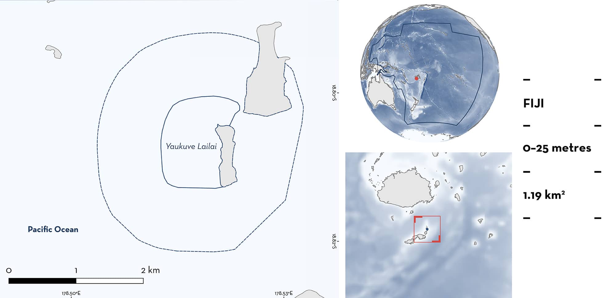
Yaukuve Lailai is located in the northern region of Kadavu Province in Fiji. The area lies near a small island surrounded by a shallow sloping fringing reef. It is in the lee of the predominant east to southeasterly winds, which seasonally increase in strength from April–October. Within this area there are: threatened species and feeding areas (Reef Manta Ray Mobula alfredi).
Download factsheet
Yaukuve Lailai
DESCRIPTION OF HABITAT
Yaukuve Lailai is located near a small island in the north Kadavu region of Fiji. The area lies within a large lagoon (~10 by 30 km) created by the Great Astrolabe Reef. Yaukuve Lailai Island is surrounded by a shallow fringing reef that slopes to ~20 m before turning into a sloping soft sediment habitat (L Gordon pers. obs. 2024). Winds in Fiji are seasonally stronger during April–October and blow from the east and southeast (Kumar & Prasad 2010). The area lies on the western leeward side of the island which is sheltered from the wind for much of the year. Its location is a likely driver of the seasonally high zooplankton abundance in the area during April–October (L Gordon pers. obs. 2024).
This area overlaps with the Kadavu and the Southern Lau Region Ecologically or Biologically Significant Marine Area (EBSA; CBD 2024).
This Important Shark and Ray Area is benthopelagic and is delineated from surface waters (0 m) to a depth of 25 m based on the bathymetry of the area.
CRITERION A
VULNERABILITY
One Qualifying Species considered threatened with extinction according to the IUCN Red List of Threatened Species regularly occurs in the area. This is the Vulnerable Reef Manta Ray (Marshall et al. 2022).
CRITERION C
SUB-CRITERION C2 – FEEDING AREAS
Yaukuve Lailai is an important feeding area for one ray species.
Reef Manta Rays regularly feed in this area in large groups. Between 2019–2024, a total of 194 snorkel surveys were conducted, recording 1,720 Reef Manta Ray sightings of 142 different individuals identified using photographic records (Gordon et al. 2023; Manta Project Fiji unpubl. data 2024). Surveys were concentrated between April–October when environmental conditions favour feeding events (Gordon et al. 2023). Strong southeasterly winds during this time are likely to bring cooler, nutrient dense water into the shallow lagoonal areas in the north Kadavu region, resulting in increased zooplankton abundance in the area (Gordon et al. 2023). Reef Manta Rays are sighted on 92% (n = 178) of snorkel surveys in this area (Gordon et al. 2023; Manta Project Fiji unpubl. data 2024). Most sightings are recorded between April–October with a peak between June–August. Reef Manta Rays aggregate in the area to feed in dense zooplankton patches that form on the leeward side of the island. Group size ranges from 2–68 individuals (mean = 10.5) (Manta Project Fiji unpubl. data 2024). Most sightings (~83%) recorded feeding as their behaviour, and in 2023, that proportion was 96% (Gordon et al. 2023; Manta Project Fiji unpubl. data 2024). Reef Manta Rays engage in various feeding strategies (surface feeding, somersault feeding, chain feeding, piggyback feeding, sideways feeding, and cyclone feeding), often switching from one strategy to another during the same feeding event (L Gordon pers. obs. 2023). Reef Manta Rays display high site fidelity, with 85% of individuals resighted in more than one year and 73% seen in more than two years (Manta Project Fiji unpubl. data 2024).
In addition to snorkel surveys, 36 acoustic tags were deployed on Reef Manta Rays in the wider region, with a receiver station placed in Yaukuve Lailai between August 2019 and November 2021. Acoustic detections confirmed the seasonality in the use of this area, with detections concentrated during April–October and only sporadic detections at other times. The receiver at Yaukuve Lailai recorded the second-most detections of the 15 receivers in the region, with ~77,000 detections of 32 tagged individuals (Manta Project Fiji unpubl. data 2024), highlighting the frequent use of the area by Reef Manta Rays.
Download factsheet
SUBMIT A REQUEST
ISRA SPATIAL LAYER REQUEST
To make a request to download the ISRA Layer in either a GIS compatible Shapefile (.shp) or Google Earth compatible Keyhole Markup Language Zipped file (.kmz) please complete the following form. We will review your request and send the download details to you. We will endeavor to send you the requested files as soon as we can. However, please note that this is not an automated process, and before requests are responded to, they undergo internal review and authorization. As such, requests normally take 5–10 working days to process.
Should you have questions about the data or process, please do not hesitate to contact us.


